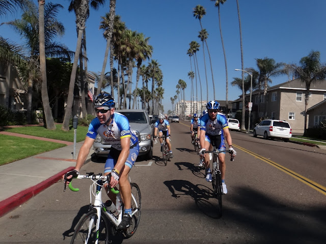
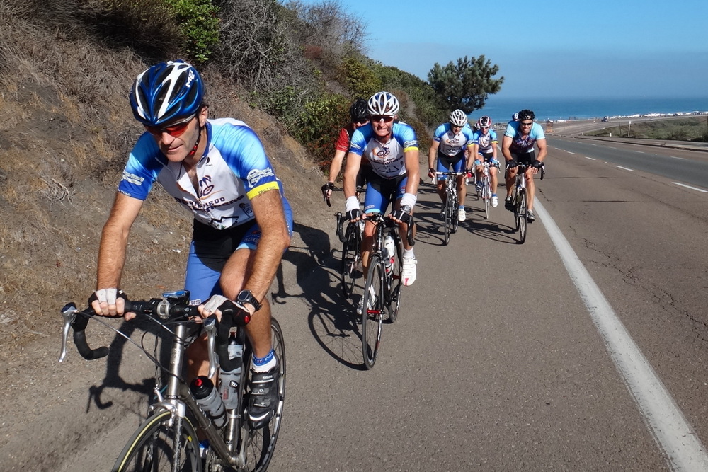
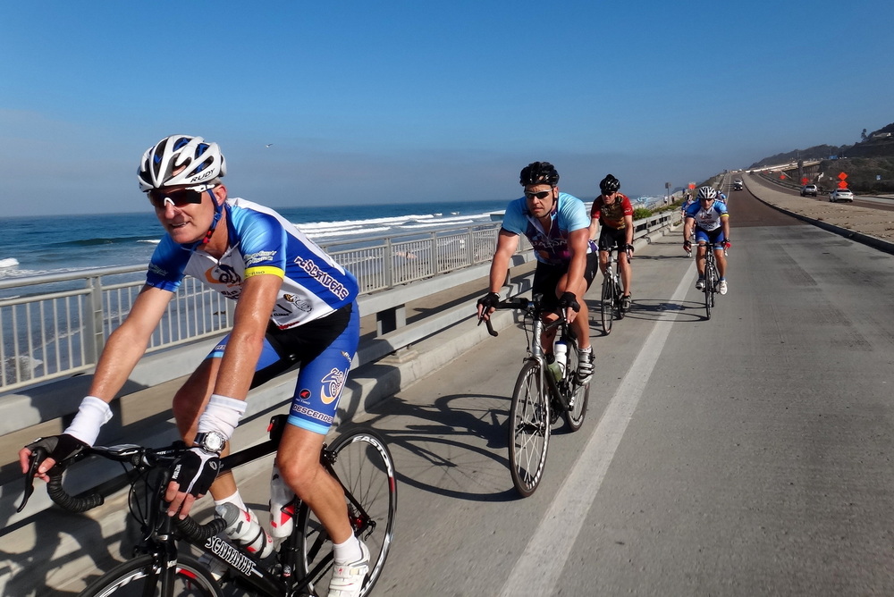
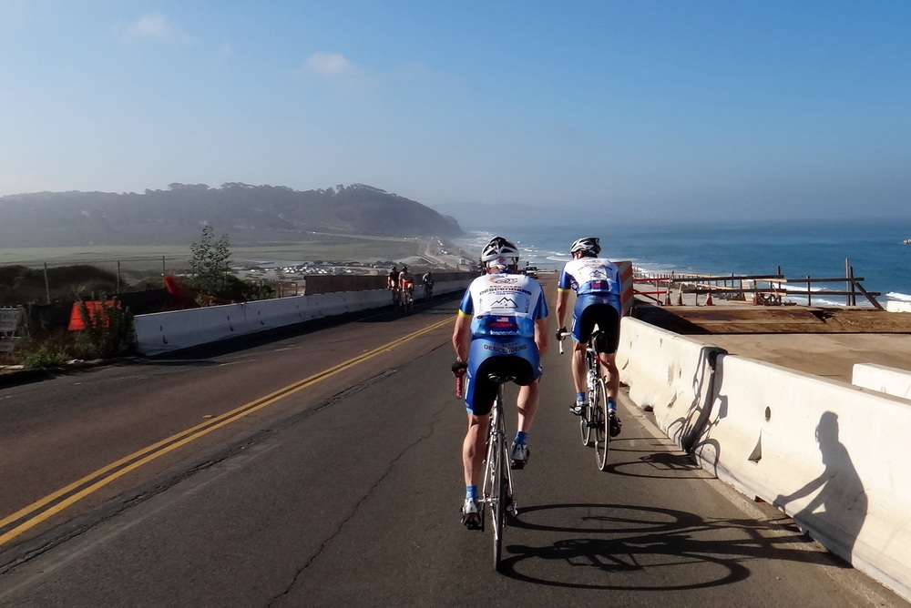
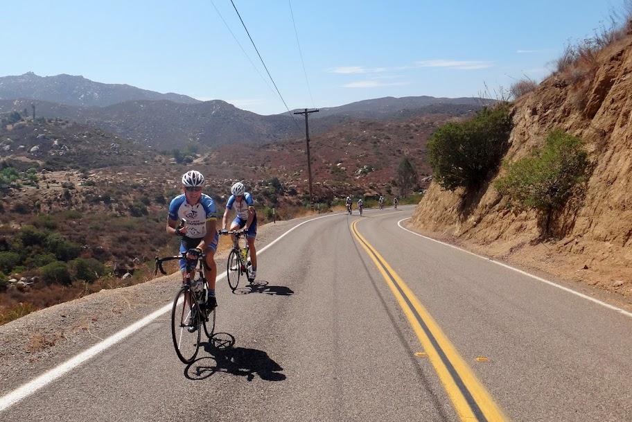
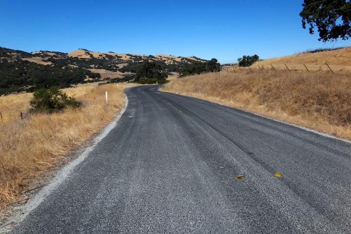
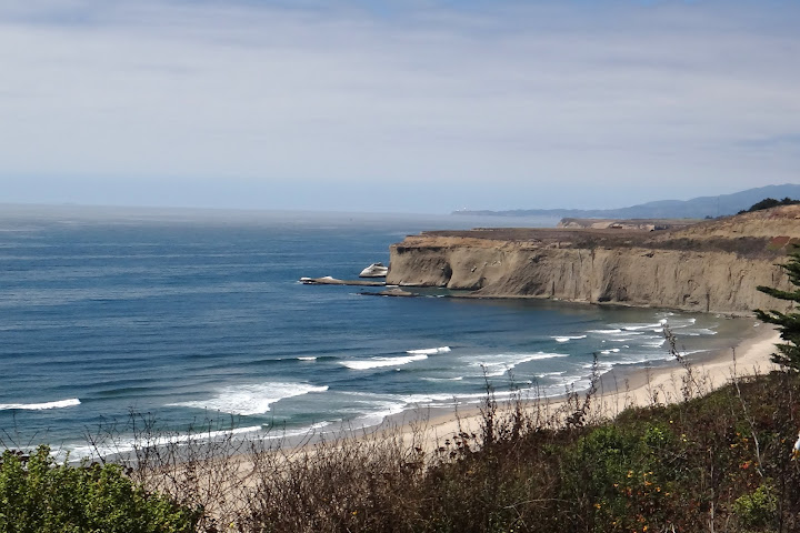
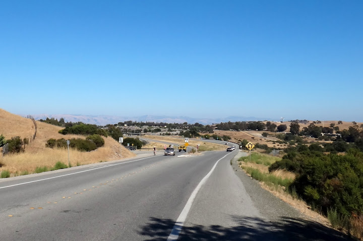
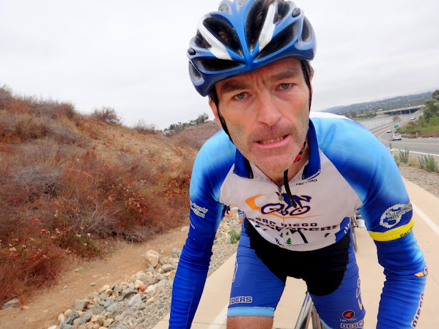
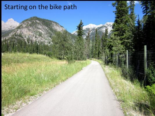
This was our last chance to really burn up the legs before Tour de Poway. We had a great Descenders group ride on Saturday so we decided to hit the coast Sunday. I thought I coordinated a group ride to meet on the bike path at Camino del Sur at 8 am. I pedaled over and met up with Guido and Bob Proulx. Bryan Jones and Jeff Cresap were maybe’s so when no one else arrived we decided to head west on the bike path towards PCH. I unfortunately had mentioned to Mobil station/Circle K store and found out later that Jeff and Bryan were waiting for us there. We did not connect and they rode a loop west and up El Camino Real to the Three Witches.
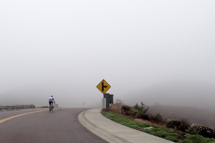
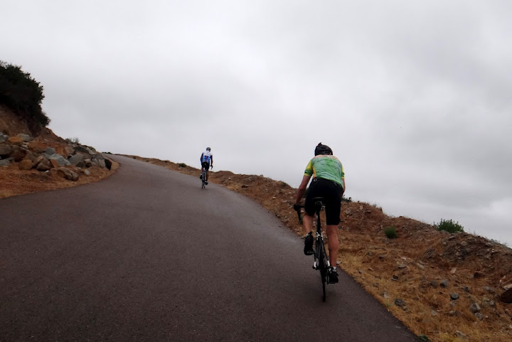
Guido, Bob and I pedaled into the fog heading towards Torrey Pines. We climbed up the Carmel Country loop and back down towards Sorrento Valley Road, cutting through back towards Carmel Valley Road. Unfortunately the bridge heading to TP was closed to all traffic so we just went north on PCH. We rode to Loma Sante Fe and then back east towards Rancho Sante Fe. The fog had cleared and the bright sun started to warm the day. Bob was on point most of the time until Guido led us into RSF.
We decided to loop the golf course and came out near Lago Lindo to start Stud Loop backwards. After a brief sprint through Stud Loop we cruised down toward El Apajo. We spotted Garet climbing up Via De La Valle as we left RSF. He was out on his Sunday cruise through the county. Bob continued to pull us to 3 Witches and then we cruised to Santaluz lower loop. Bob peeled off for home to pack for his business travels to Athens and Bologna. Guido and I cruised back to the bike path.
My mistake in not properly coordinating for Bryan and Jeff. Guido, Bob and I rode 38 miles and climbed just 2,500 feet, but we were home just after 10 am. Another fun Descenders Sunday ride. Hope to see many of you next Sunday for Touor de Poway; party at Ernst’s following!
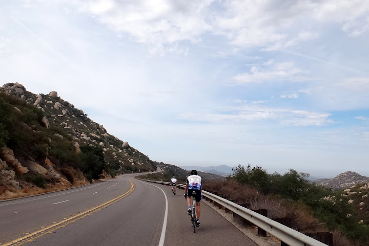
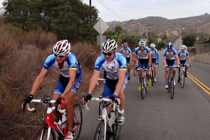
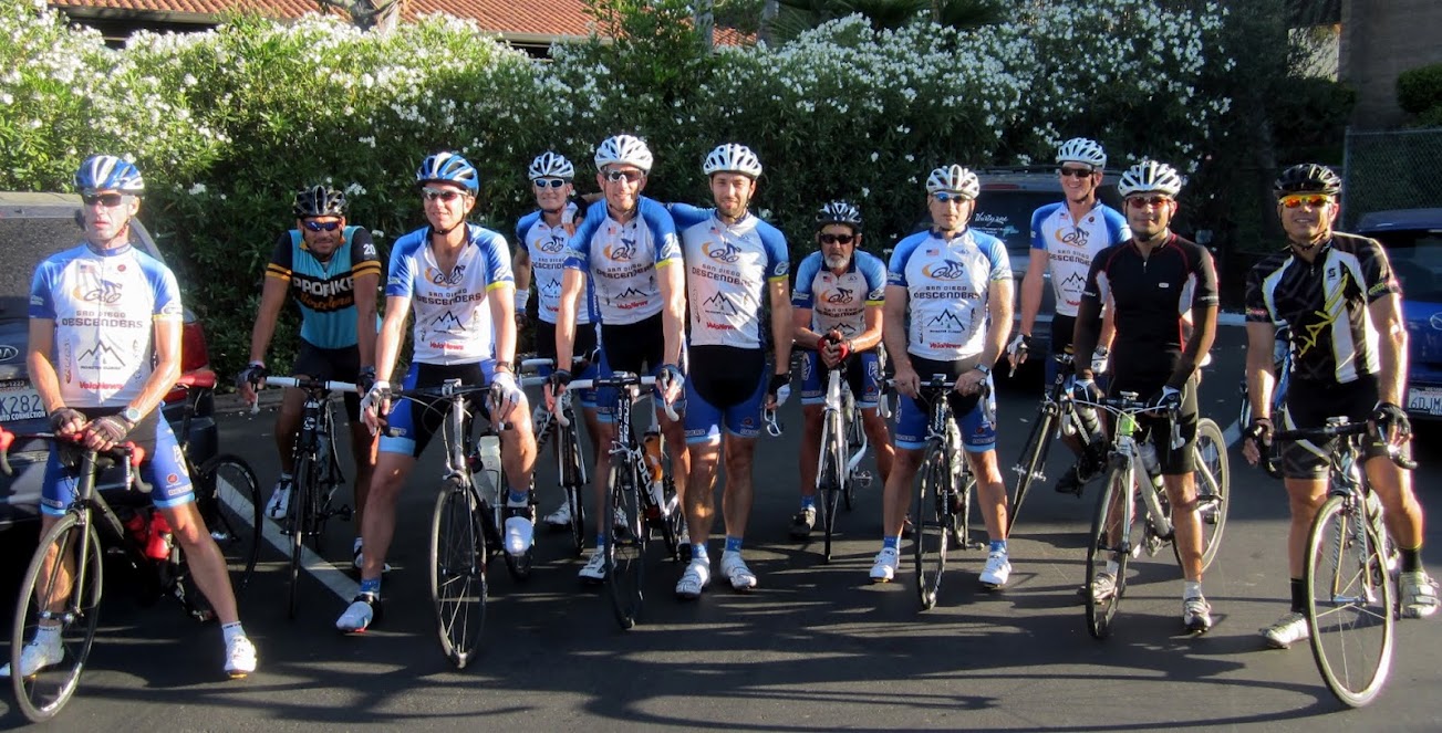
This is a ride that Bryan Jones has termed the “Descenders Coat-Tail Group” ride. It starts every Sunday at the bottom of Highland Valley Road at Pomerado. It has a number of excellent riders, including a few Ranchos. They keep up a wicked pace. Bryan, Guido and I were to meet at the corner of Black Mountain and the 56 bike path at 6:45 am. I was late as usual and they were gone by the time I finally got to the corner. I chased them across Ted Williams to Pomerado where 4-5 other riders were also heading north towards HVR. We had told Sheehan to meet us at 8 am, the time we thought the ride started. We cruised over to the bottom of HVR just before 7:30 am and I knew we had made a mistake in the timing for Sheehan. Most of the group kept going while a few guys stopped to meet other guys.
The pace up HVR was fast and I fell off the back quickly. Byran and Guido hung on most of the way up to Bandy. Our group of about 9 riders reformed and flew down Bandy towards the Ramona Grade. We rode by Yi-Shiou just before the San Pascual School going about 28 mph. He must have been out for an early am ride so I waved him to join us. I was spent before we started the Ramona Grade climb. Bryan hung for a while and Guido eventually rode away from me. It was a warm morning as I slowly pedaled up the road. Large groups of riders who had started later from HVR flew by me. Another Ranchos kit came by and I decided to hang on to Ramona. Everyone regrouped at the gas station, there must have been 25 riders in total.
We all sped out towards Dye Road and flew in a group back towards 67. Sheehan had been chasing us this whole time thinking he was late as his usual time to the meeting spot. He chased us down Dye not knowing where we were and finished in the top 5 for the sprint, going solo! That man can fly on the flats. Our large group was well ahead of Dave and we sped back on 67 towards Mount Woodson. Guido eventually started to fall back. Fortunately for me the group waited at the Poway town sign before a fast paceline to the top of the Poway Grade. Some guys went down the grade while others went over to SPP. Bryan and I waited a bit for Guido and the three of us went down SPP to Mercy and up Black Mountain. Bryan kicked into Park Village and I hit the bike path home while Guido kept going up Blk Mtn to his house. This is a great early am ride that gets you home before 10 am. We rode 53 miles and climbed 3,600. We should consider this on future Sundays for a Descenders group ride.
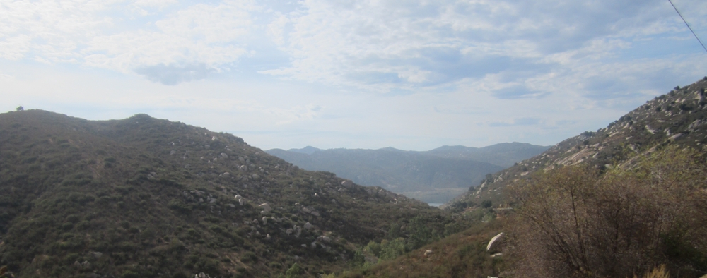
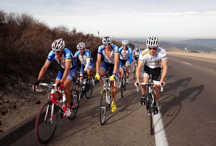
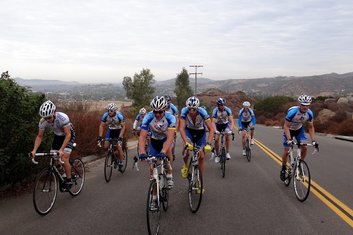
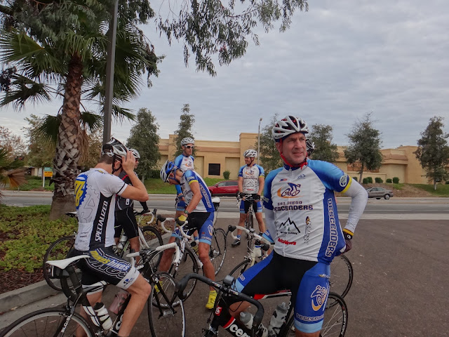
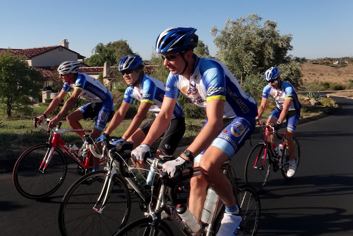
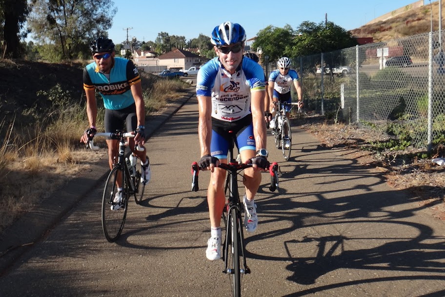
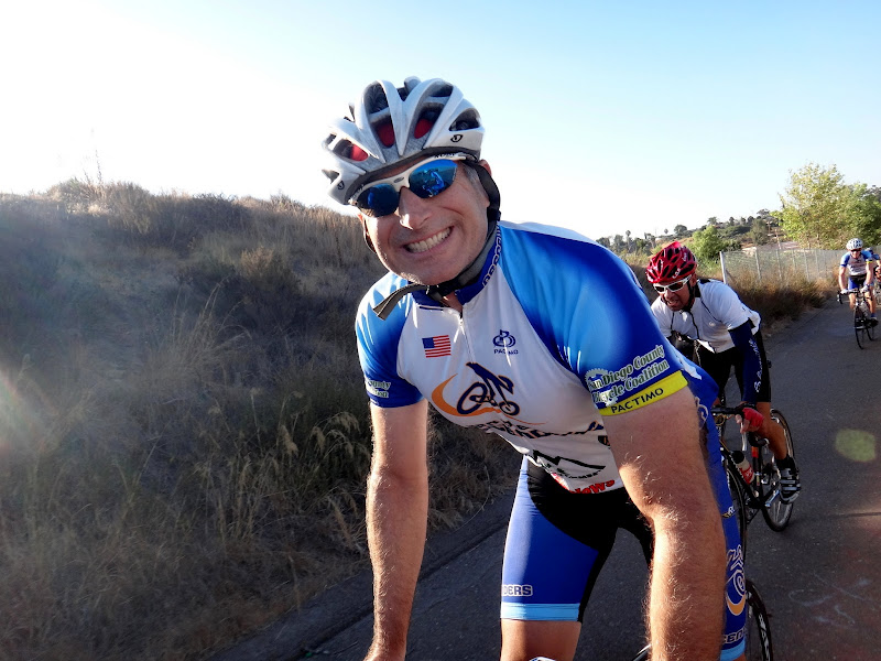
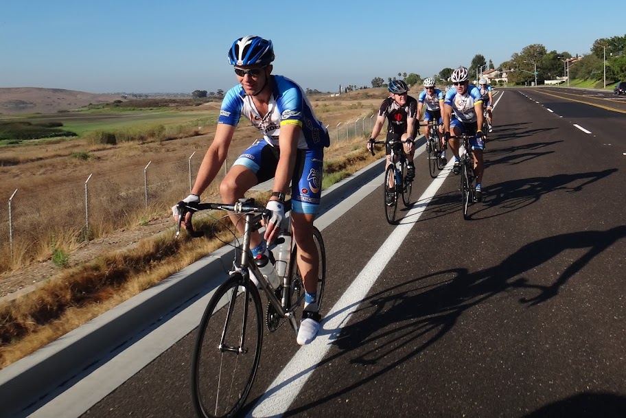
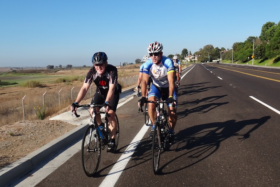
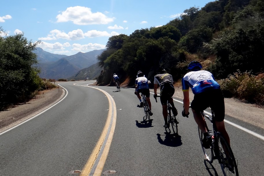
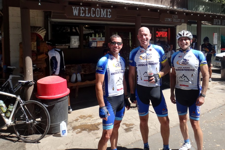
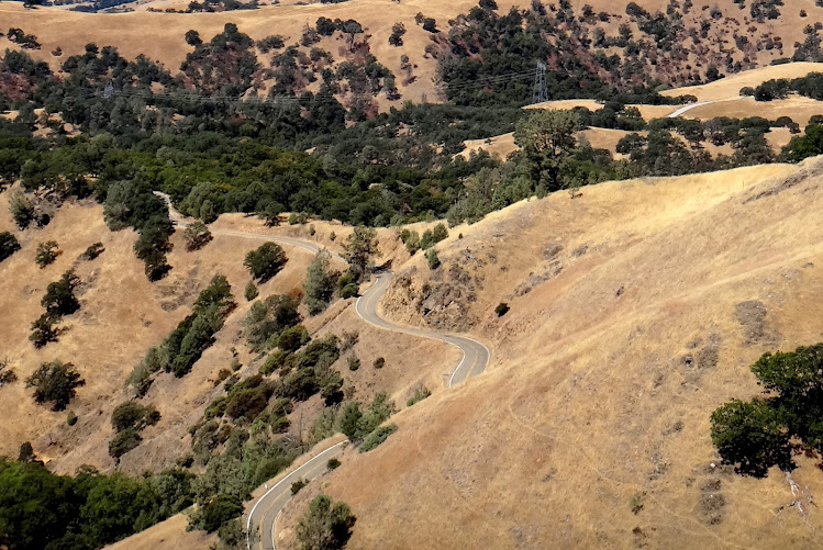
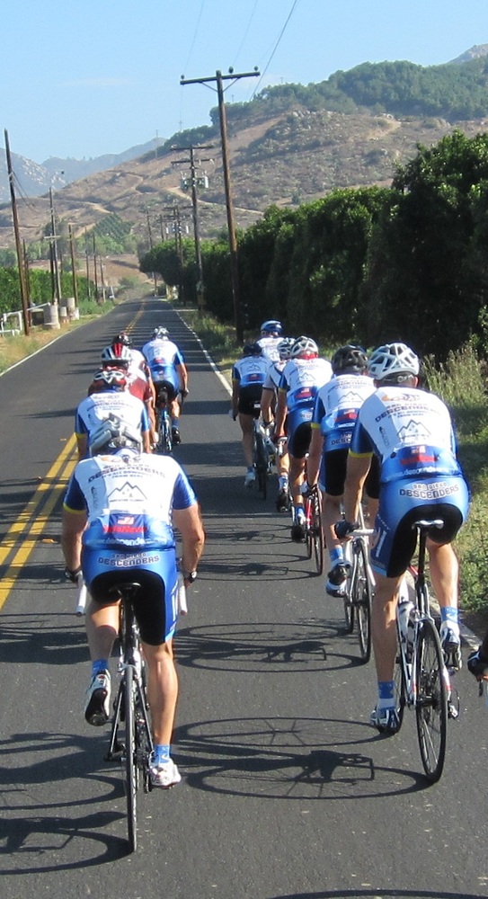
The planned ride was a favorite–Mussey and Pamo. I met Chad on the 56 bike path and we pedaled over to Spring Meadow. We picked up Proulx, Voris, Jeff S, Oleg, Rick and a new rider, James Wingert. James told us he worked in Oleg’s physics lab and had recently moved from the San Fran area. This was all correct, now for the rest of the story. James worked at a Mike’s Bike shop in Berkely and raced bikes. His team won the N. CA title this past season, he was no ordinary guy. Are all these physics guys great riders? My ranking in the GC continues to fall with each new Descenders member. Rick was delivery boy for gear purchased by Bob and Jeff. He gave out the jersey and shorts, then we headed over to 7-11 to start the group ride.
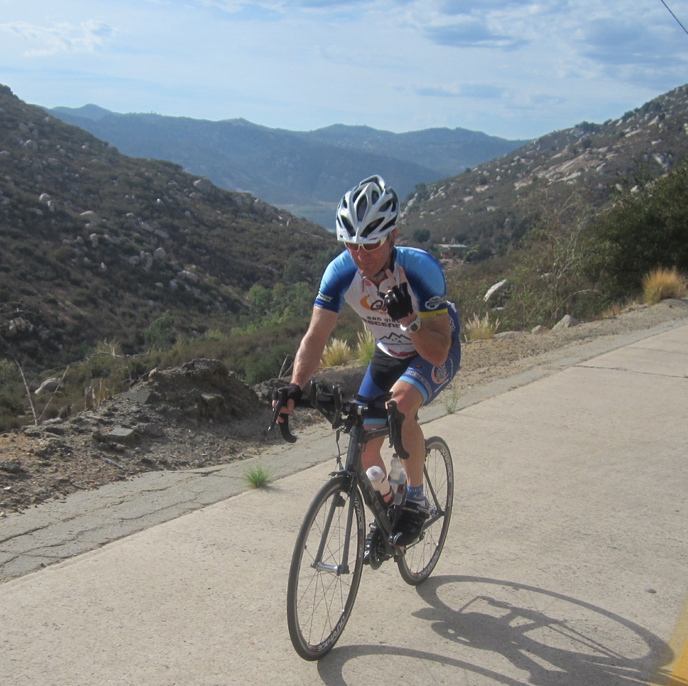
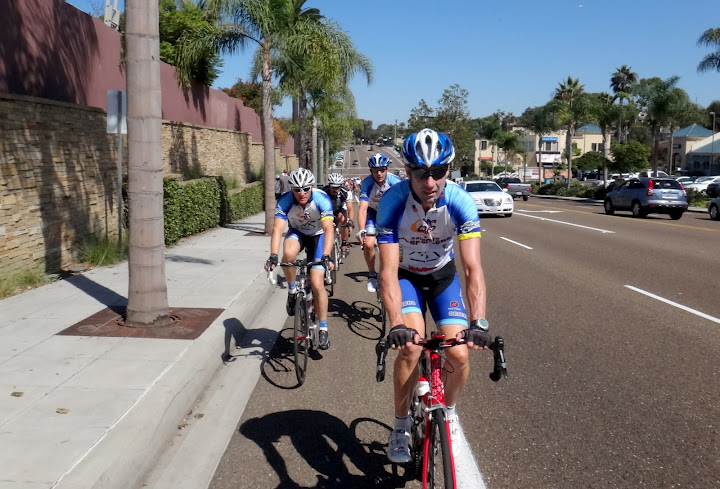
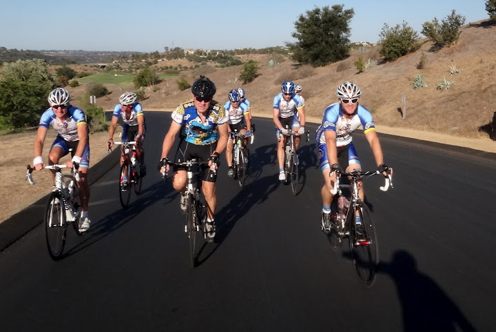
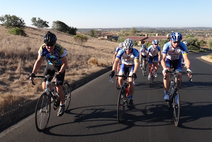
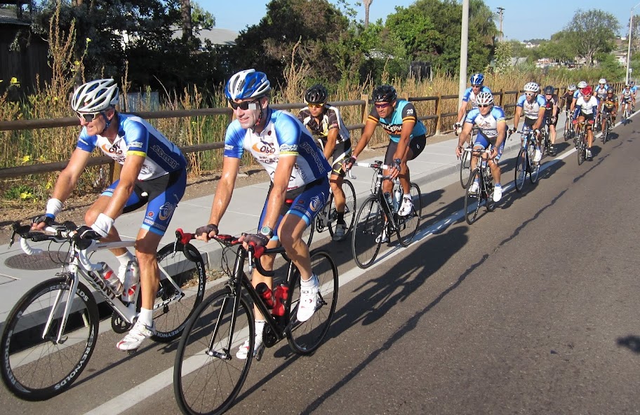
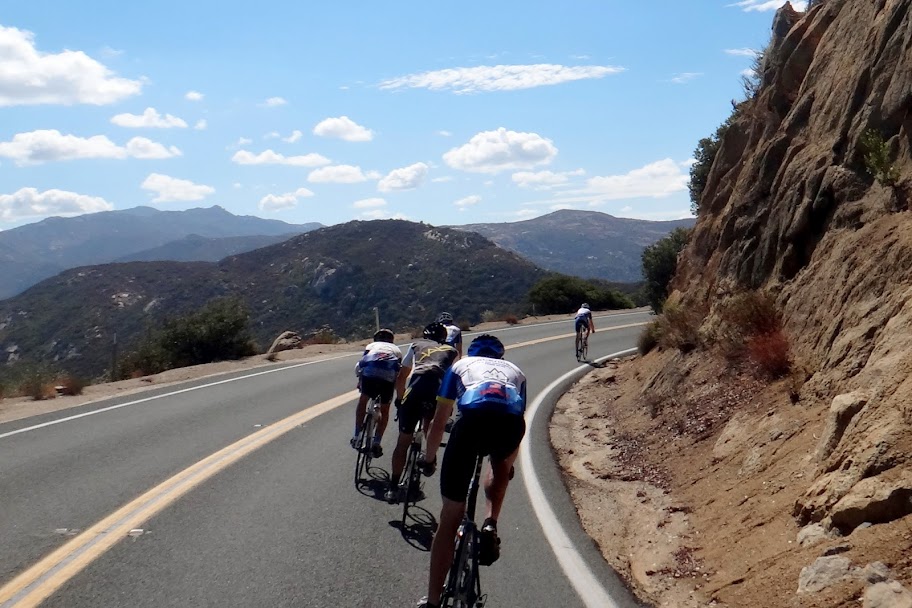
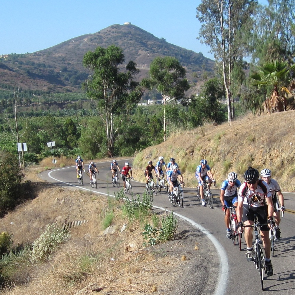
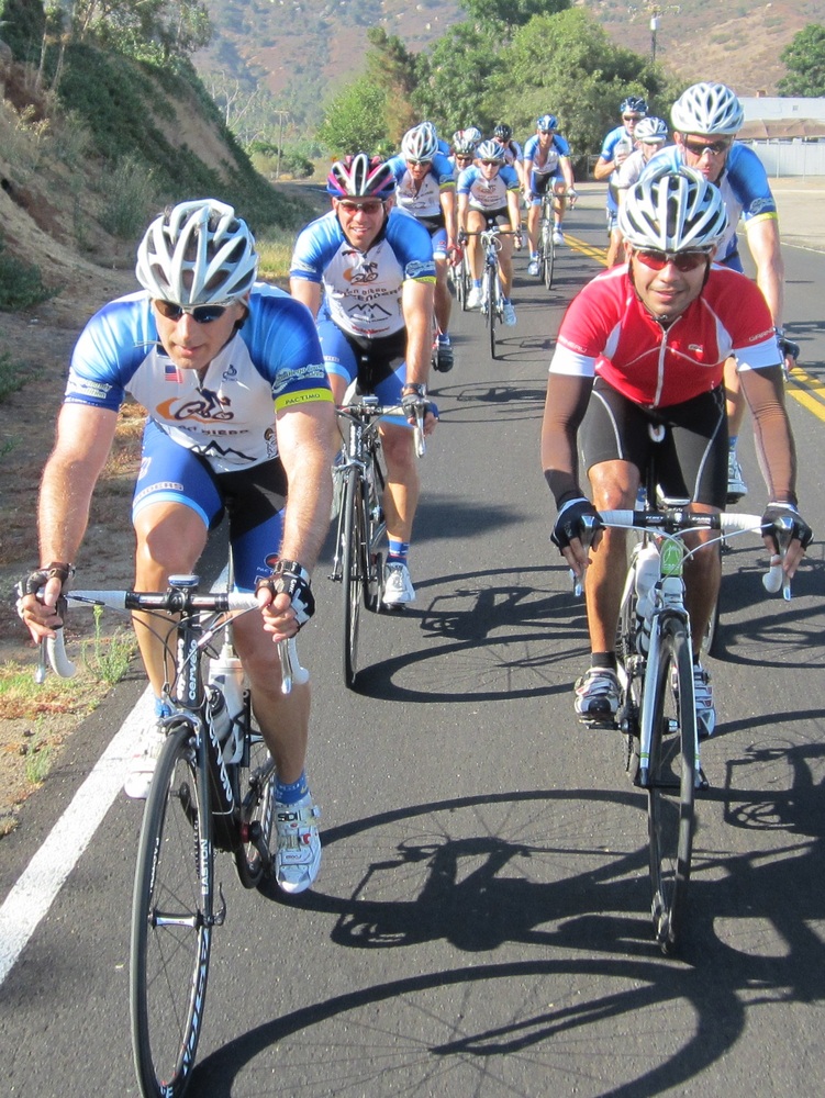
Everyone else met us on Poway Road. We picked up Bob R, Frankie, Garet, Yi-Shiou, Cresap and Sheehan. We had a large group of 13 as we headed down Garden Road. Sheehan snuck away early to get a lead up SPP. I took off after him but stopped to take a photo of the group riding up Sycamore Canyon. We stayed mostly as a group up SPP and along 67 around Mt Woodson. The group split a bit and then reformed heading to the turn of Mussey. James got on point with Oleg right behind. We flew along at 29 mph+ with James pulling for over a mile, he is no ordinary rider. The descent down Mussy was not as a single group but a number of smaller and still fast clusters. Bob R took the new KOM for Mussey descent. He eclipsed the old KOM held by Matt B and me by 2 seconds. We regrouped at the bottom and climbed back up Mussey. Oleg got a flat while James took the KOM, fast riding.
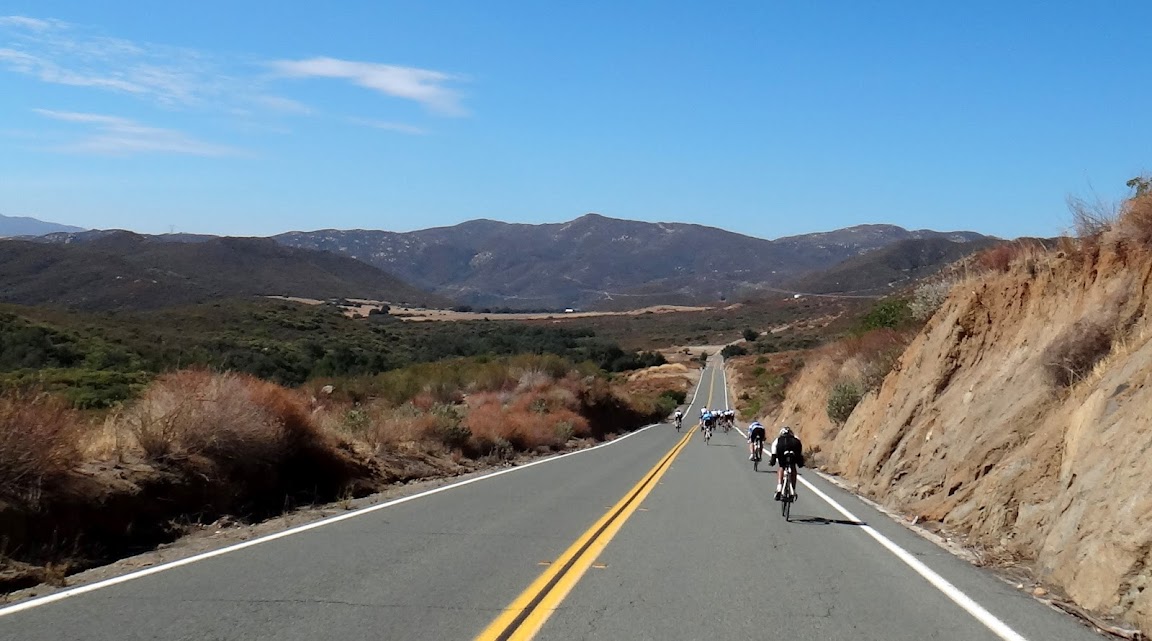
At the top of Mussey, Rick and Bob P headed back towards home while the rest of us cruised along Dye Road. Sheehan had to turn around at the end of Dye. Garet had to turn back once we got into downtown Ramona. The remaining group stopped at the Circle K store for water before pedaling over to Pamo. Oleg had more tire troubles so we left him there and rode toward Pamo. Cresap decided to go down 78 to Bandy. I joined him leaving the group of 7 remaining riders to descend Pamo.
Jeff pulled me all the way down 78. The road was not too crowded and it was a nice smooth descent. We climbed up Bandy and went down HVR. At Pomerado Jeff heading east while I went west over the I-15 and back through 4S Ranch towards Black Mountain. I got home with 64 miles of riding and almost 3,900 feet of climbing.
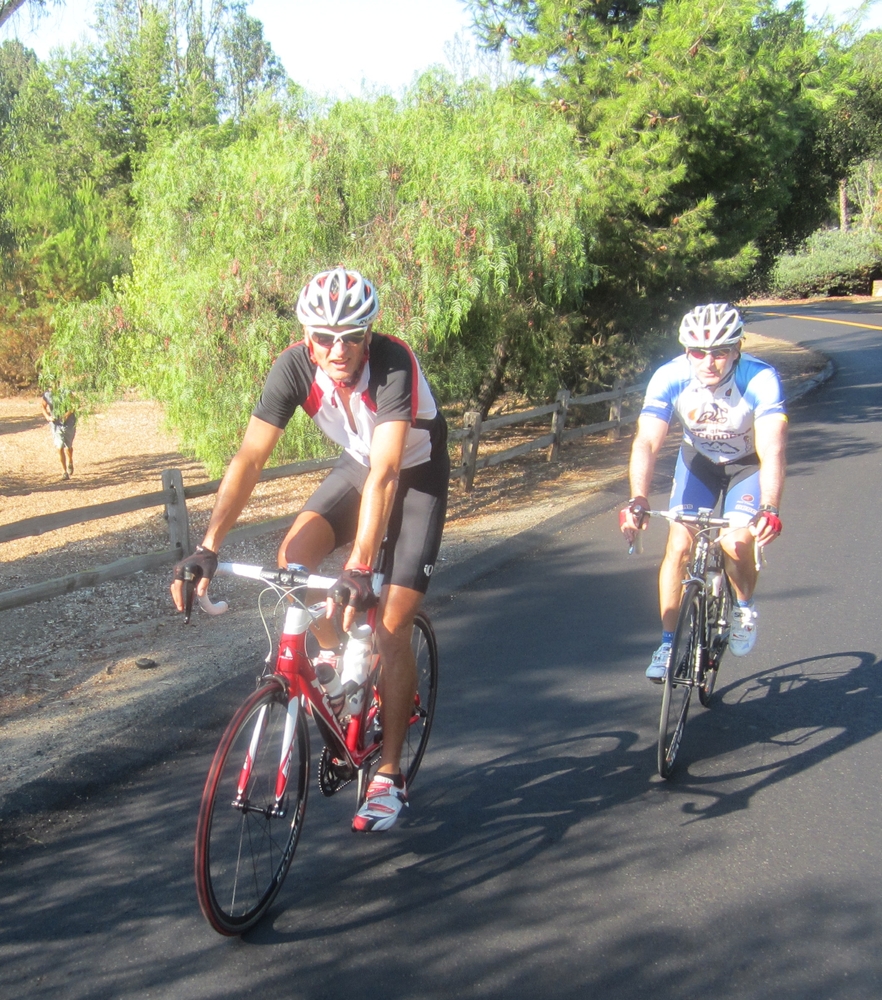
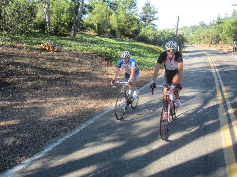
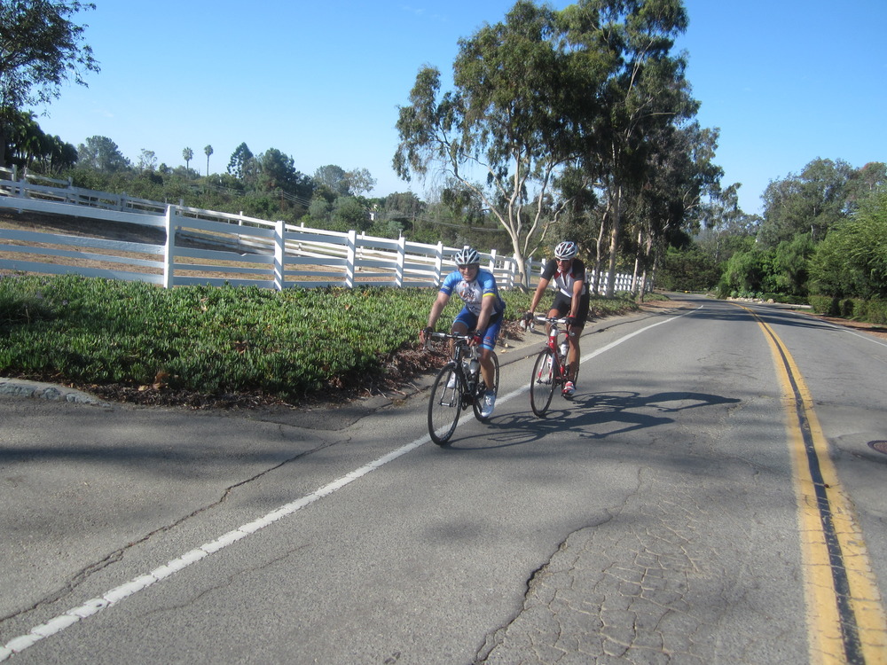
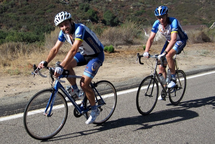
Another great Descenders ride. Here are a few photos.
Ride on-
Rob
P.S. Tour of Paway is next Sunday, 30 Sep. Hope to see many Descenders there. Good luck to Bernie and Rick–they will ride the Everest Challenge next weekend. I think Drew is riding too. Good luck guys.
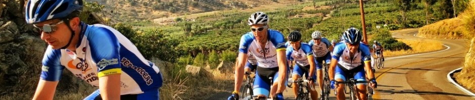
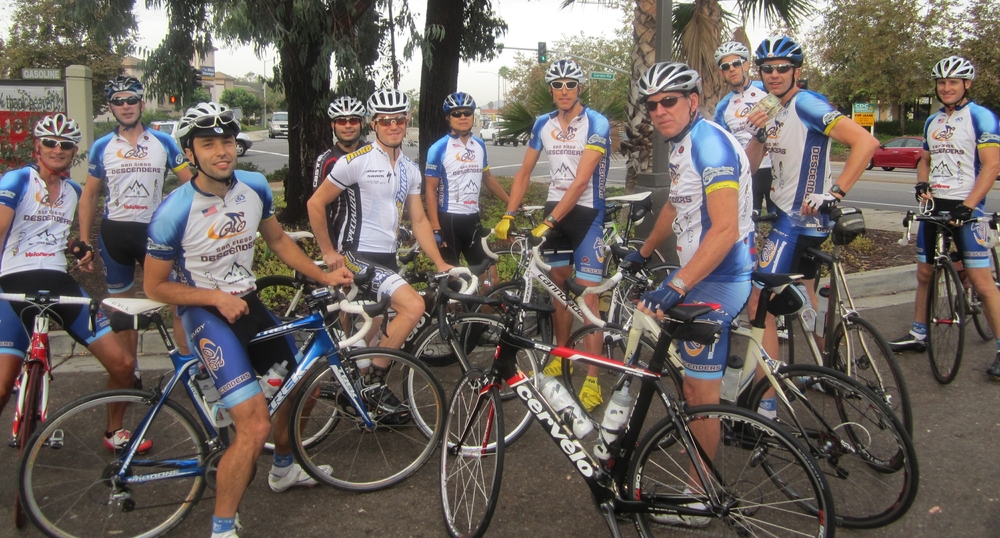
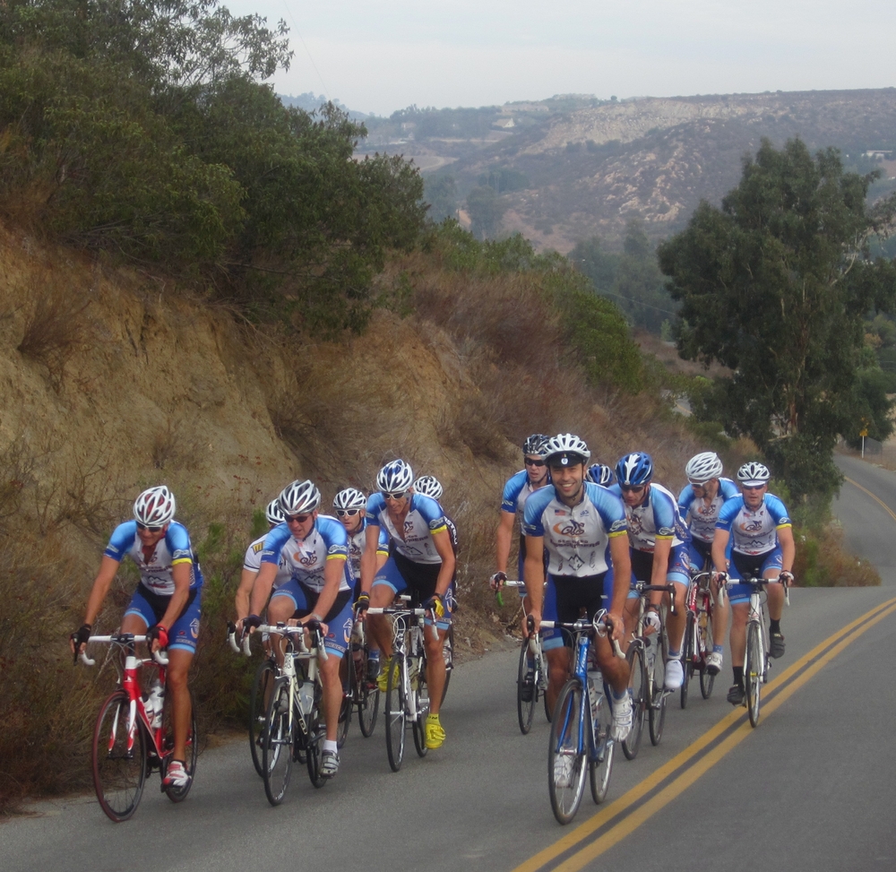
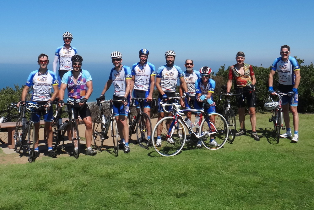
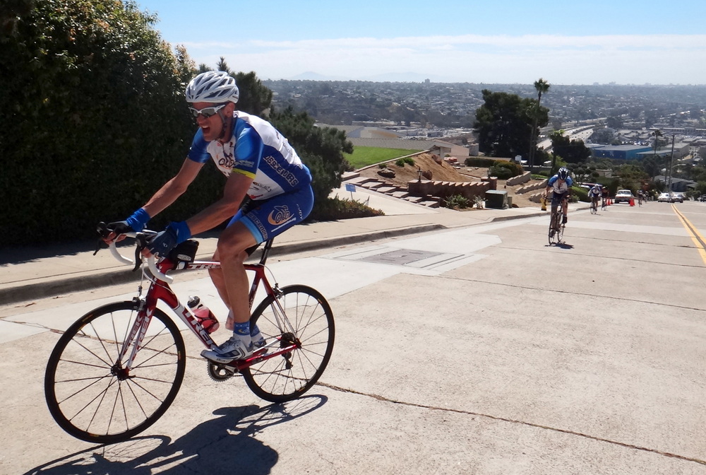
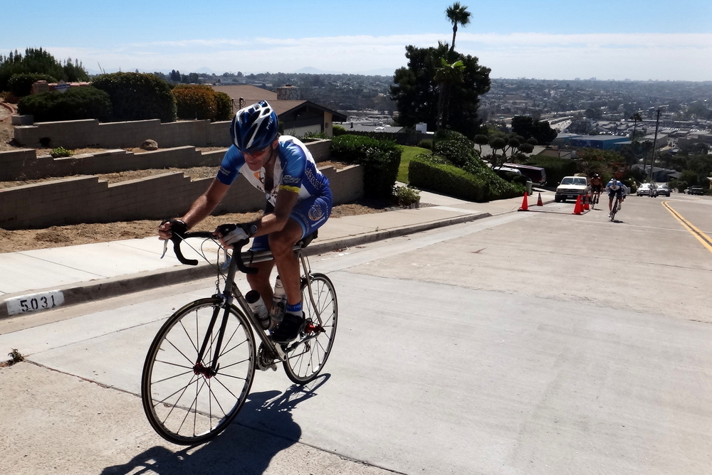
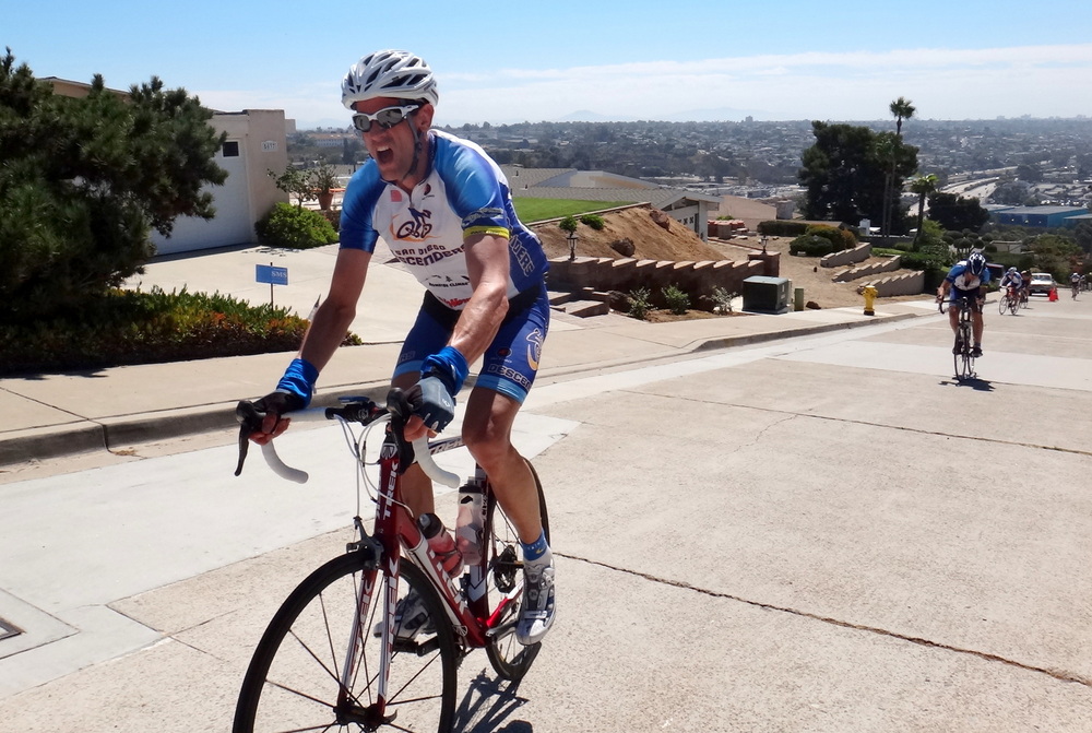
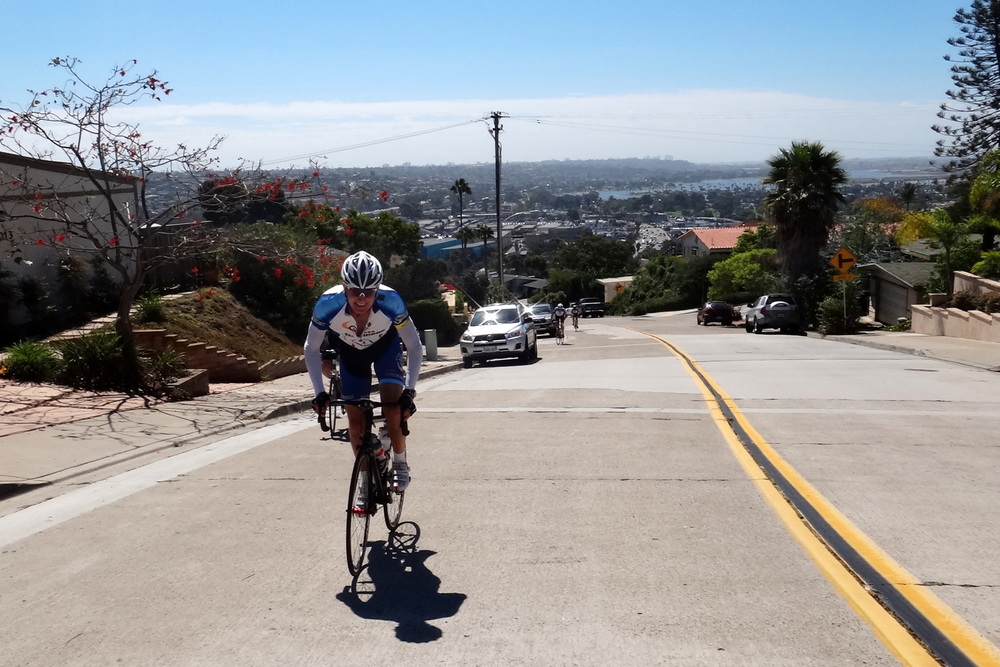
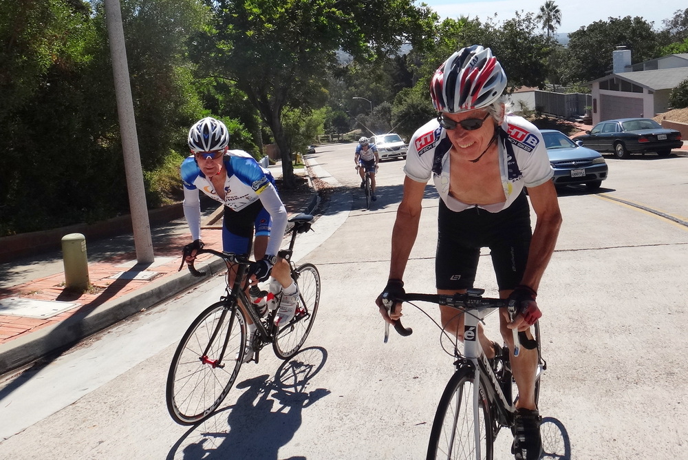
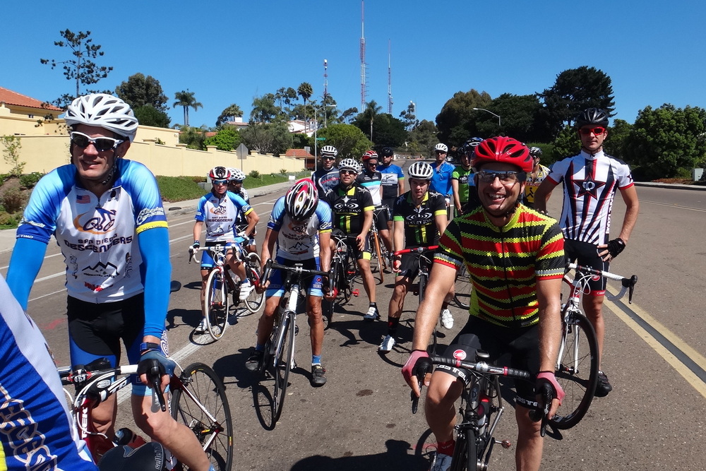
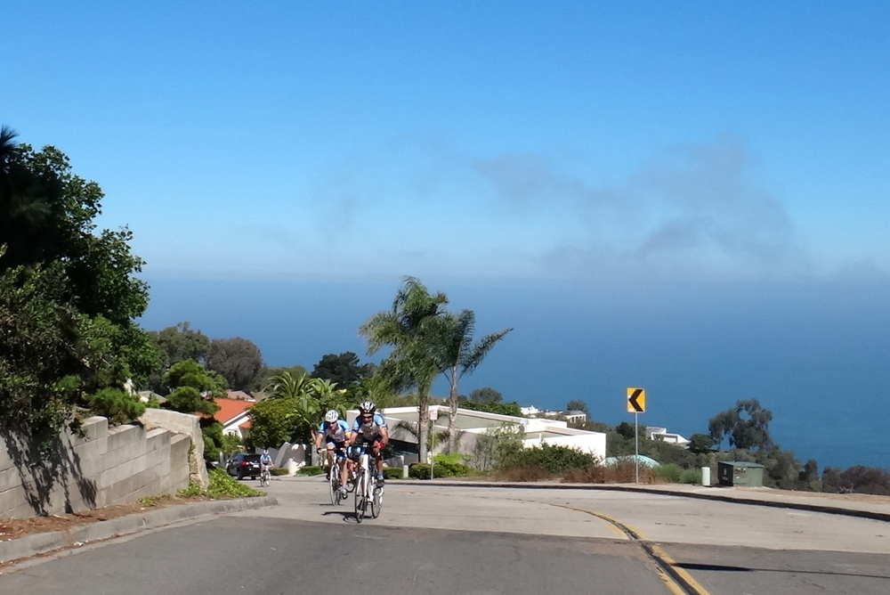
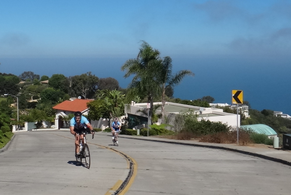
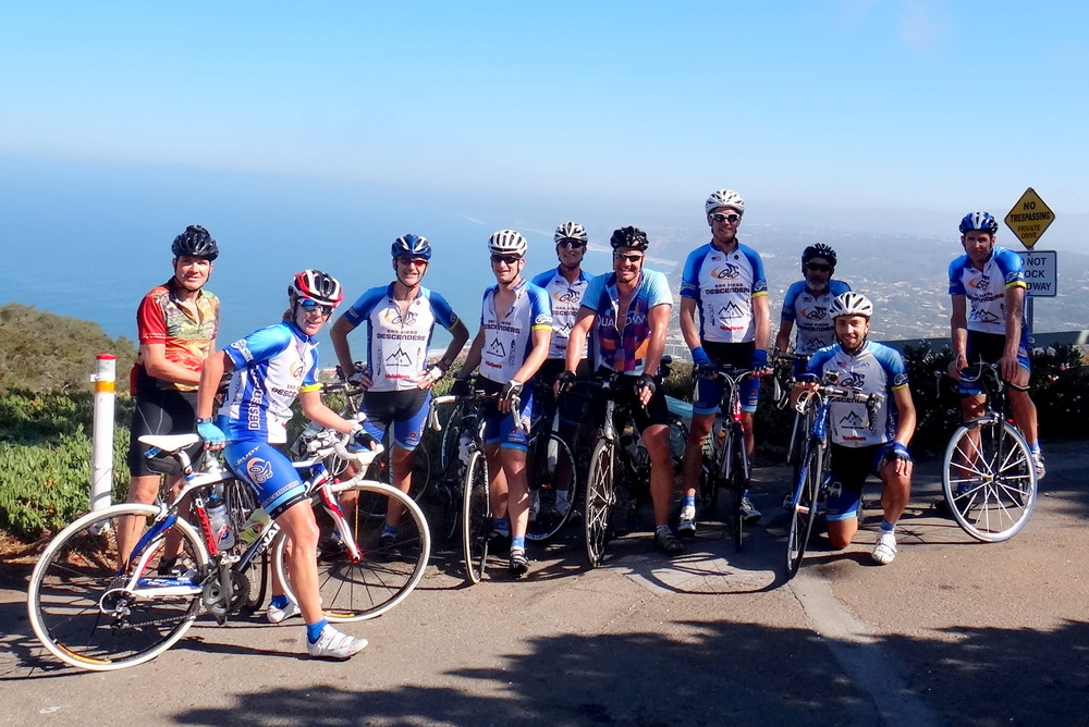
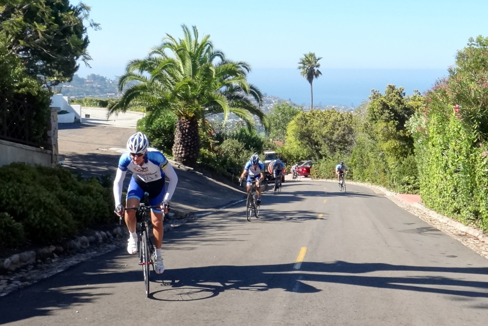
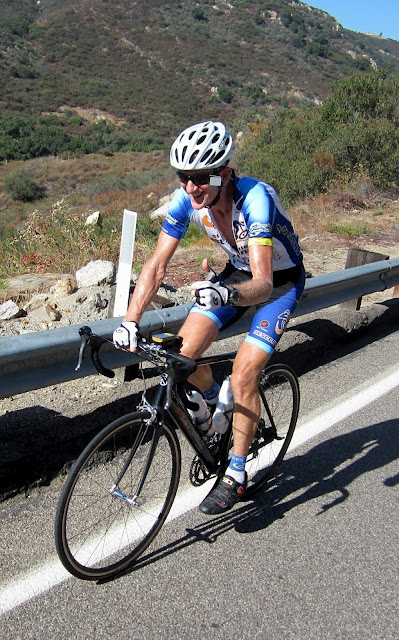
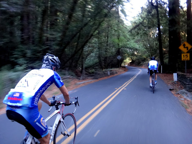
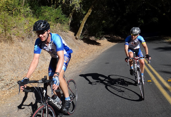
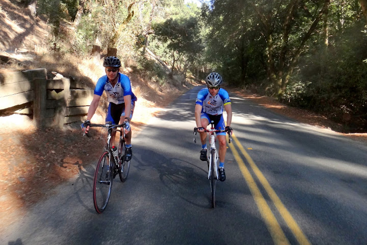
Descenders, today we rode towards Ramona, featuring Mussey and Pamo Roads – descenders classic!
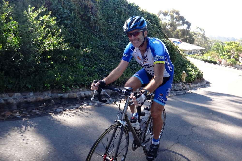
I counted at least 13 riders. At the start in Poway we had an amazingly gorgeous cloud cover that soon disappeared. We climbed Scripps Poway together as a group, and then motored up and down 67 and down Mussey, often breaking into small breakaway/chasing groups. James Wingert, who joined descenders for the first time, set KOMs up Mussey and up Pamo, congrats – an amazing solo effort!
Since this was a taper ride in preparation for Tour de Poway next Sunday, many riders turned around after Mussey and bypassed Pamo.
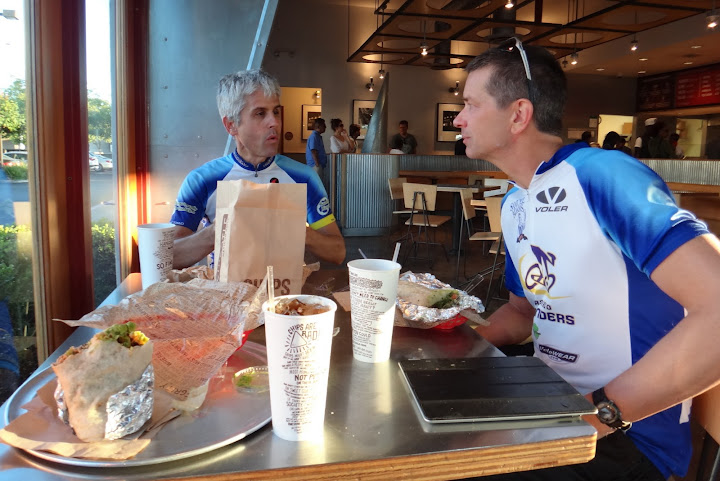
On the way up Mussey I had a slow leak in my rear tire, despite my best efforts I couldn’t track down the source – and by the time we got to Ramona I had another slow leak, in my second tube now. Double-flat, which was frustrating. Thanks to Voris for lending me his pump and an extra tube to trouble-shoot it. Of course as soon as Voris gave me the pump, he had a flat himself down in Pamo Valley, in perfect accordance with Murphy’s Law.
Other than that, it was a great ride. You should have come!
Bob Proulx had to drop off his daughter at UC Santa Cruz. I had a consulting strategy session in Pismo Beach. We decided to meet in Santa Barbara on our way back home to do a local ride. I headed up the CA coast on Saturday afternoon and arrived at my hotel in Pismo Beach pretty late. Bob packed up the trailer Saturday afternoon and left very early Sunday morning for the 8 hour drive to Santa Cruz. I had work to do most of the day Sunday and then a business dinner. I did get a chance for a quick run along the beach and coastal trails near Pismo. Bob rose very early on Monday after unpacking the trailer the previous night. He drove to Santa Barbara. I left Pismo a bit later and caught up with Bob just before we got to SB.
We went to Hazard Cyclesport on Anacapa Street to get last minute guidance on the route to Gilbraltar Road. They offered a local map that showed the roads leading to the climb and guided us to Sambo’s, down by the pier, for a bite to eat. We ended up parking just off of State St in downtown SB and got ready to ride. We rolled about 11 am. It was still a bit cool and cloudy in downtown SB but we could see the bright skies up above in the mountains. Our route went up Olive St and cut over to Laguna St and then up to the Santa Barbara Mission. The loop on the north side of the park took us on Mountain Road to the start of the climb of Gilbraltar.
The climb was immediately up as it curved up into Rattlesnake Canyon. There was very little car traffic and we only saw one rider. A guy passed us moving quickly up the climb. I started after him for a bit of a chase but wisely decided that at the first mile of the climb I needed to relax and enjoy the miles ahead with Bob. We kept up a nice comfortable pace as the road weaved and curved back up into the mountain; it got steeper as we got closer to the top. The sun was out and skies bright blue but it was not too warm.
Gilbraltar to La Cumbre, the top of the climb, is an 8 mile Strava HC segment. This is part of East Camino Cielo road heading north along the ridge of the Santa Ynez Mountains. The climb topped out and began a beautiful smooth road that eventually descended down some as we connected to the top of Painted Cave Road. Bob and I took it very conservatively along this road since we were unfamiliar with it and I was still a bit gun shy to get too aggressive due to my fall from the previous week. Painted Cave was very narrow, with lots of curves and very steep. There is a cool forested overhang section that got dark as we descended down. Our conservative approach required plenty of braking. About halfway down my right brake seemed to get very loose and almost bend far forward. If fact my right side handlebar cracked and broke off underneath the tape. This was a result of my fall last week and all the braking pressure. I had limited rear breaking for the last part of the ride.
We crossed over state route 154 and descended down a less steep section of Painted Cave with a few more tight turns, down to Cathedral Oaks Road. We took the Crosstown bike route through neighborhoods and along Modoc Road to head back towards the cars. I got a flat that we quickly fixed and then we cruised back through downtown. Our ride was about 36 miles with almost 5,000 feet of climbing. Most of the climbing was in the first 20 miles. We were both exhilarated and tired. We changed and then headed over to SB Brewing Company for a cold beer. Great riding experience.
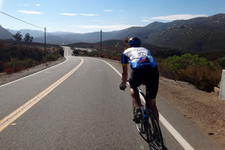
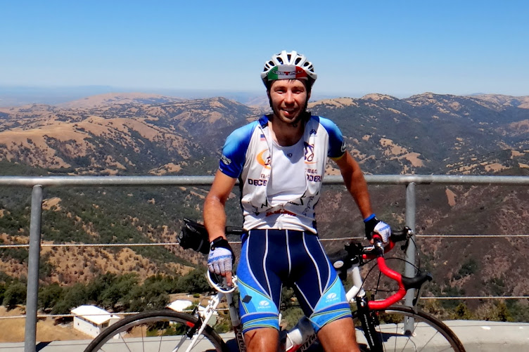
There are tons of rides in the local area and the route we took could have been extended up to the Gilbraltar Reservoir, farther to the east. We need to consider a Descenders trip to SB for a long weekend. It will be worth the adventure. Here are a few photos of our fun day riding in Santa Barbara.
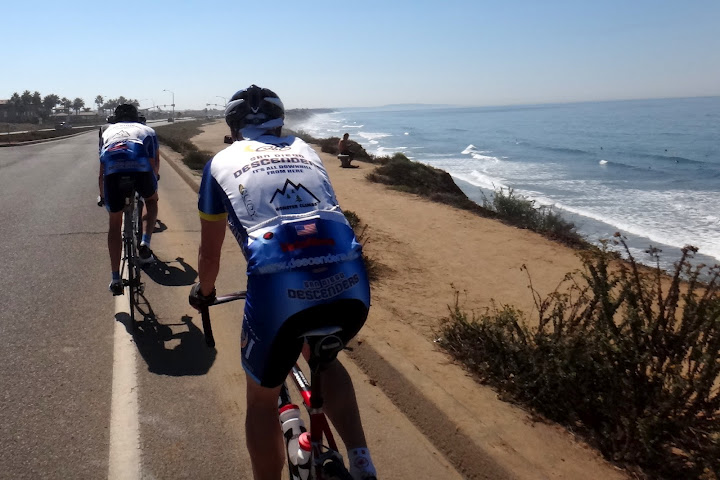
Today we road coastal (in reverse), a last-minute substitution of Pamo/Mussey ride due to hot weather.
At the start we only had 7 riders: Bob Proulx, Steve, Matt Babb, Dave Voris, Yi-Shiou, Chad, and I – we picked up Ernst and Garet and then Jeff Southerton on the way, for a total of 10. Not bad considering the heat.
We did Santa Luz climb (but no Stud loop, in the future we may want to do one or the other but not both if we need to save time). It was a beautiful climb and very fast descent – Matt Babb got a KOM chasing Steve and me, and now Descenders have 15 of the top 20 times on that segment, including top 5 spots.
Some riders had prior commitments and had to turn early – Steve, Garet, Bob and Ernst turned, leaving 6 of us.
The pace remained "animated" despite only 6 riders left – Chad, Jeff, Matt and Voris are not exactly shy about going to the front and pushing the pace till everyone hurts.
We picked up several "free-loader" riders while riding along the coast who hung on with our group – they made things a bit dicey a few times. Jeff lead the group out for Oceanside Harbor sprint, holding 29 mph for what seemed to me (as I was desperately trying not to get dropped) to last forever. At the final turn Matt jumped to the front, while Chad and I followed. I tried to sprint by Matt, who obviously was taking it easy, but he got on my wheel (along with Chad), and outsprinted me at the line. Nicely done, Matt! Of course strava says we were tied for KOM, so next time you have to try a bit harder, Matt! Descenders now have top 5 spots and 9 out of top 12 spots on that segment.
After re-filling the bottles, I thought we were going to take it easy on the way back (especially as it was getting hotter and hotter) but we just kept hammering – we picked up two other strong riders who shared some pulls. We lost Yi-Shiou and then Jeff turned back in Encinitas (after taking some super pulls).
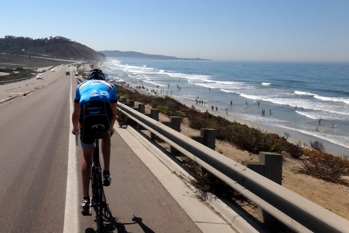
Voris, Matt and Chad went north to 56 bike path while I continued to Torrey Pines, by the time I got home it was 101F!
For me it was 82 miles with only 3,600ft climbed, but the strava suffer index was up there – 308, which is 11th suffer-most ride I have ever done, and 3rd toughest descenders local ride I have ever done (excluding Dudley/Julian/Stagecoach rides – those are always super-tough!) – and we tend to think of coastal rides as "easy"!
Great ride despite the heat – selected photos are attached. You should have come!
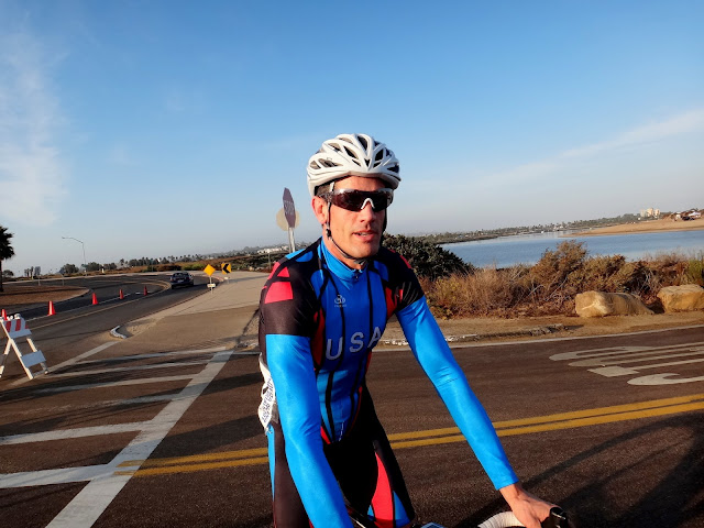
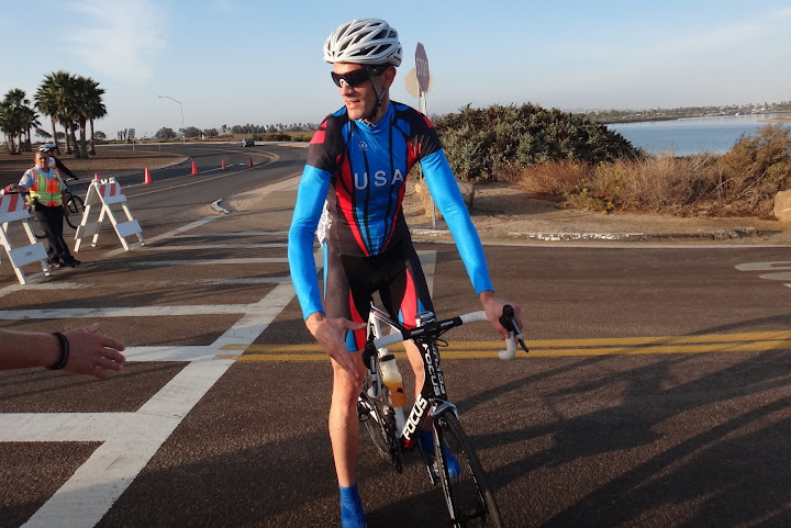
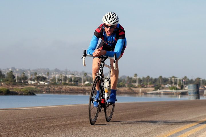
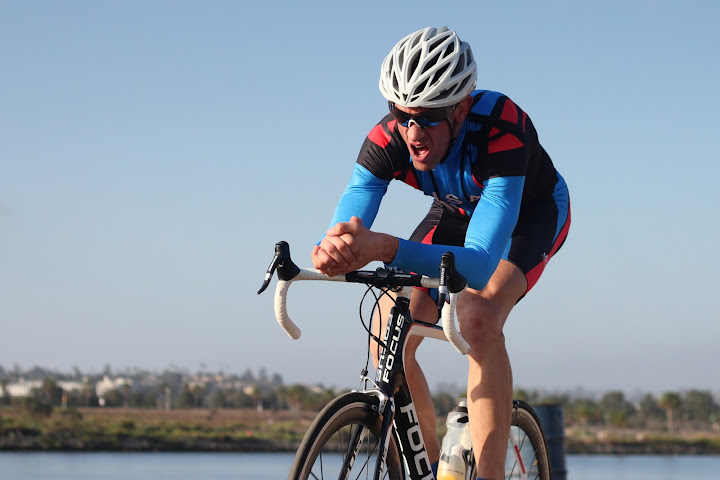
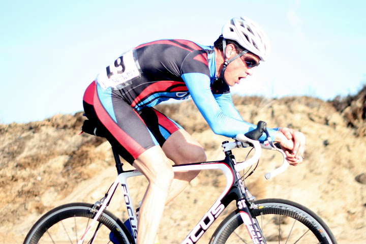
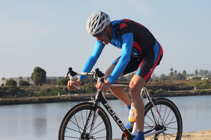
Bob Raibert has done Merckx-style Time Trial (no aerobars, aerohelmets or other aero equipment of any kind) at the Fiesta Island. Bob rode 20K (3 laps around Fiesta) in 30 minutes and 28 seconds.
Below is a brief report from Bob, and some photos of Bob in action.
Good to see you this morning, thanks for keeping an eye on my daugher.
The results were just posted, some fast times in the Eddie Mercx, I ended up 6th place out of 15. On course I passed 4 guys in my group, a good day, only 1 guy on a full TT bike setup passed me.
My Garmin was not “started” for the first 1.5 laps so will be unable to upload to Strava, bummer. My goal was to beat my time from last year but thought I was off by 30 seconds. My posted time was 30:28, a 24.5 mph average! This is 30 seconds faster than last November with the aero bars and aero helmet. So a successful morning afterall.
Add the aero bars and TT helmet and then and hope to break the 30 minute barrier in November.
Now on to do some hill climbing, hopefully later today and put the skinsuit aside for a while!
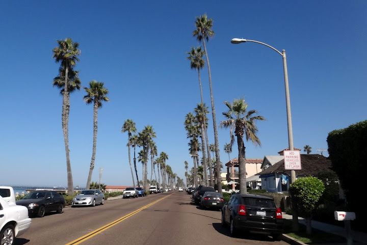
The Oceanside gang enjoyed a nice day along the coast. We had a small group of 4 riders including Steve, Yi-Shiou, myself and a new rider from Scripps Ranch, John. No pic’s to prove the ride happened, but we do have a new friend in Del Mar that can vouch for us.
We headed to the coast following our normal route down the 56 BP. We were all very chatty until we reach the Del Mar hill, when Steve put in a strong surge. It was very reminiscent of a large party sitting down to a nice meal and the room goes silent because the food is so delicious. Our energetic enthusiasm was damped slightly when we were pulled over by a sheriff for not stopping at the 4 way stop at the bottom of the hill after exiting the Del Mar Village. The way he pulled us over, one would have thought we had just robbed a bank. He came barreling past us with lights blazing and cut in front of us. After delivering the expected lecture, which he was right on all points, he informed us he was not citing riders but was only issuing warnings…. Our lucky day! The police were out in force yesterday, so looks like they are kicking off another road safety campaign. Be careful at stop signs if heading up the coast. The rest of the ride to the Oceanside Harbor was uneventful.
The return leg was exciting as there were 2 different organized rides coming down the coast. The first group was part of the AmTrak century ride and the other was a club out of Newport Beach call Bike Region. Their plan was to finish in downtown San Diego and return to Newport Beach via a party bus… Sounds a little more entertaining than AmTrak.
We had planned to cut inland and return via La Costa/Rancho Santa Fe, but we got caught up in the frenzy of riders and continued down the coast instead. There were a number of very fit riders and our pace accelerated, ranging from 28 to 30+ MPH. With the two events large groups formed on the road, especially at stop lights. We became separated after stopping at the Lomas Santa Fe intersection when a group of 50+ riders gathered. We managed to regroup in Del Mar, but we were still missing Yi-Shiou. BTY – Our sheriff friend was still positioned at the stop sign upon our return. With the number of cyclists on the road yesterday, I suspect he had a very busy day!
Our pace slowed as we headed out of Del Mar and alone the 56 BP hoping Yi-Shiou would return to the group. Another great day in the saddle… I finished with 67 miles and a very very impressive 2,274 ft of elevation gain! J Others riders likely ended with 80+ miles once they reached their final destinations.
See you on the bike soon!
Dave
Descenders,
For those looking for a 3rd ride option, there is also a Saturday local ride planned for 8:00 am. Route will be from 56BP/Black Mtn Rd. to Oceanside Harbor, returning via La Costa/Rancho Santa Fe, for a total of approx. 65 miles.
What: PQ to Oceanside Harbor returning via La Costa / Rancho Santa Fe / Santa Luz
Where: 56 Bike Path/ Black Mtn Rd
When: Sep 8, 8:00 AM – 12:00 PM
Hope to see you then.
Guido
Posted inLocal Ride Reports|Comments Off on Sept 8th – Oceanside Ride Report
We had a fantastic ride up Soledad today – we liked it so much we did it four times.
12 Descenders and two cameo appearances (by Roman De Salvo and Herb "Soledad" Johnson, more on that below). Len and I rode from Soledad (all covered in thick layer of fog) over to Carmel Valley where we found Neil and Eileen waiting. Soon we saw Hodges, Sheehan, Bob Raibert, Ernst, Claus, Geoff, Guido and Steve. Geoff and Sheehan got away from us going up Torrey Pines and build up a huge gap – even though we brought Sheehan back, Geoff stayed away to the top. The descent down La Jolla Shores was fast – I was following Ernst who was amazing in the switchbacks. We slowly climbed Hillside, almost everyone taking the gated cyclocross path – it was new way for many descenders. We lost Eileen for a minute – she started the descent before realizing we are gathering at the cross but she found us eventually.
We had coffee, bananes and pastries at the top – then we went down Nautilus – Sheehan and Guido had to get back to Poway because of family obligations, but we carried on to Country Club. Once we started climbing, I informed Neil we are on a KOM segment (about 30 seconds into it) – he took off like a rocket and managed to set two new KOMs, despite late start!!! Via Casa Alta provided another steep section. The descent down La Jolla Scenic drive and climb up Nautilus was less animated, I think. At the top we saw Roman De Salvo who was on a birthday ride with some of his friends. It was good to see familiar faces!
We then descended down Soledad Mountain road, and met Mr. Soledad himself, Herb Johnson, who at 67 years of age placed 2nd at this year's Palomar challenge behind Drew Peterson, and has won it and many other climbs before. He has done 48 minutes up East Grade at age of 67 last year – amazing! He lives on Mt. Soledad and I see him training there a lot. He took off up steep grades of Pacifica and only Neil could follow (and eventually outpace him). I chatted him up on the way up Soledad Road, turns out he has a Physics Ph.D. from UCSD of all places – it's a small world.
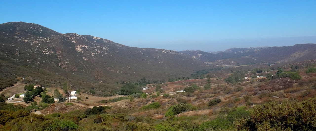
The guys kept riding back to Del Mar/56 bike path while Len and I went back home. My ride was shorter but most descenders got 65 miles with 5,600 ft of elevation. Selected photos are attached (more photos are here: https://picasaweb.google.com/109410926478548321411/20120901#)
this is a little delayed ride report for Greater Western Ride, aka “Donkey Ride” aka “This Deal is Going South, Fast” we did back on Aug. 18, 2012.
This was a new route for Descenders – going through gorgeous roads of Japatul, Dehesa and Lyons Valley with a fair bit of climbing.
The route was designed by Matt Babb who rides these roads routinely. We met at the Performance bike store in Bonita – the ride featured many local riders and friends of Matt – Larry, Brandon, Roberto and others – as well as regular Descenders Ernst, Voris, Len the elder, Guido, Rob V., Bob R., Bernie and Frankie. We also picked up Neil, Eric and new rider, Zach at the 40-mile start point, at Starbucks some 15 miles into our ride.
The ride was a tough for me – after averaging 20 miles a week of riding for about 8 weeks since Monster climbs I was slowly trying to get back in shape. And having ridden in 35F weather in Colorado this week it was difficult to quickly acclimate to 100F weather we were going to have on this Greater Western ride.
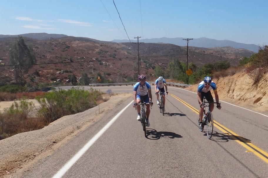
Lead by our fearless leader Matt, the pace seemed to be fast the whole ride. Soon we started climbing Dehesa and the group quickly broke up into smaller sub-groups, all suffering at their own limits. It brought memories of suffering Alpine challenge.
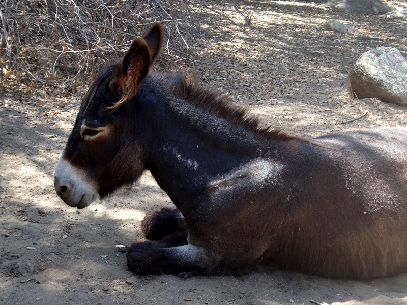
We stopped to regroup in the shade at the turn to Lyons Valley – it was close to 100F and we were running out of water. After some fun descent and rollers we refuelled and refilled our bottles at the store at Lyons Creek, next to the Donkey farm. Donkeys look to be suffering from the heat as much as me.
After some more fun descents, hitting infamous “Wall” with pitches up to 15% (which felt like 150% to me!) where Neil blasted by me as if he was on a motor bike, we regrouped again, then chased each other some more, until we finally got back to urban riding of Rancho San Diego. At some point in the final miles Ernst seemed to have disappeared from the back only to get ahead of the whole group – he obviously knows those roads and found a shortcut!
65 miles with 4,500ft of climbing. My heart rate *average* for the entire ride including descents and warmup/cooldown was 147, which is high for me, earning a strava suffer score of 302 – among top 10 “suffermost” rides I have ever done. Did I mention it was hot?
Below are some photos and some GoPro highlights of the ride, more photos are here.
A fantastic ride exploring some new roads, you should have come!
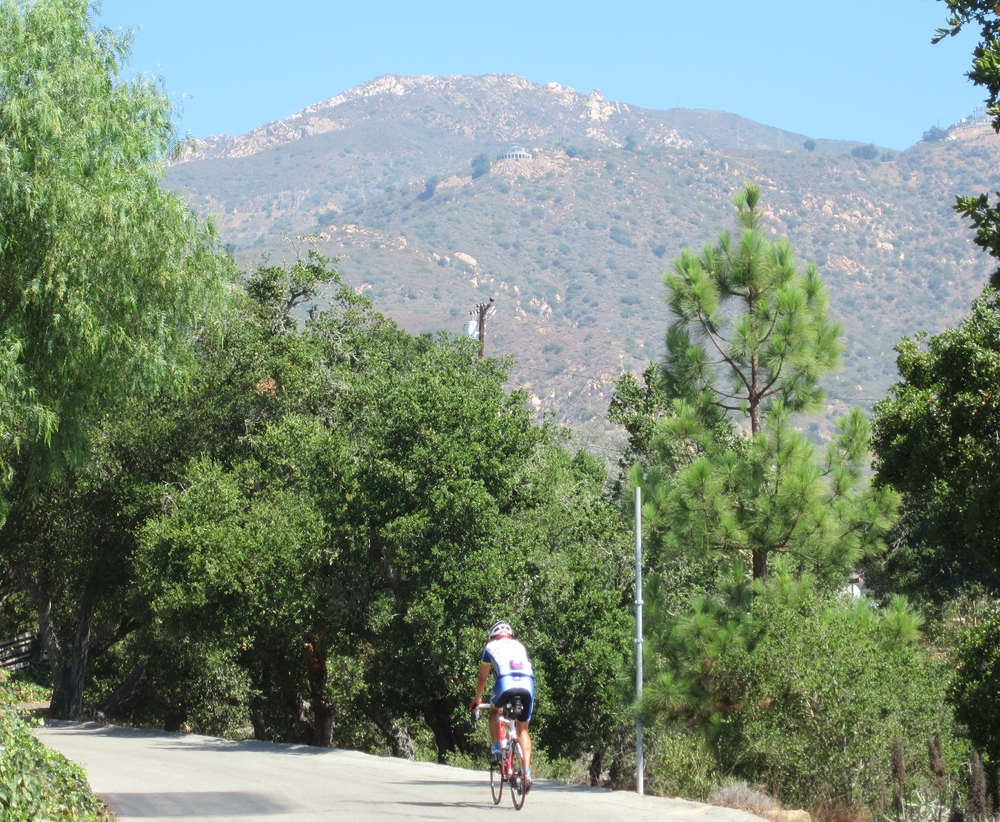
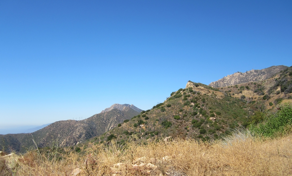
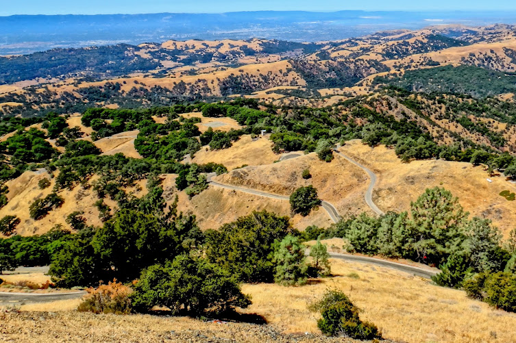
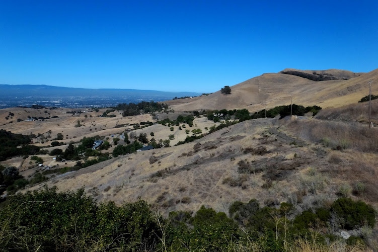
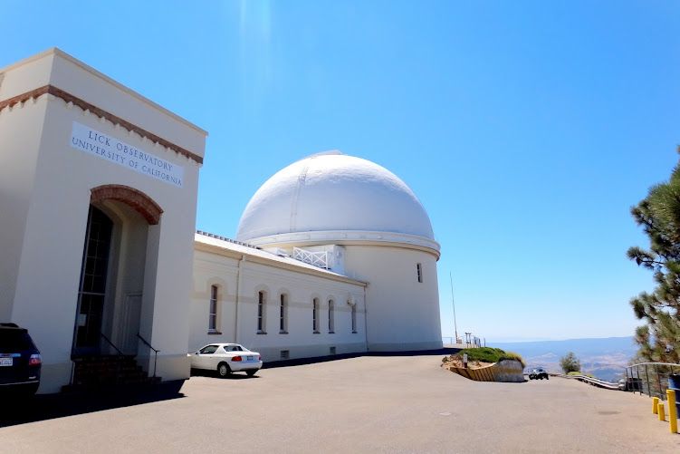
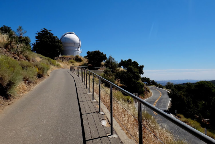
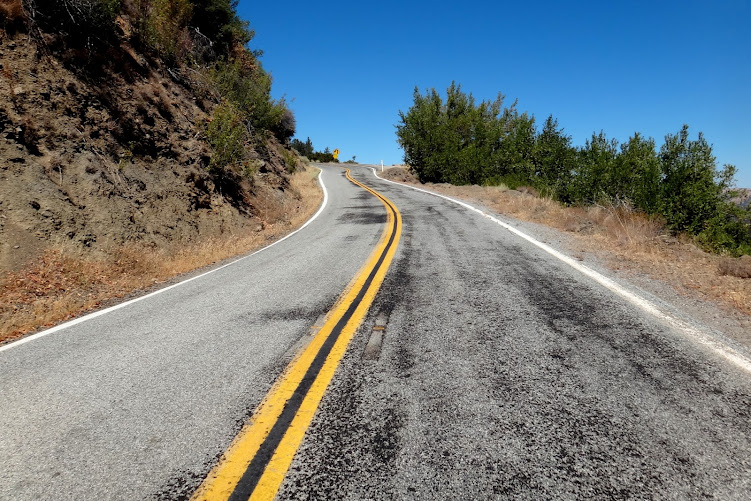
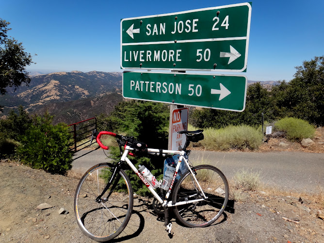
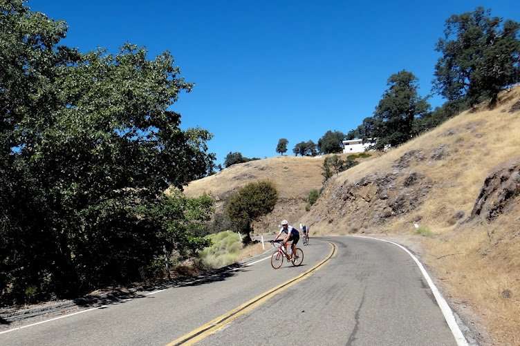
Today I rode up Mt. Hamilton – the West side of Mt. Hamilton is an 18 mile climb (from East Foothills) with a few short descents thrown in the middle – so even though Mt. Hamilton sits at 4,200ft elevation, the 18-mile west side climbs a bit more, 400 ft or so, than if descents weren’t there. And of course on the way back the descents become short but annoying climbs that interrupt the rhythm of a good descent. The final section of ascent is about 6.5 miles long and is very steady at 6%. Nothing too steep.
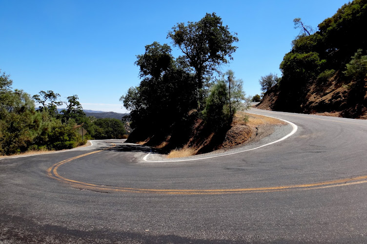
East side of Mt. Hamilton is steeper and shorter – it drops 2,000 ft in 4.5 miles, for an average of about 8%. A lot of very sharp switchbacks.
After the first 3 miles of climbing (almost a 1,000 ft) I had a flat – I changed it but decided to go back to the car to get another spare tube. By the time I started climbing again it was 10AM – and the temperatures were forecasted to be in the 90ies in Livermore and even warmer inland.
About half way I had my first encounter with a mountain lion. I have lived in California for 5 years now and has never seen one in the wild. It looked like a large cat and was standing by the side of the road staring at me. It must have decided that I am no threat because it then proceeded to slowly cross the road right in front of me. I was too slow to reach for my camera, by the time I got it out the mountain lion was gone in the bushes.
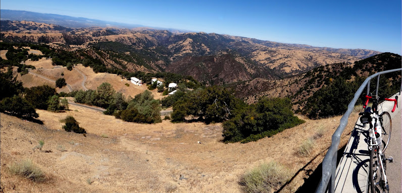
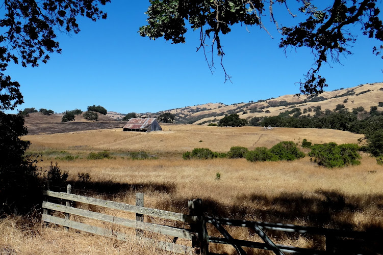
The scenery was absolutely amazing, see the photos below. By the time I got to the final 6.5 mile section of west side, leading to Observatory, it was hot – it went from 64F at the start to 90F in the final section of the climb to the top! I ran out of water, but I knew there was water at the top.
It took me 2 hours to go 18 miles! I decided to venture onto the backside, descending 5 miles on the east side of Hamilton and then riding up again, for an extra 2,000 ft. The descent on the east side was fast with a lot of tight corners and reduced radius turns – no cars whatsoever. I think I only saw one car going up.
Now the temperature was 98-99 with sun on my back, completely exposed to the sun with almost no shade and very little breeze. It was hot!
I suffered through the climb up to the top at pedestrian speed of 6mph or so, refilled my water bottles (I drank both bottles on my 45-minute climb of east side) and descended down to East Foothills. The temperature was still 95F at the finish. The two short climbs on the way back were annoying, as I had no energy left. But descending west side was a lot of fun, with good road surface (for the most part – they were doing some resurfacing today) and nothing too technical or dangerous. No sight of mountain lion on the way back (I had my camera ready but no luck). A fun day in the sun, even though a bit on the hot side for me.
57 miles with 7,700 ft of climbing. Strava suffer score of 272 – felt a lot worse than that though. After so many tough rides in the past 5 days I am really tired. Was barely moving today but glad to finish the ride as intended, plus extra 6 miles and 1,000 ft due to early mechanical.
Posted inNorCal Ride Reports|Comments Off on Mount Hamilton (ride report by Oleg)
Since I was visiting Berkeley I wanted to get in a Descenders ride with recent NorCal transplants – Keith and Dave Voris. We met at Castro Valley and soon were climbing up Redwood Road, which offers some of the most beautiful views.
The descend down Pinehurst was superfast and superfun! It moved into shaded redwood area.
Climb up Pinehurst was pretty hard – with Keith pushing the pace at the front. We stayed together but Keith easily pulled away towards the end to take the bragging rights.
We turned on Skyline and descended towards Redwoods from where we retraced our tracks back. There were some more fast descending and of course more climbing and then some more descending, with some roller sections in-between. Almost zero flat miles! Not much traffic and very few stop signs.
Our cooldown was done on a road very appropriately named “Seven Hills Rd.” It was like riding on a rollercoaster. We extended the cooldown by doing an extra loop, and then went to a nearby Chipotle for a few burritos and some catching up.
36 miles and 3,300 ft climbed (Voris got 500ft more than me, it must be adjusted for height or size).
A fantastic ride with some great Bay Area Descenders, you should have come!
Posted inNorCal Ride Reports|Comments Off on NorCal Descenders Ride: Dave Voris, Keith and Oleg
This is the 4th time my Ritchey Breakaway goes to Bay Area.
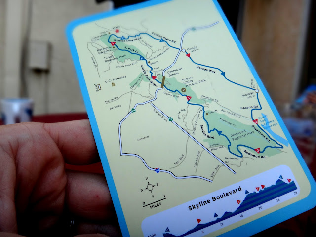
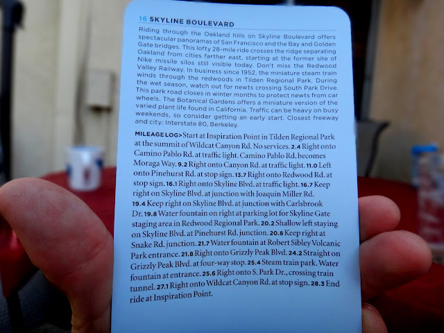
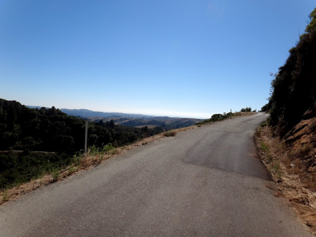
Originally my plan was to ride Mt. Hamilton but I decided to change it last-minute and go to Tunitas Creek. It was a great day, with the weather in mid-70ies. I started from Woodside, a town filled with cyclists of all types, shapes and sizes – they were everywhere, most of them finishing their rides (I got there around 1PM). I assembled my Ritchey and was ready to ride – I was going to follow the route described in one of the Bay Area cards – they look like this (the one shown below is for the ride I plan to do tomorrow):
The cards are fantastic because they show a simple map with all important turns and mile markers and orienteering points indicated clearly, along with elevation, water/food stops and other details relevant to cyclists. They also fit in the back pocket of a jersey and are sweat-resistant. Highly recommended.
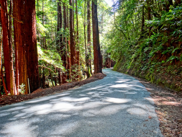
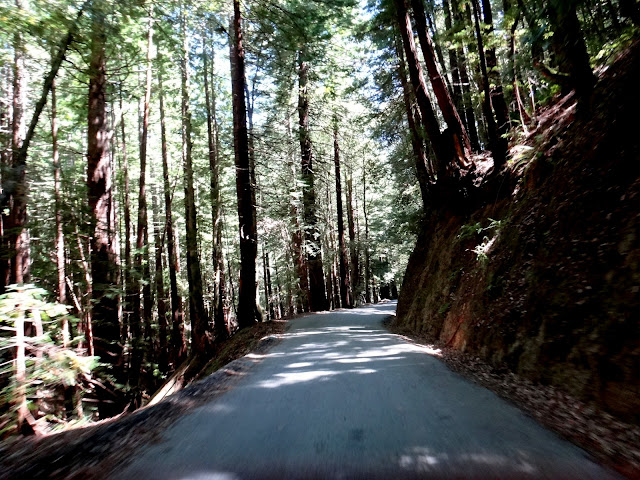
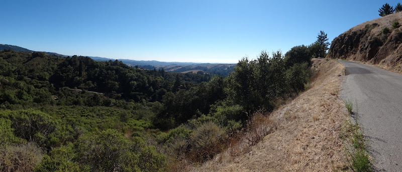
The climb up Tunitas Creek (along Kings Mountain Rd.) towards Skyline Blvd. was gorgeous.
The descent was fast and a bit tricky – the road is narrow, and there is a blind corner after blind corner – rarely do you see further than 50-100 yards.
After the descent I got on Cabrillo (Hwy 1) that runs along the coast.
After riding through some gorgeous farmlands I started to feel the 90-mile 7,000ft club ride I did the day before – my legs were sore, I was getting tired and hungry.
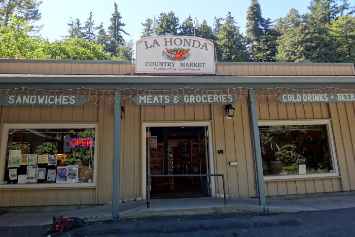
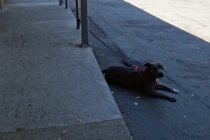
I stopped at La Honda market (kindly indicated on my map card) for some lunch.
Yes, it is a dog-day afternoon – this is how I feel too.
Soon I was refueled and up and riding on La Honda Rd.
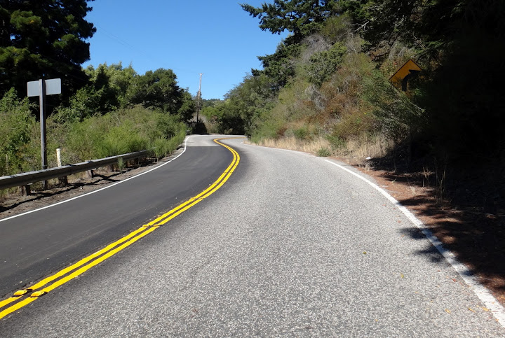
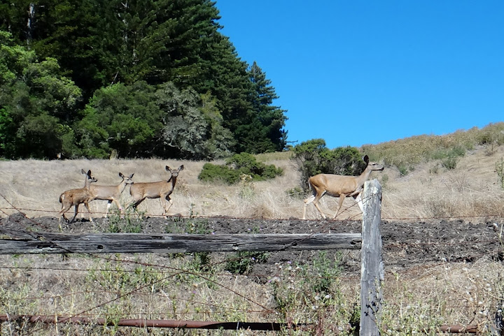
I took the Old La Honda Rd., famous among local cyclists – except I was doing it backwards and going at touring pace (easy and with a lot of photo stops).
A herd of deer at the top of Old La Honda Rd. I almost hit one on the descent.
After a quick descent I was on Sand Hill rd. heading towards Stanford campus/Palo Alto.
View of Palo Alto in the distance.
The photo above is of Stanford Linear Accelerator (3Km long). I have an experiment here in November.
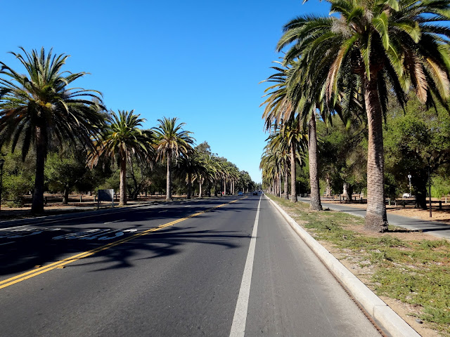
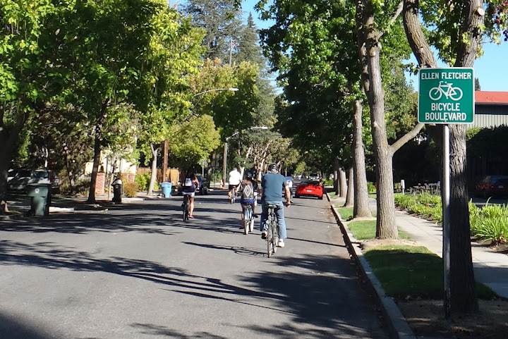
Stanford campus: Palm Drive.
We need more Bicycle Boulevards like this one in Palo Alto!
Eventually I have had enough of exploration and rode back to Woodside. It is virtually impossible to get lost with those little card maps. 56 miles and almost 5,000 ft climbed, but felt longer and tougher.
Posted inNorCal Ride Reports|Comments Off on Tunitas Creek, Old La Honda and Stanford
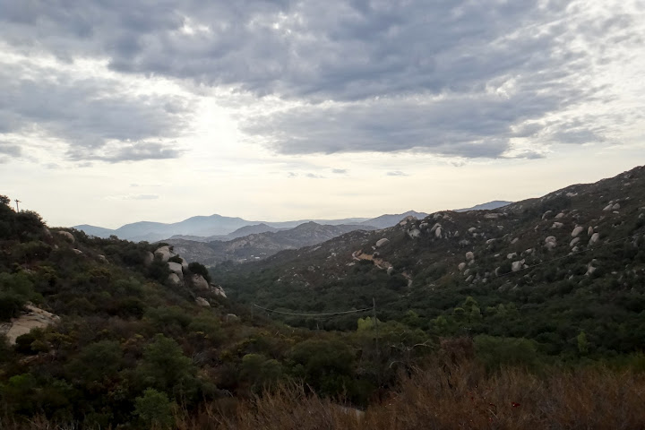
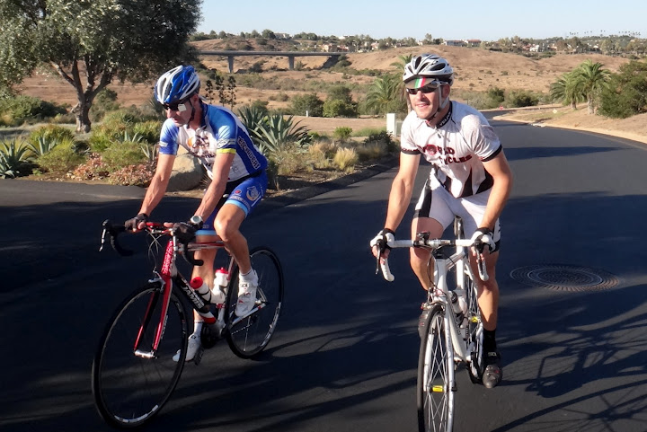
Descenders, we had an outstanding ride yesterday. I rode from home and half way into the ride it started drizzling. It was foggy at the top of the Black Mountain Road. I met up with Matt Davis, RIck, Voris, Ernst, Hodges, Guido, Klaus, Geoff, Jeff S. as well as new rider Steve. We started rolling on wet roads and picked up Eric R. by Santa Luz. 12 riders altogether, not bad for a rainy day. The drizzle stopped by the time we got to Rancho Santa Fe and it was perfect belgian weather.
We pushed it a bit just before and on the Stud loop but then backed off and rode as a group. Eric got a flat at the turn to San Elijo – Matt and Rick stayed with Rick while the rest of us pushed on to Double Peak. (Eric manage to reglue his tubular and trace his way back, according to Strava). Jeff S. was pushing the pace uphill for a while and was the first to the top. Double Peak was completely surrounded by fog, from the top you could not even see the parking lot. On the way down we saw Rick and Matt, who stayed behind to do some Double Peak repeats. Ernst stayed behind to chat with them. Elfin Forest was not as enjoyable as usual, due to on-going road repair. We decided to be adventurous and turned right to Via Ambiente, a new road I found while riding in that are last week (Guido went home the Elfin Forest way). It features a brutal 2-mile climb at about 7% average with pitches of 15%, and amazing views. Surprisingly, nobody seemed to object, at least not to my face – I am sure there was some cursing in the back of the group. Once again Jeff was pushing the pace up to the top. The descent on the down side was fast – strava clocked me at 54 mph! Once we got to Del Dios we tried to explore another road, Bing Crosby Blvd that would have gotten us to Camino del Sur, but quickly gave up once we discovered a gate surrounded with a fence. Jeff S. turned back towards RSF as we continued on Del Dios to Lake Hodges. Instead of going on Pomerado from Lake Hodges we decided to turn right and go on Bernardo, new roads to me. We lost Klaus and then Steve as they were turning to go their own way home. Hodges, Voris and Geoff turned on Black Mountain as I continued straight on Carmel Valley. By the time I got home I got 90 miles with 7,000 ft of climbing – a great day in the saddle with some new roads.
Here's the link to the photos with a few selected attached:
Description:REVERSE Elfin Forrest Loop with Double Peak: Meet at 56 bike path & Black Mountain Road for 50+ miles through Santa Luz, Rancho Santa Fe, to San Marcos, Double Peak, and back through Elfin Forest. Map: Reverse Elfin Forest, Double Peak
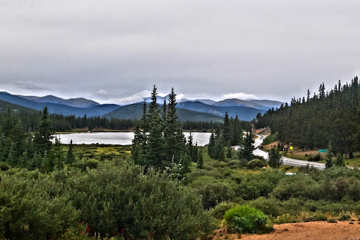
Following a meeting with one of my collaborators at the University of Calgary, I had a chance to head up to Banff for a long road ride. A number of shops rent road bikes in Banff, but only one, Soul Ski and Bike, rents a carbon fiber bike. In particular, they rent the Cannondale Synapse with a Shimano 105 gruppo. The shop opened and 10 AM, and I was out of the door with seat adjusted and pedals fitted 15 minutes later.
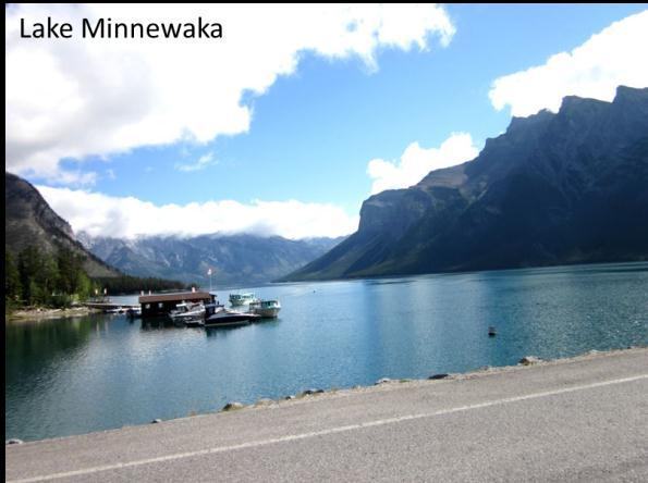
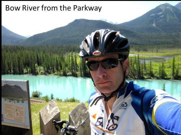
The ride started from the center of Banff to the East along Buffalo and Tunnel Mountain Roads. After the first small climb, the road rises well above the Bow River Falls (rapids actually). The climb continues after this and gets a bit steeper heading up Tunnel Mountain Road. At this point, I noticed that the cage on the front derailleur was rubbing when I was using low gears. This was a little irritating, but I figured I would deal with it once I looped back through town before the big climb of the day (Mt Norquay). Tunnel Mountain Road rolled up and down through the woods and brought me back to Banff Ave. I then headed north to Lake Minnewaka. The climb up to the lake is reasonably uniform with a few steep pitches. The lake is flanked by massive granite peaks fading off into the distance. Following the lake was a gentle downhill section with ideal road conditions and well banked turns.
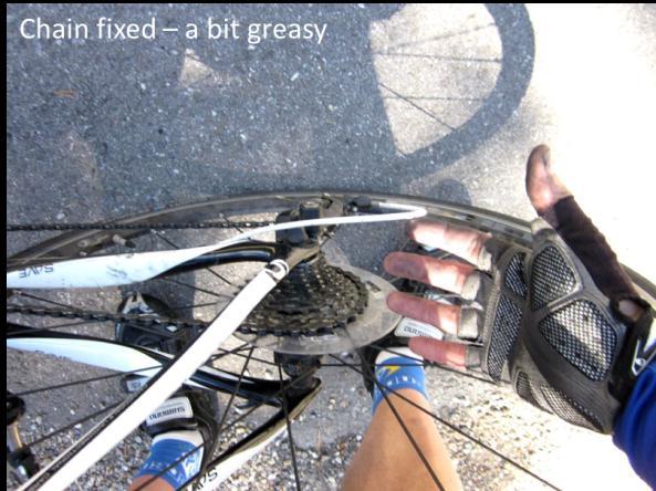
I headed back into the town and swung by the bike shop. The mechanic adjusted the low limiter on the front derailleur and also spent some time adjusting the tension on the rear derailleur. I was a bit puzzled with the rear derailleur adjustment, since it had been working reasonably well. I headed off to the main climb of the day. As the slope began to pitch up a little heading out of town, I noticed the rear derailleur was shifting poorly. Rather than going back to the shop or attempting a fix on the road, I just adjusted the tension a little from the cable and it began to work a little better. Soon I was heading up Mt Norquay and encountering the longest sustained pitches of the day. The shifting was still a bit troublesome, but the views of the Bow River Valley were so amazing that I decided to keep riding. At one point the slope became steep enough that I was looking for one more gear. I began to shift to a larger cog on the back, and as I did so I looked down. Oddly, it looked like I was on the largest cog already, but the shifter was moving. Before I could react, the chain came off the largest cog and went straight into the wheel. I stopped pedaling, immediately realizing I was going to be jamming the chain hard between the cassette and the spokes. Regardless, the chain did jam, and the bike came to a sudden halt, requiring some quick foot work to avoid falling over in the middle of the road. Safely off the bike, I looked down to see the chain firmly wedged behind the cassette. This was pretty annoying, since I was making good time up the mountain and hoping I might actually have a chance at a top 10 for the segment (reviewing the climb later, it became obvious I wasn’t even close). The next 10 minutes were spent getting progressively greasier as I worked to pull the chain out. The alternative would be to walk back down the mountain, since the rear wheel was not going to do a lot of free wheeling. The chain finally came free, and I did my best to clean up my hands with dirt and leaves. After properly adjusting the tension on the rear derailleur cable and the low limit screw, I headed back up the mountain.
I turned around at the Ski resort on top of Mt Norquay. After taking a couple pics on the way down, I decided to just hammer down the mountain. If I went up slow, the least I could do is go down fast. It turned out to be a great descent – smooth roads, banked turns and long straightaways. Coincidentally, I made the top 10 on the descent. Sheehan would have killed it.
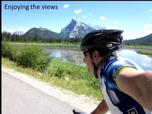
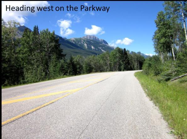
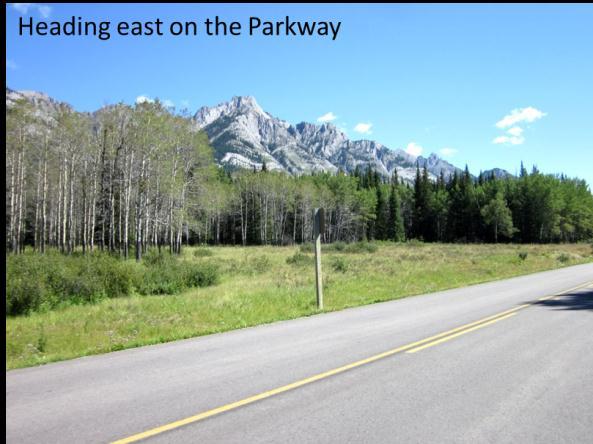
For the final leg of the journey I headed along Highway 1 to the Bow Valley Parkway. It was about 12:45 PM as I turned onto the highway. Based on the 1.5 hour drive to Calgary and my 7:00 PM flight departure, I figured I should turn around after about 1 hour in order to be heading out of Banff by about 3 PM or so. With no specific end goal in mind and just a turn-around time, this part of the ride was quite relaxing and a chance to just enjoy the view. The Parkway runs along the Bow river and provides some excellent views of the surrounding mountains and the river. Traffic is incredibly light, since anyone in a hurry is on Highway 1. Bicyclists are reasonably numerous including one guy on a TT bike and a club running a paceline (both going in the opposite direction). I rode until Johnston Creek and made a slow loop through a heavily wooded campground. The left brake lever assembly had been loose for most of the ride, so I took a few minutes to tighten it down. Without an actual ball-end hex, it was almost impossible to get this done properly. While taking a few pictures at the turn around, I began to notice a steady accumulation of mosquitos. By the time I had my camera stashed, helmet back on and was away, I had attracted quite a swarm. Fortunately mosquitoes are slow and I was rid of them in a few pedal strokes.
On the way back I took a slightly different route. When mapping out the ride, I had noticed a path to the south of the highway that did not appear to run all the way to the Bow Valley Parkway. Since I had nothing to lose, I looked for a possible connection between this path and my route. Just as I was getting onto the highway on ramp, a path entrance appeared to the right. The entrance was gated – likely to keep bears off the path (or maybe on the path – not sure which). As it turned out, this has to be one of the most scenic bike paths in the world. Describing the views really does not do them justice, so I have included a few representative pictures.
I headed back into Soul Ski and Bikes at about 2:45PM. After telling them about my experiences with the rear derailleur and the left shift/brake lever, the manager gave me a 20% discount and pointed me toward the bathroom next to the repair area with a ready supply of hand degreaser. The discount was more than I had expected – it was a rental bike after all. Next time I get a rental, however, I will do a more thorough checkout before heading off on the ride. Overall a fabulous ride with a few, manageable mishaps.
Hot! Damn Hot!* *quote taken from Good Morning Vietnam
It was a scorcher last Sat for our group ride. Jeff S rode over from Del Mar to meet Guido and me on the bike path at Black Mountain Road. We pedaled over to Spring Meadow to get Voris. I swung by Hodges house. He was getting in touch with his inner self by listening to Hall and Oates music and painting his small garage what had to be characterized as pastel blue. Mike declined to ride as he is in his recovery phase. He promised to be there for Tour of Poway next month. We pedaled over to the start.
A large group gathered at Pomerado and RB. We had more than a dozen riders, including Denise, Garet and a new rider, Steve. The large group cruised over to HVR and climbed up to Bandy Canyon. We flew down and rode over to the Ramona Grade. We formed a large paceline, smoothly rotating along the ride. This was Denise's first paceline; she is riding great. It was already getting very warm. I turned around at 78 and went back along Bandy to sweep up Sheehan while the rest of the group climbed to Ramona. Sheehan and I held a comfortable but steady pace on the climb, the heat intensified. We passed Eric and Bob P worked on Eric's rear tire. The group gathered in Ramona at the corner gas station in what little shade could be found and refilled now empty water bottles. Eric, Bob P, Sheehan, Garet and Steve decided to egress back towards Poway and cooler temperatures. The rest of us rode toward Old Julian.
We still had 11 riders on the climb to Old Julian. The heat rose as we climbed. I was not worried about getting to the top but how was I going to get back home after getting there. We rode to the end of Old Julian, now just over 40 mile for the ride at that point. The descent down was fast with Rick holding back a bit to pull Denise along. Thank goodness as I was holding onto her wheel getting the full benefit of Rick's pull. We all rode back to the Chevon gas station for another round of water and shade. Guido was feeling the effects of the ride and wanted to get going back down Dye Road at an easy pace. I immediately volunteered to take the easy pace with Guido. We headed out expecting the group to swallow us up soon.
Guido and I cruised along Dye and back around Mt Woodson on Hwy 67, no group yet. We descended Poway Grade and were stopped at the Twin Peaks/Espola Light with Bob Raibert came up behind us. We were hot, tired and running low on water. Bob led us along Twin Peaks. I pealed off at Rancho Arbolitos to get more water from my college buddy's house. I left Bob and Guido to make their way back home the final few miles. My return pace was super slow but I finally made it back to the bike path and home; hot and exhausted. 72 miles and 4,700 feet of climbing. Great way to spend the morning!
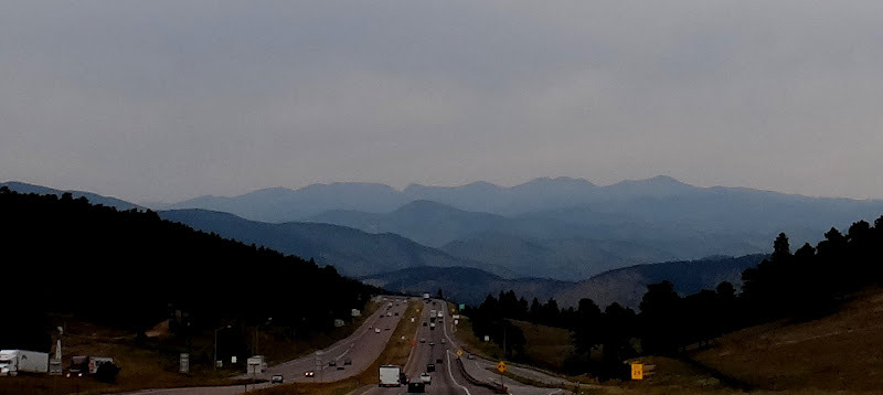
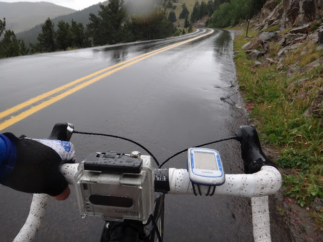
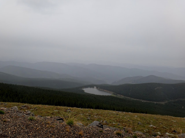
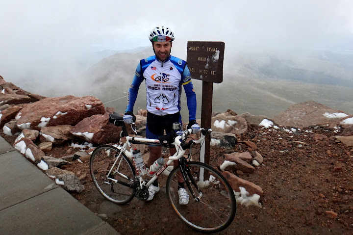
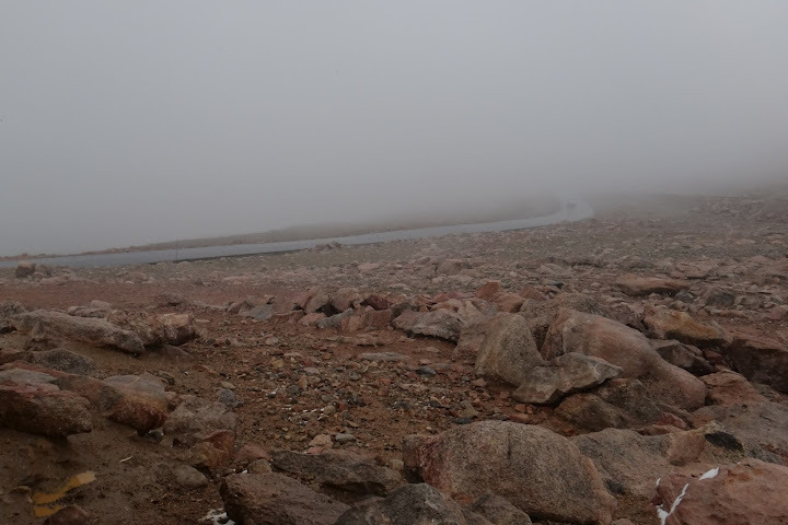
Yesterday (August 13) I climbed Mt. Evans in Colorado. At 14,130 ft it is the highest paved road in North America. It also turned out to be the toughest day I ever had on a bike, and elevation had nothing to do with it.
I was traveling from Chicago to San Diego and decided to stop by Denver to do Mt. Evans specifically – I got 6AM flight from Chicago to Denver and 8PM flight from Denver to San Diego. Perfect layover!
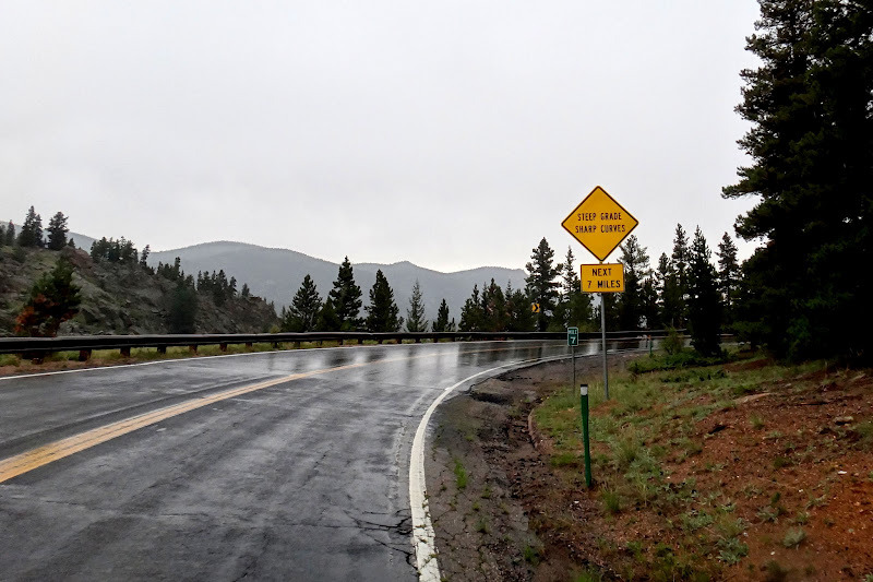
The weather in Denver was warm – with high of 91F, as it should be in mid-August. I chose to do a full climb from Idaho Springs (high of 86F on the day of the ride), rather than the shorter version from Echo Lake – the route from Idaho Springs is 28 miles long and just short of 7,000 ft of elevation gain. At about 4% average it is not nearly as steep as California climbs we do often, but everyone who has ridden it comments on how the elevation has a serious effect past 10 or 11 thousand feet.
When I checked forecast, it claimed temperatures around 50F at the summit and 20% chance of showers in the afternoon (typical for Denver), with hourly forecasts predicting showers from 2PM to 6PM. I started riding around 10AM and with 3 hour climb and 1 hour descent I figured I may just be lucky enough to escape them.
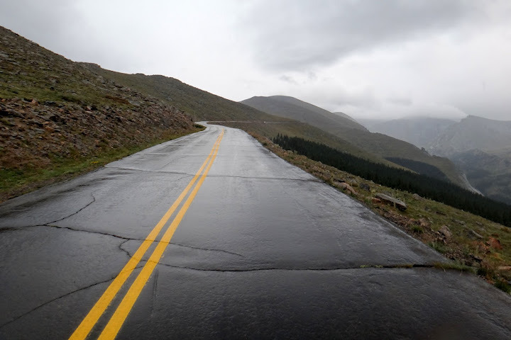
But I wasn’t so lucky – just a few miles into my ride it started drizzling, then turning into serious downpouring. The temperature was in high 70ies when I left Idaho Springs but now was low 50ies and dropping. Should I turn around and go back to the car and postpone my date with Mt. Evans till next year? My shoes, my clothes were already completely wet, but I wanted to get to the top so I just pressed on, despite the rain – after all, how much worse could it be?
The park rangers at the fee collecting station by Echo lake (by the way, cyclists no longer have to pay $3 entrance fee) warned me not to go all the way up to the summit, saying the road is likely to be completely shut down due to bad weather. This only made me want to climb faster, wanting to get to the top before they shut the road down.
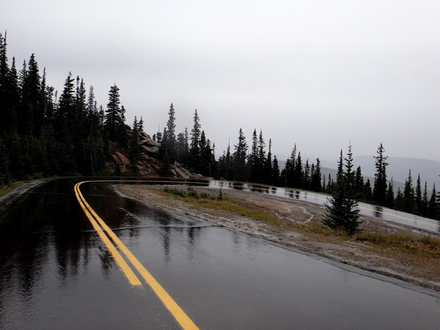
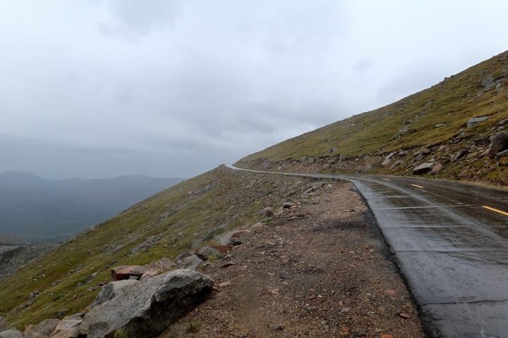
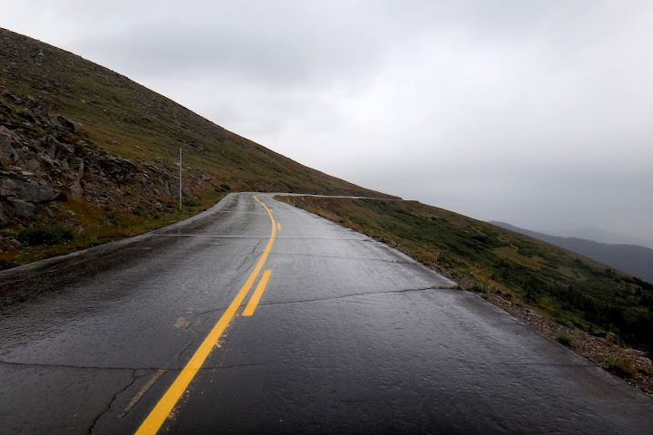
With about 3 miles to the summit the rain turned to snow, with some mixture of hail-like particles that I could see bouncing from the wet road. Wind was brutal too. Visibility was almost non-existent, so no good photos unfortunately – on a clear day one can see Pikes Peak and even curvature of the Earth from the top of Mt. Evans. My hands were freezing, despite my full-fingered gloves.
I finally made it to the top, after going through the famous 11 switchbacks (I tried counting but my hypoxic brain couldn’t manage this simple task, I lost count at 5 or 6). I had no negative altitude effects until around 13,000 ft when it felt like someone started squeezing my chest with a vice. I slowed down quite a bit and monitored my breathing, to avoid getting altitude sickness – in the end I felt fine, somewhat surprisingly. It wasn’t so much the climb itself (long but not very steep – with sections at 6-7% but nothing steeper) or the high altitutde that proved to be the worst for me, but the cold, wet weather.
At the summit the temperature was 36F (more than 40 degree swing from base to summit), very strong winds and on top of it, it was snowing pretty hard. I was wearing wet shoes and clothes for 3.5 hour ascent and my whole body was getting cold. My fingers and toes were frozen numb.
After hiding out in the bathroom structure at the summit to warm myself up a bit, I decided to (very gingerly) start my descent down wet switchbacks. Unlike California, there is no barriers and 1,000 ft dropoffs to my right (the side I was descending) plus numerous freeze cracks in the asphalt. But descent wasn’t nearly as technical, especially past 11 switchbacks near the top. I was freezing on the descent and got borderline hypothermic. At times my hands and my chest were shaking, not a good thing for descending wet roads with low visibility!
I finally made it to Echo Lake tavern/gift shop where I spent a few hours drinking hot tea and eating bowls of chowder, wrapped in a blanket near the space heater (thanks to wonderful waitress Becca for taking good care of me) until I recovered from my hypothermia. I went down to the car, took apart and packed my bike and made it back to Denver
In the end I made it fine – a bit of misery and suffering, perhaps pushing my body a little too far beyond its limits, at least in context of getting a bit hypothermic (that part wasn’t fun), but an epic and memorable ride nonetheless. Even though I entertained the idea of turning around to the car 30 min from start all the way to the top (including flagging a car to get me down safely), I am glad I finished the climb despite the weather.
Below are some photos (visibility was very limited), as well as some brief highlights from my GoPro which gives you some idea of the weather conditions and my suffering.
Suffering is good for the soul, but I am also happy to be back in sunny and warm San Diego.
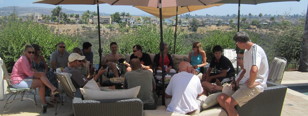
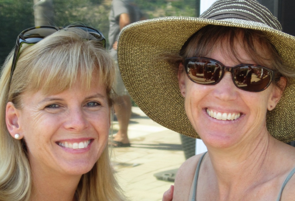
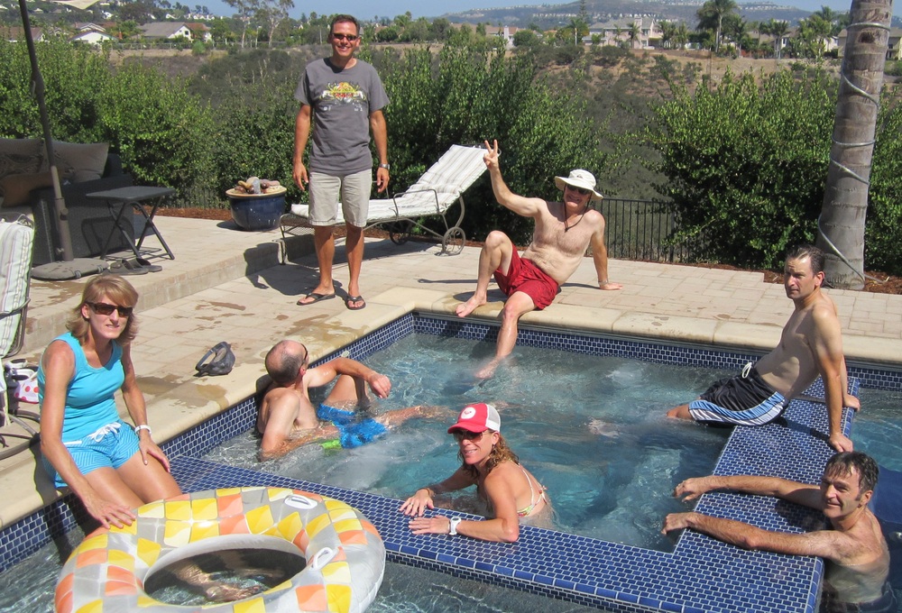
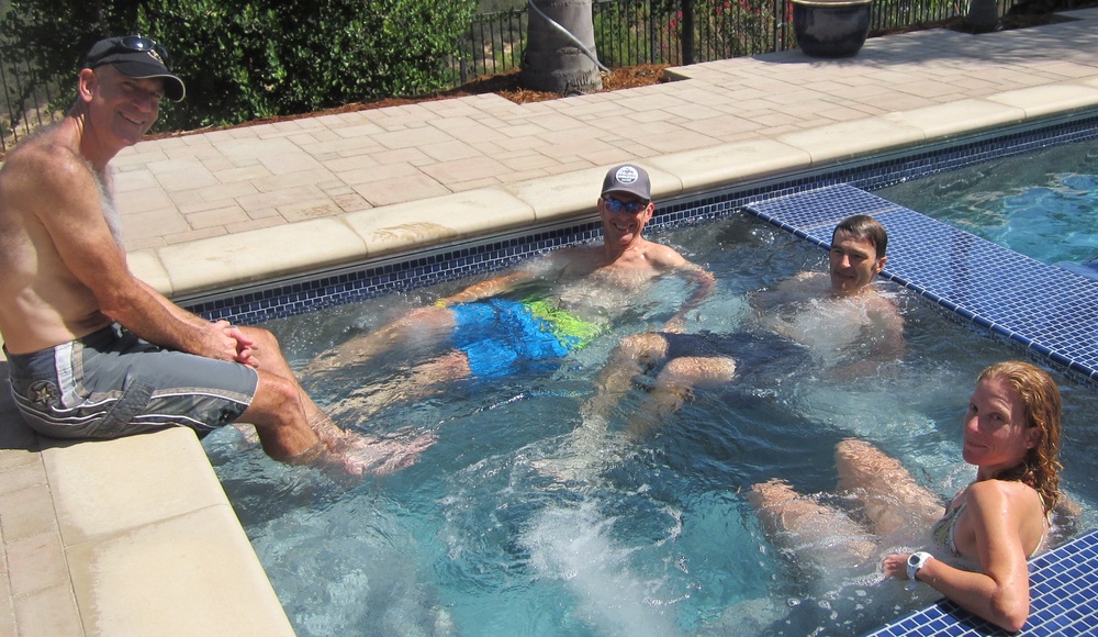
The pool party was a good time. We had more than a dozen Descenders there and a number of significant others. The pool was open and we had another picture perfect San Diego weather afternoon. Our friends from down under are heading back to Australia later this week. We wish Bill and Pete the best and look forward to having them ride again when they return to the US. There is still lots of extra beer so I will plan another social soon!
The Leadville 100 MTB race is this Saturday. We wish Mike M and Mark W a good ride. Go get ’em guys.
See you on the road this weekend-
Rob
—————————————– ******************************************************************* IMPORTANT MESSAGE FOR RECIPIENTS IN THE U.S.A.: This message may constitute an advertisement of a BD group’s products or services or a solicitation of interest in them. If this is such a message and you would like to opt out of receiving future advertisements or solicitations from this BD group, please forward this e-mail to optoutbygroup@bd.com. ******************************************************************* This message (which includes any attachments) is intended only for the designated recipient(s). It may contain confidential or proprietary information and may be subject to the attorney-client privilege or other confidentiality protections. If you are not a designated recipient, you may not review, use, copy or distribute this message. If you received this in error, please notify the sender by reply e-mail and delete this message. Thank you. ******************************************************************* Corporate Headquarters Mailing Address: BD (Becton, Dickinson and Company) 1 Becton Drive Franklin Lakes, NJ 07417 U.S.A. *******************************************************************


You must be logged in to post a comment.