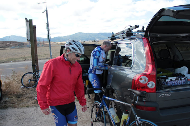
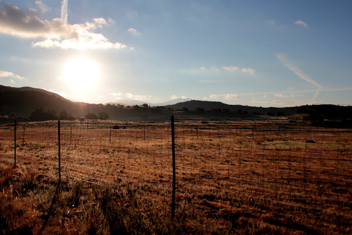
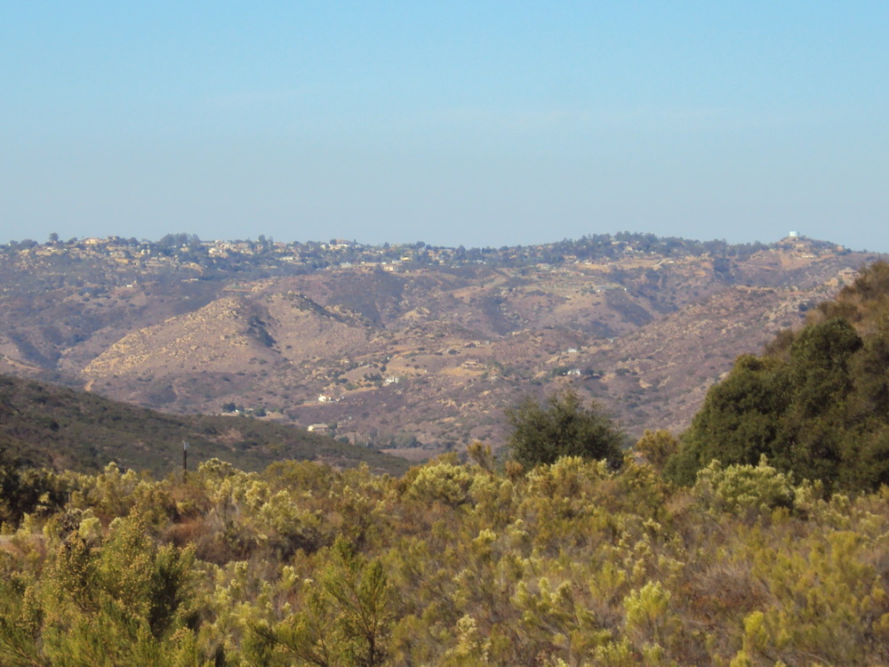
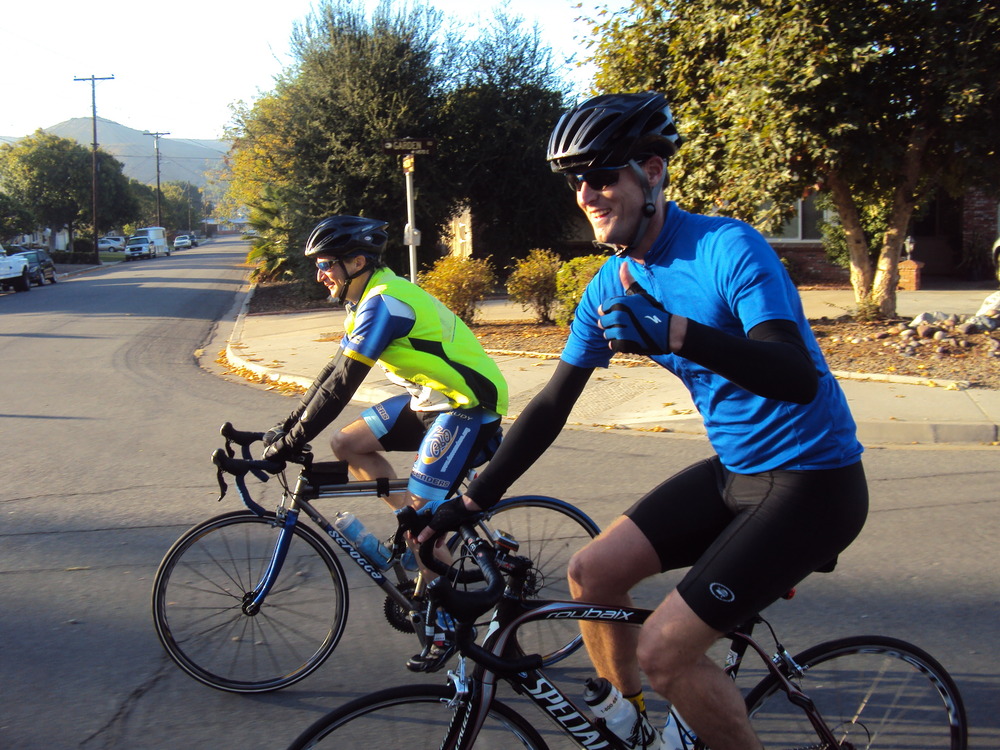
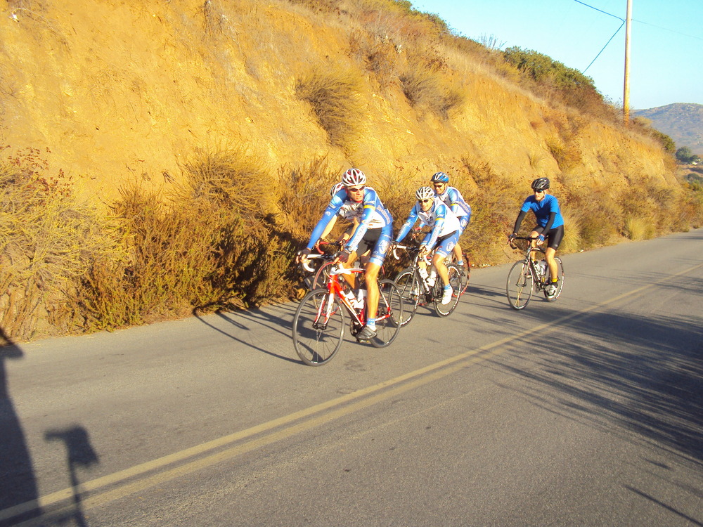
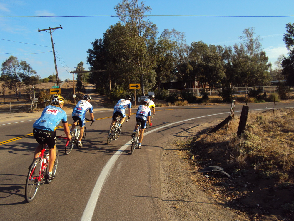
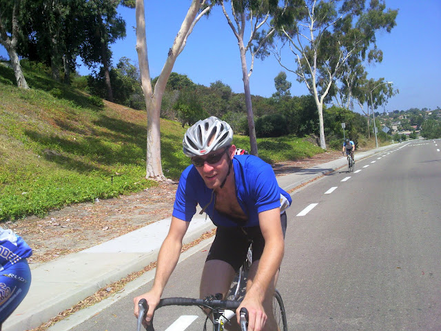
Hi Guys,We had Descenders riding everywhere today. I see from Strava that both Rick and Bob R kicked some but at the time trail today. I know others rode the time trial too. A small group of us did a casual ride toward Ramona. I know others were out riding and running as well. Oleg, Guido and I met at the corner of the 56 bike path and Black Mountain early today. Oleg had put in plenty of early miles riding from his house to meet us. We rode over at a much too brisk pace to the 7-11 store at Poway and Garden to meet Jeff Cresap and Rick (buddy of Rick B who rode with us to El Capitan a month ago). It was sunny but very cool as we started the climb up SPP. It was turning into a beautiful morning for riding. Jeff and Guido kept a tame 8 mph pace all the way up the climb and we smoothly headed north on 67 around Mt Woodson before things got crazy. The descent along 67 was its usual fast pace and then Rick busted to the front right before the Archie Moore curve. All heck broke loose as the five of us flew at near 35 mph towards Mussey Grade. Everyone took turns at the front and the pace never faltered. I was wasted by the time we cruised to the light at HVR, where we turned left.I could only hang on the back as the group pedaled along HVR in a paceline. I did manage to get in a couple of photos; it was a beautiful morning! We flew down the descent of HVR and eased off a bit back towards Pomerado. We headed south and split at Ted Williams. Guido, Rick and I went west while Oleg and Cresap continued along Pomerado. Guido had to get home so we all pushed hard to get back to Black Mountain quickly. The only thing that slowed us down were the traffic lights; a much needed rest for me. I peeled off up to my neighborhood while Rick continued along the bike path to get in some extra mileage. I finished with 45 miles and noticed in Strava that Oleg rode over 80 mile by the time he got home.The ride tomorrow is the coast to Oceanside. Should be a flat, fun and fast ride. See you in the morning at 8 am.
What: Club Ride Where:Meet at Black Mountain Road and the 56 BP
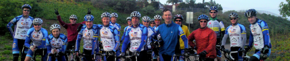
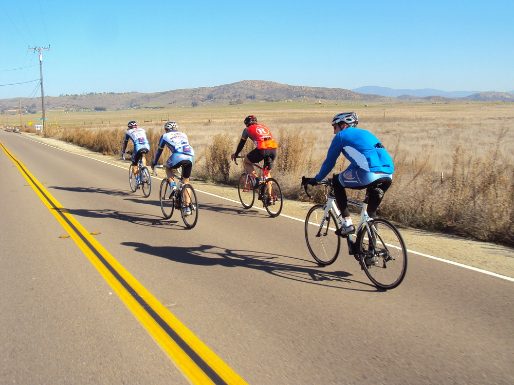
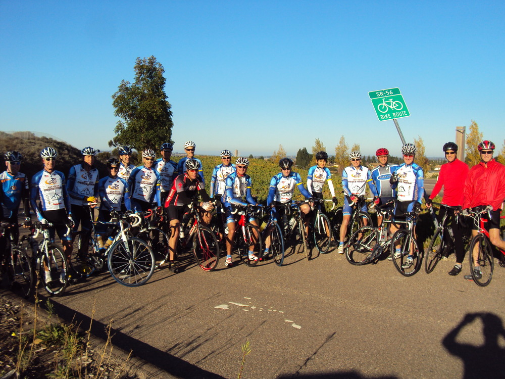
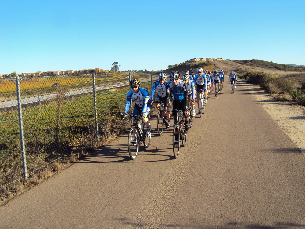
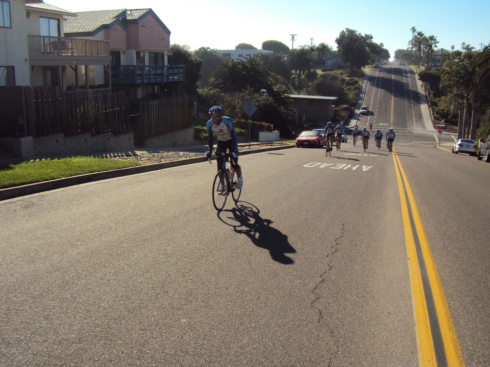
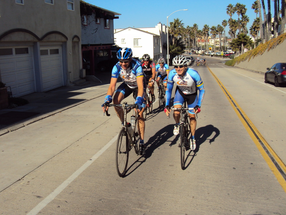
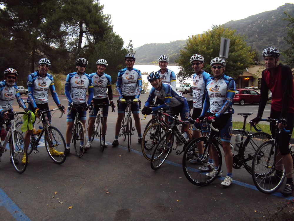
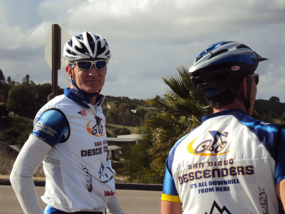
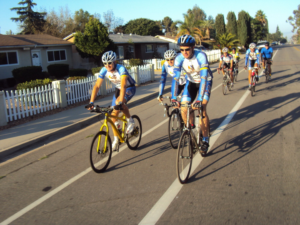
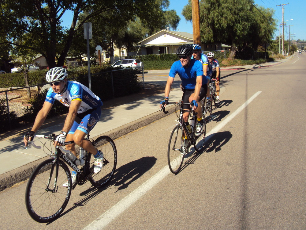
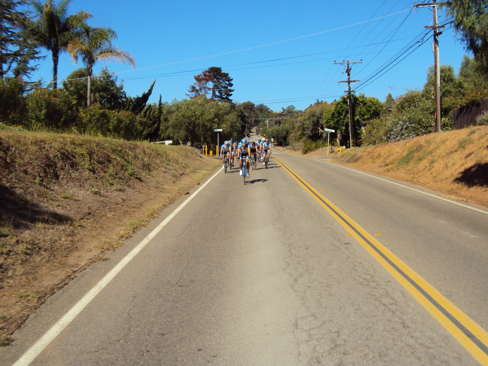
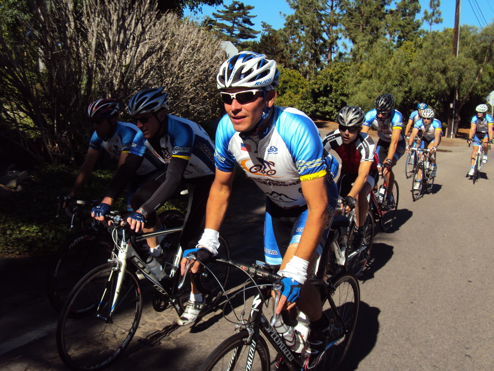
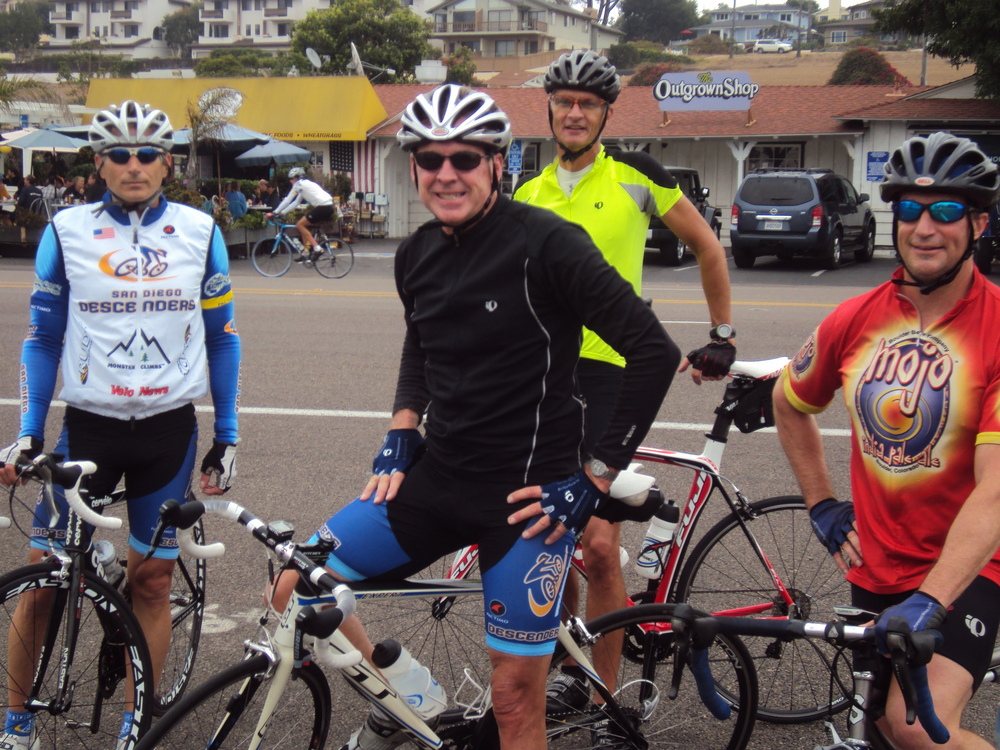
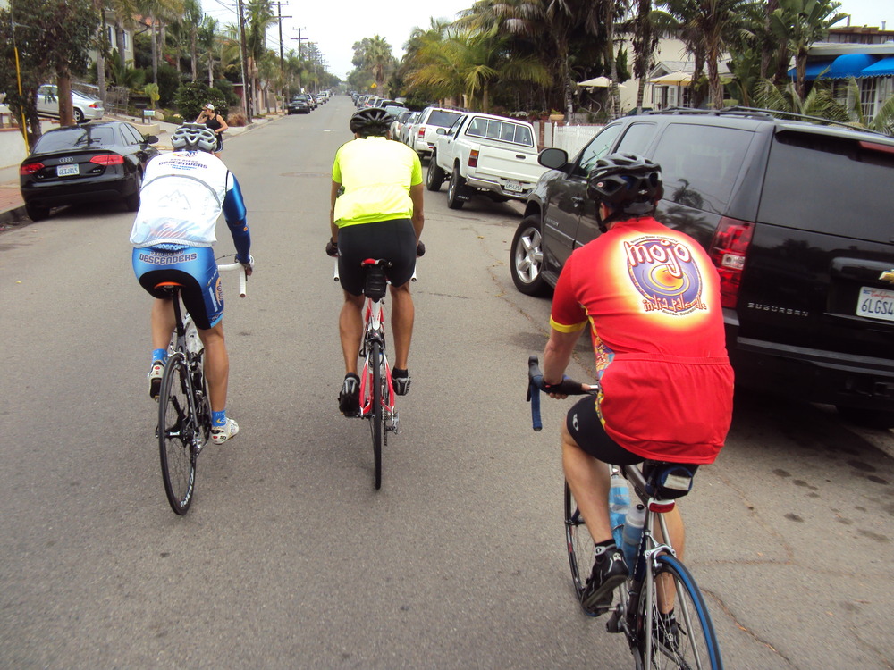
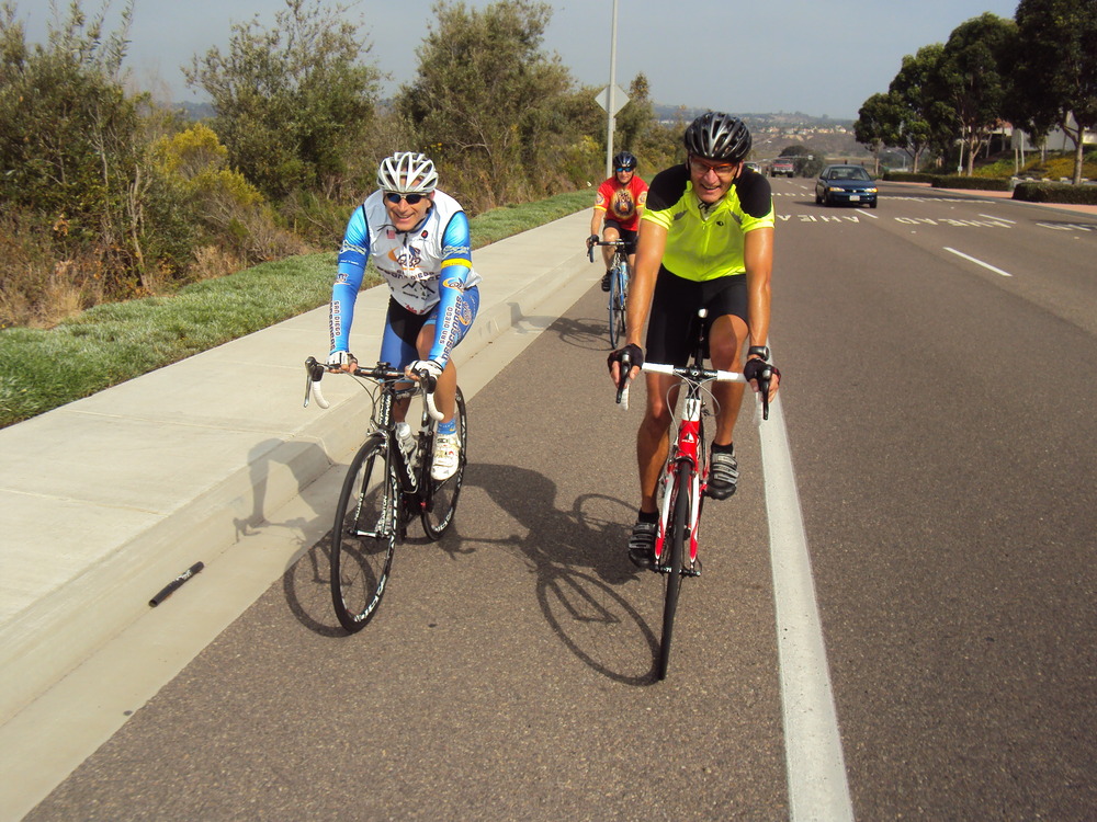
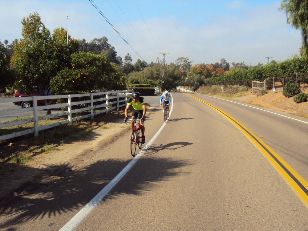
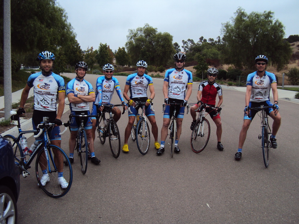
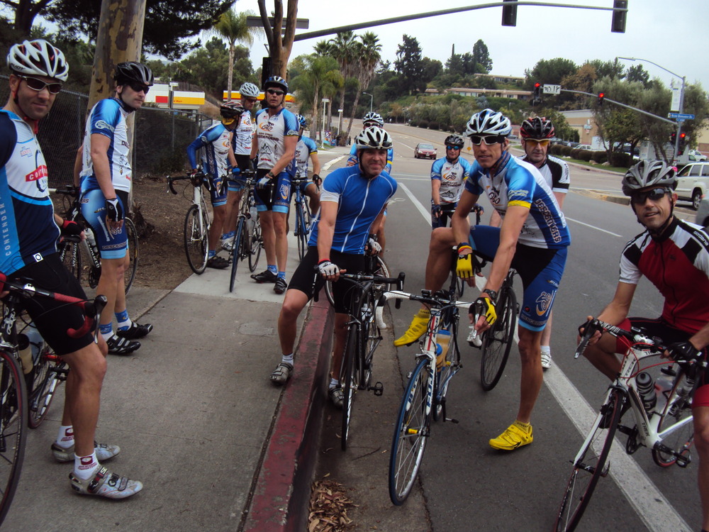
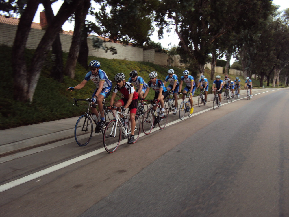
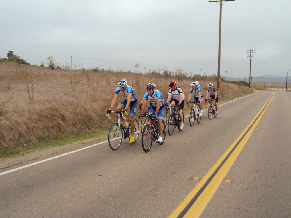
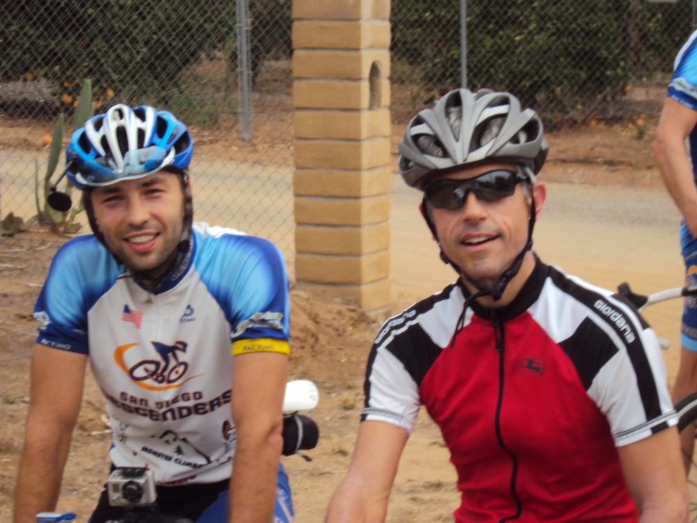
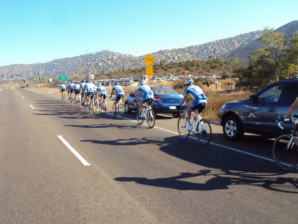
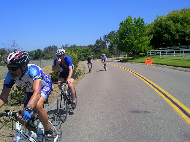
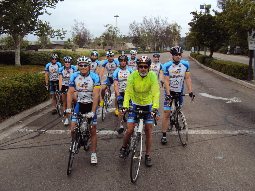
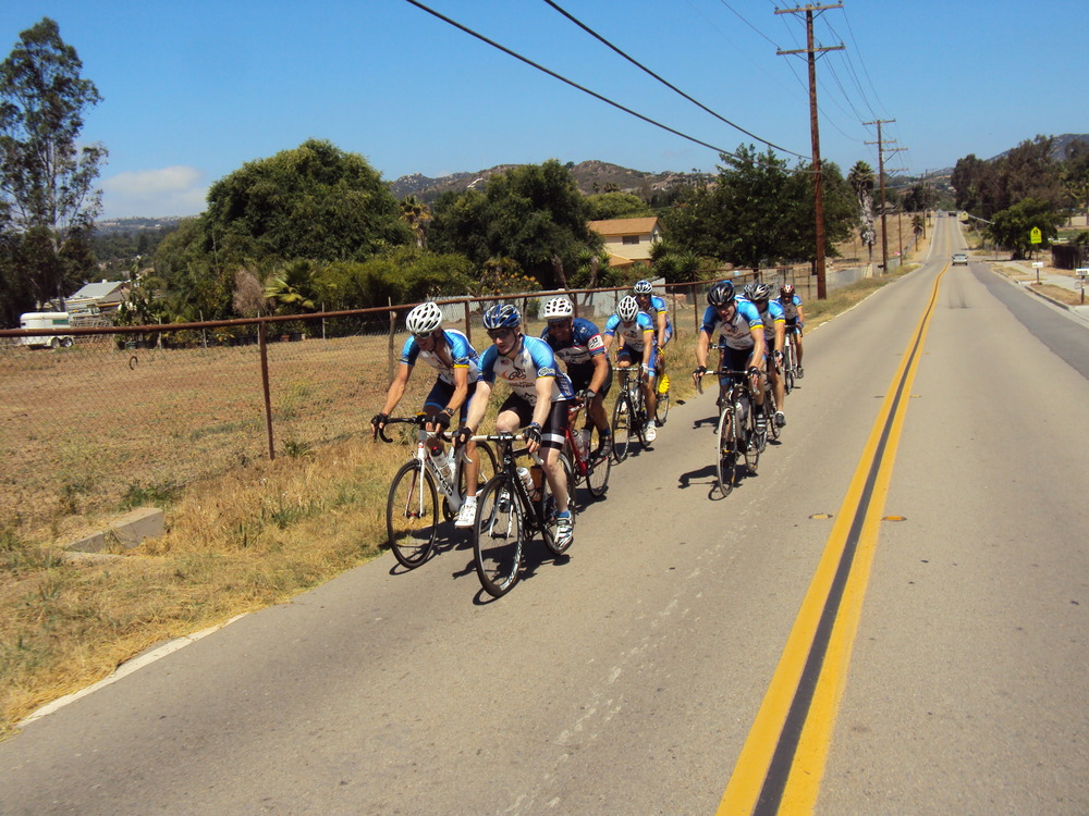
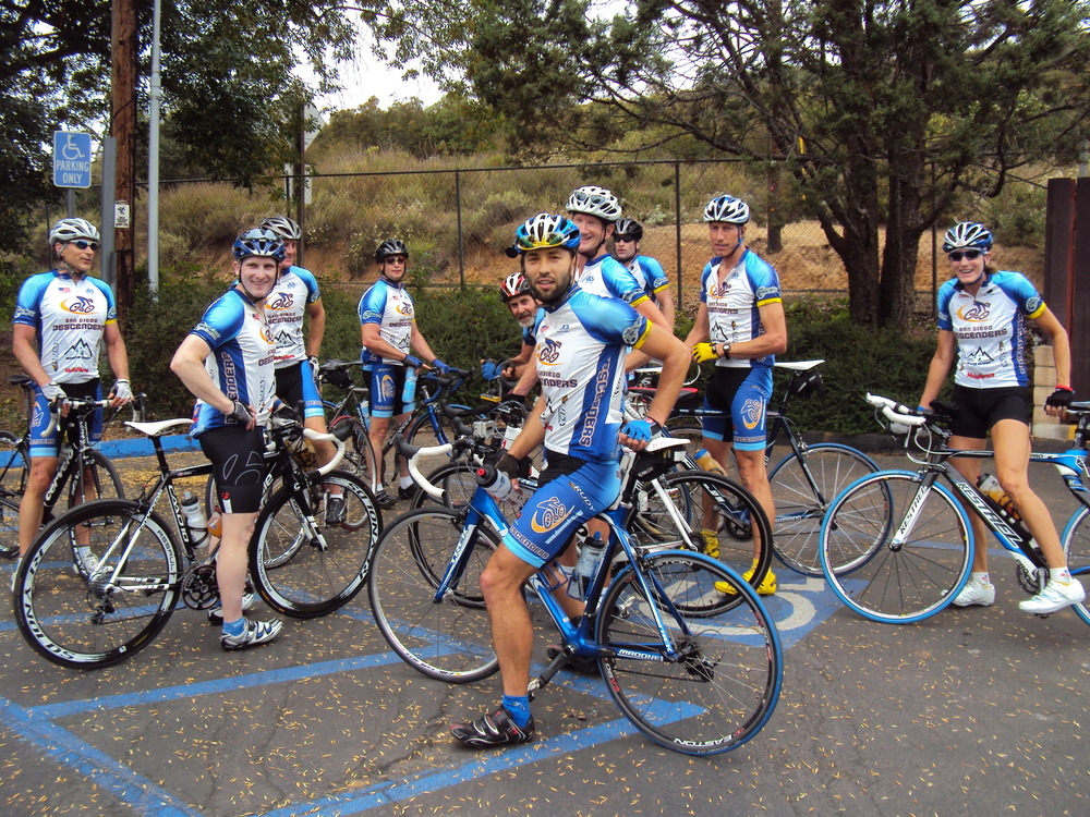
Hi Guys,Wow–what a great day and a huge turnout of Descenders for the ride yesterday! The weather was beautiful, very sunny and it warmed up nicely throughout the morning.At the start we had about 20 riders. It was tough trying to control so many riders down the bike path towards the coast. We picked up Oleg as we headed to PCH. Matt and Roman joined us again as well as new Rick, who rode well the previous day. Sam Hodges was even out in his Descenders kit with proud father, Mike. The group pace to PCH was comfortable for all. Things started to pick up north of Cardiff with some monster pulls by the guys. Bob P and Bryan Jones had to pull off at La costa while the main pack headed for Oceanside. Just south of Carlsbad the pace quickened again, fortunately for me Bob R hung back to allow me to barely grasp onto his wheel. We passed lots of riders and had a large group flowing fast into the harbor turn around.After a short break, we headed back south with more speed. We cruised through Carlsbad Village and surged past the power plant. The slight incline at this point is always painful. There was a light or two that helped keep us together as we all powered to the La Costa turn. Strava noted a number of records from the La Costa sprint, average pace of over 29 mph, super fast! The group stayed together until El Camino Del Notre where I was blown off the back and we were strung out heading to Lago Lindo. Rick waited at the top to help sweep up us stragglers as we rolled into RSF. I tried to sneak away on Stud Loop backwards and put in a failed effort as Matt, Voris and Oleg flew by me in the last half mile with others closing fast. I again saw a handful of top 15 times in Strava from this segment of the ride, guys averaging 22-23 mph.The group pulled to the bottom of San Dieguito Road and Oleg sped off to the west. The rest of the guys climbed to Santaluz. We regrouped by the side road entrance with Ernst, Farkas and Sheehan heading off north while the last 10 guys cruised through Santaluz and back to the 56 bike path. We saw Mike and Sam near Westview HS on our way back. I peeled off with about 67 miles of riding and 3,200 feet of climbing.Great day to ride and be a Descender. We are posting the ride for December in the next day or so. I have attached a few photos from the ride yesterday and will upload a bunch more to the Shutterfly account.Have a great week and see you next Sat.Ride on-Rob
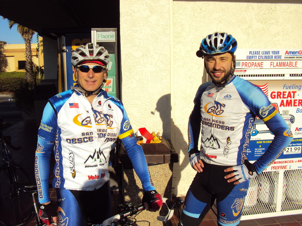
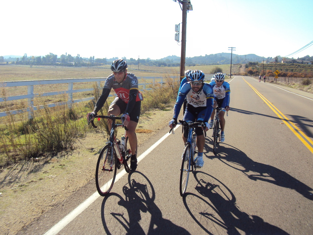
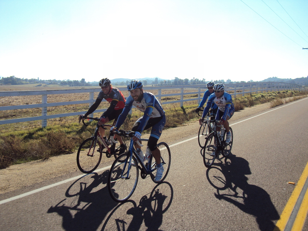
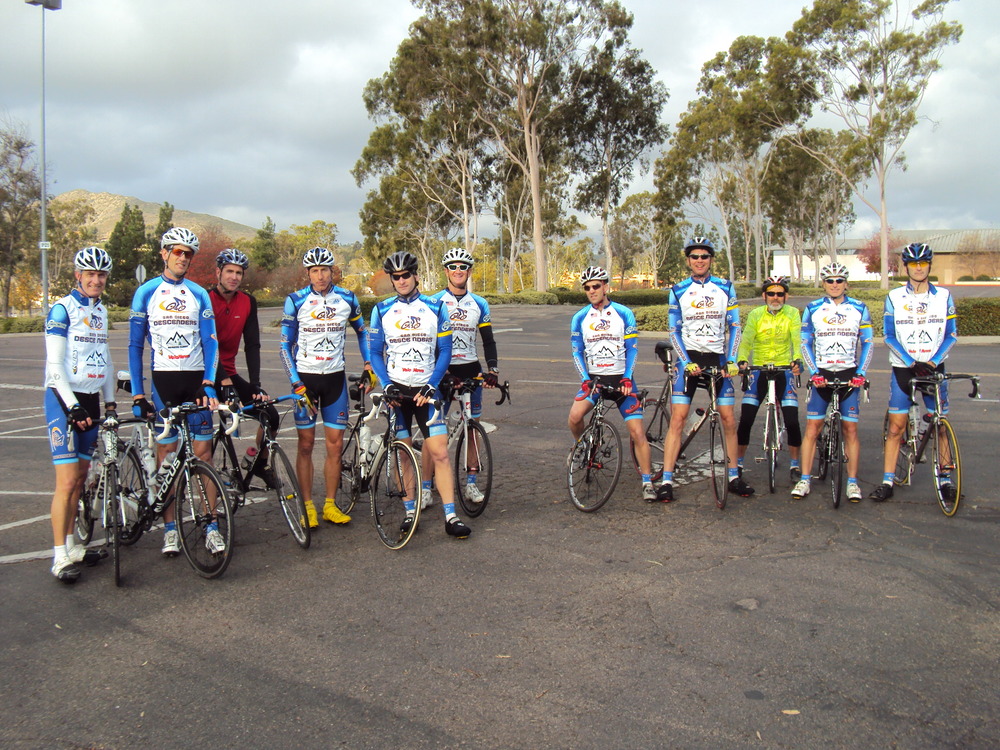
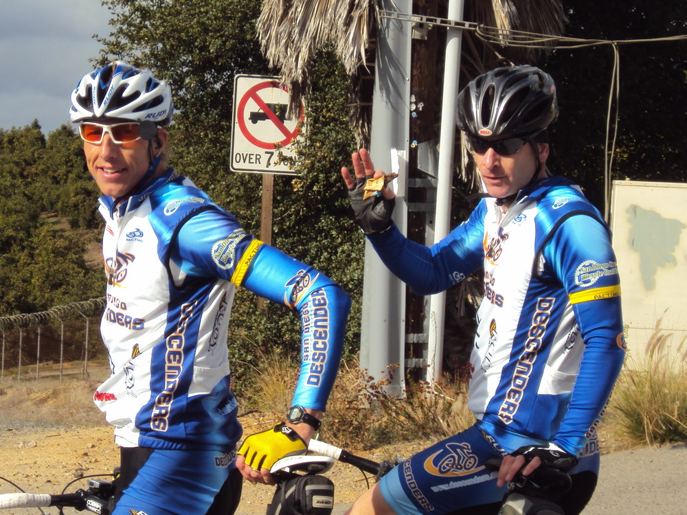
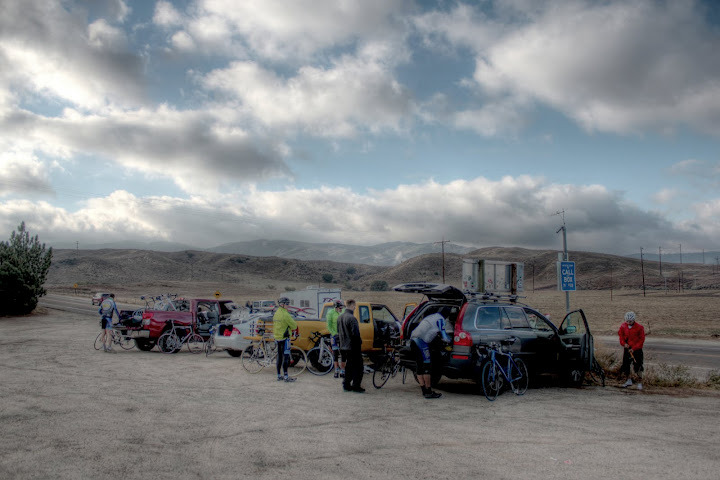
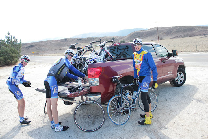
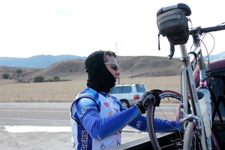
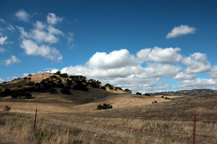
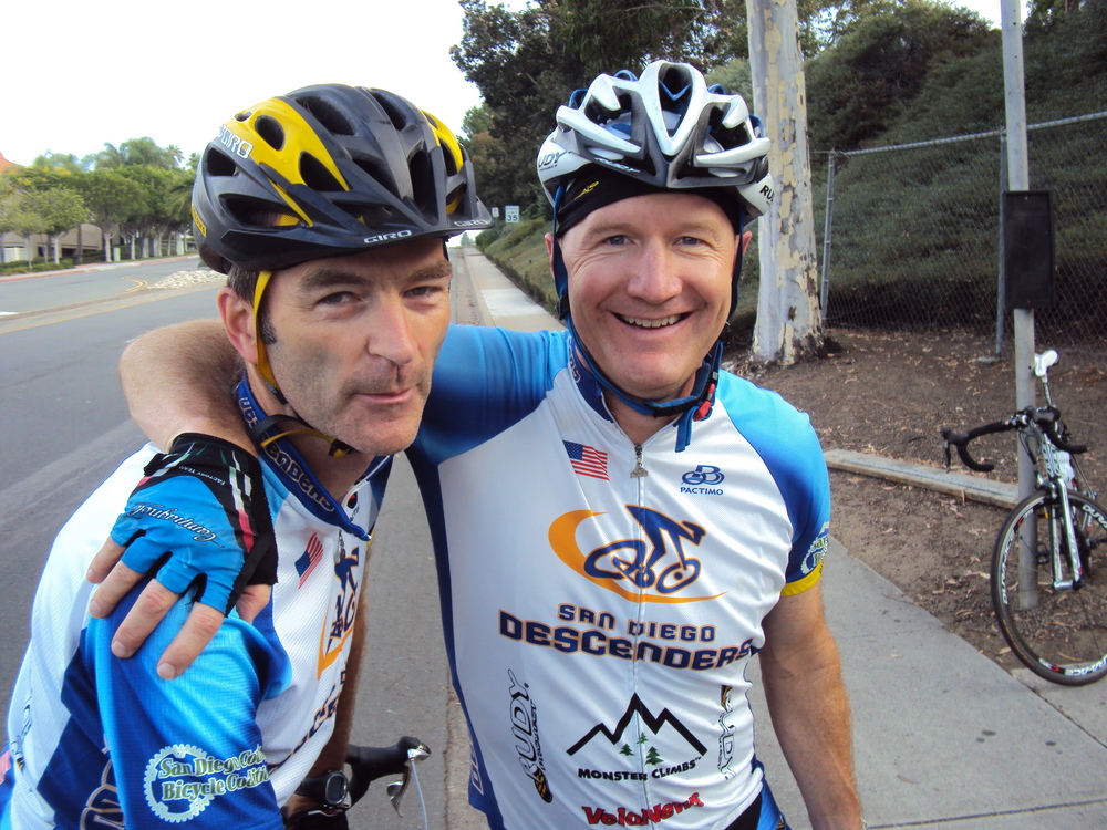
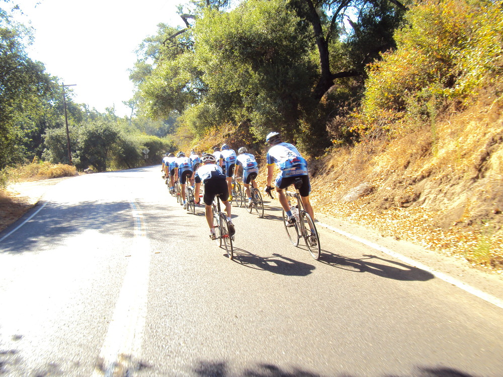
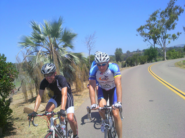
Hi Guys,Great group ride in the north county yesterday. A dozen riders met at the mall and sped off towards Lake Wohlford. We started with a bit of gratuitous climbing up Mary Lane before the tight turns of Summit Drive. Guido took a corner too hot and almost got too “up close and personal” with a car coming towards us. We all made it to Citrus and over to Bear Valley. The group split before the climb up to Lake Wohlford as the main pack hit the light. This left about 6 of us on point at the turn. Voris and Dan had to make a bathroom stop so Hodges, Guido, Geoff and I took off up the hill. Hodges was on point and I fell farther back on the ascent with Guido leading out Geoff. About a mile up the climb a new rider, Neal, blew my me like I was standing still. Rick and Bob R came by a bit later and others followed as I neared the top. We regrouped by the lake and took off again in a fast paceline over towards Woods Valley where the real speed work began. The pace was super fast as we all surged towards Valley Center. It was quite a sight to watch from the back of the pack with the 12 man group flying along the curvy road. There were a few sprinkles and some wind gusts but the pace never faltered. The riding continued up Lilac at a similar pace with occasional surges from the front. The group stopped after we crossed the bridge at old 395 before our descent down West Lilac. The group then kept up a brisk pace along Camino Del Rey with the stop at the RV park. I had suffered all morning and knew I needed a head start up past the Welk resort so I skipped the stop. The lead quickly dissipated as I saw Len coming up behind me. We both stopped at the light before the turn off at Jesmond Dene. Our break lasted less than a minute as the fast group closed on us before our GU could be eaten. The boys kept up the pace back down through the Escondido streets, reversing our route down Citrus. We finished with a brisk closing run to the mall. A fast, fun 57 miles.Rick stretched for a minute and then decided to go ride Rice Canyon. He finished with a new record and KOM ranking on Strava. Nice work Rick.Attached are a few photos from the ride. I would have taken more but the pace was too hard for me.Bob P and I are planning a ride this afternoon. Sheehan wanted to ride today as well. Do we have others that want to ride? We will meet at the corner of Pomerado and RB Roads at 2:30 pm. Hopefully this start location will entice a few of our Poway riders to join us–Boyle and Broder? See you this afternoon for an easy ride.Ride on-Rob
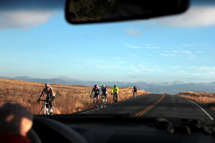
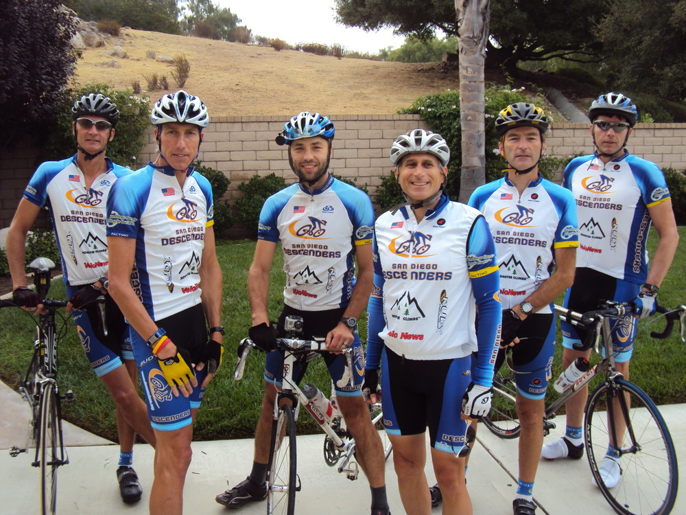
We had 12 Descenders coming out for an epic Montezuma+Borrego Springs ride this morning.
The temperatures were chilly 35F at the start, but everyone brought plenty of warm weather gear.
On the drive over we saw many riders doing Borrego double-century ride (insane! – 13,300 ft elevation over 200 miles – I heard Drew Peterson won it!) and when we arrived at the meeting spot Mike Farkas was already there, helping a rider who was struggling with hypothermia. Nice job, Mike!
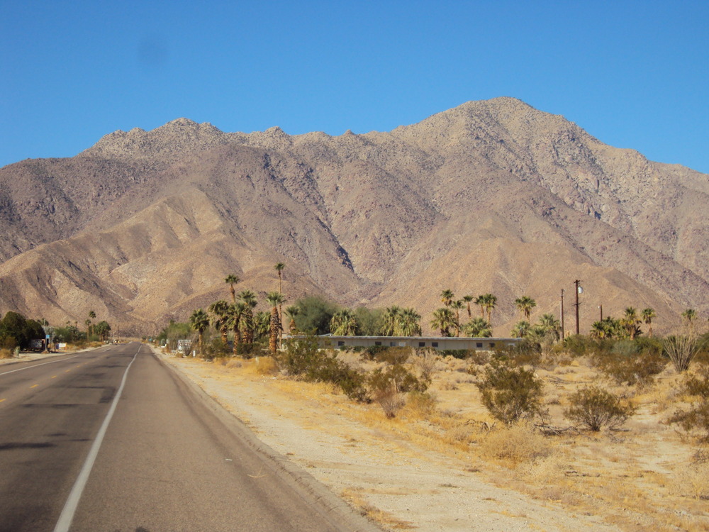
The ride was truly epic – by the time we got to Borrego Springs (mostly downhill) the temperatures were balmy 60ies, and we were shedding layers. Then the “fun” started – 11 mile Montezuma climb, gaining 3,500 ft (for comparison, Palomar’s East Grade is also 11 miles but just 2,600 ft).
At the top it was cold and windy (again) and after some regrouping we “cooled down” towards the cars. The total for the day was 60 miles, 5,000 ft climbed.
Hi Guys
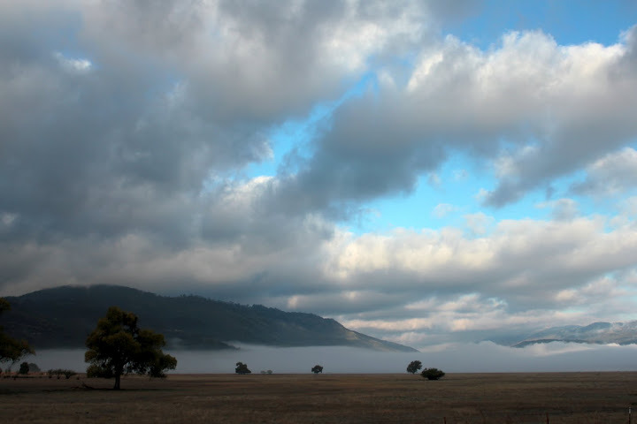
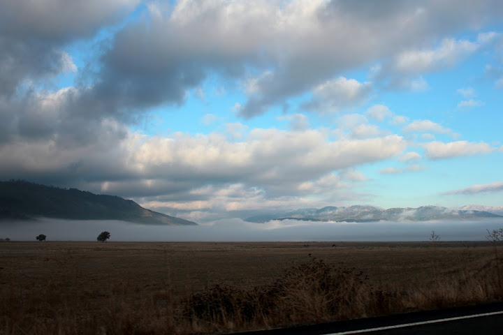
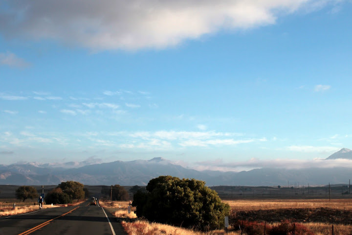
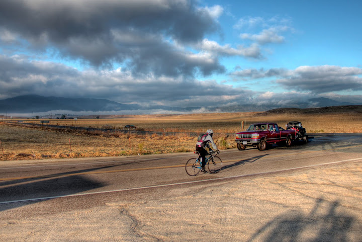
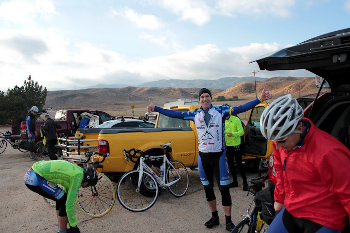
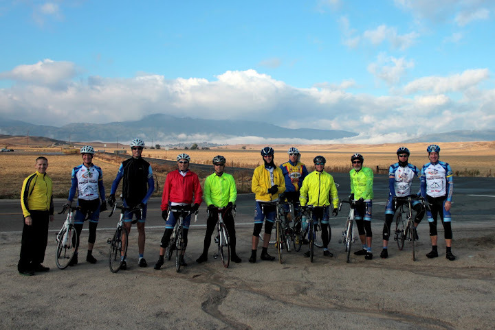
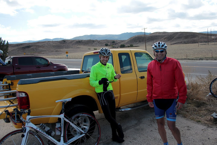
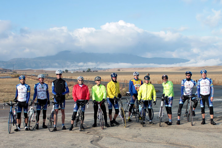
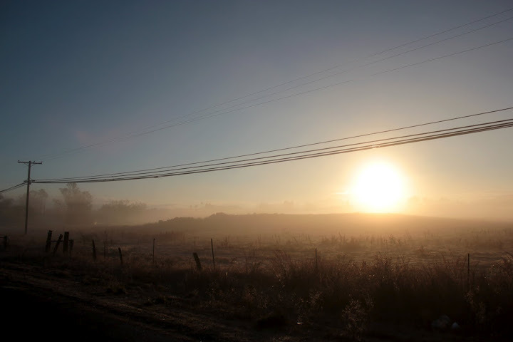
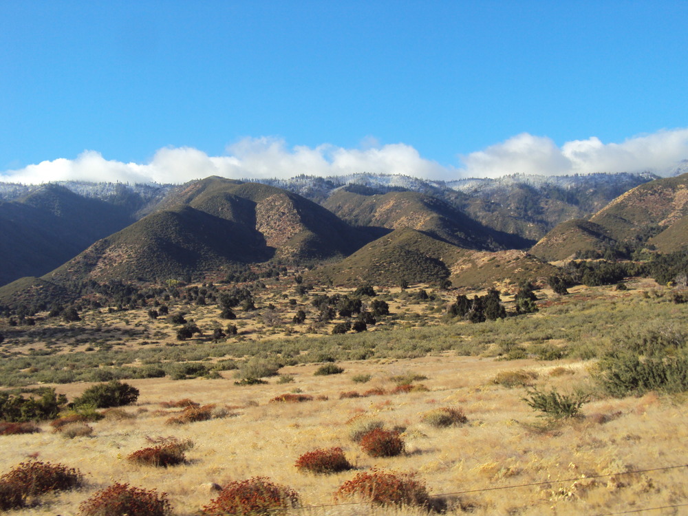
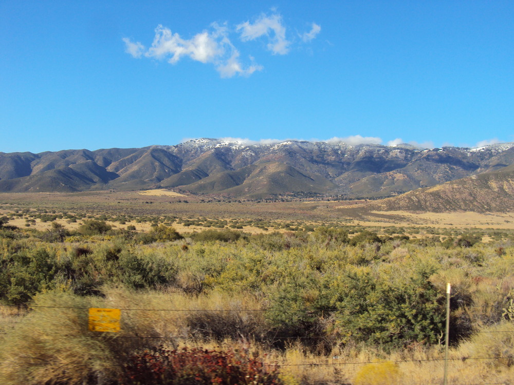
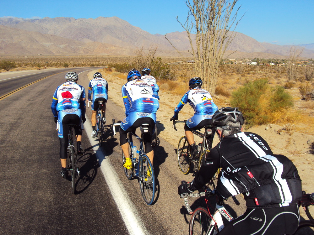
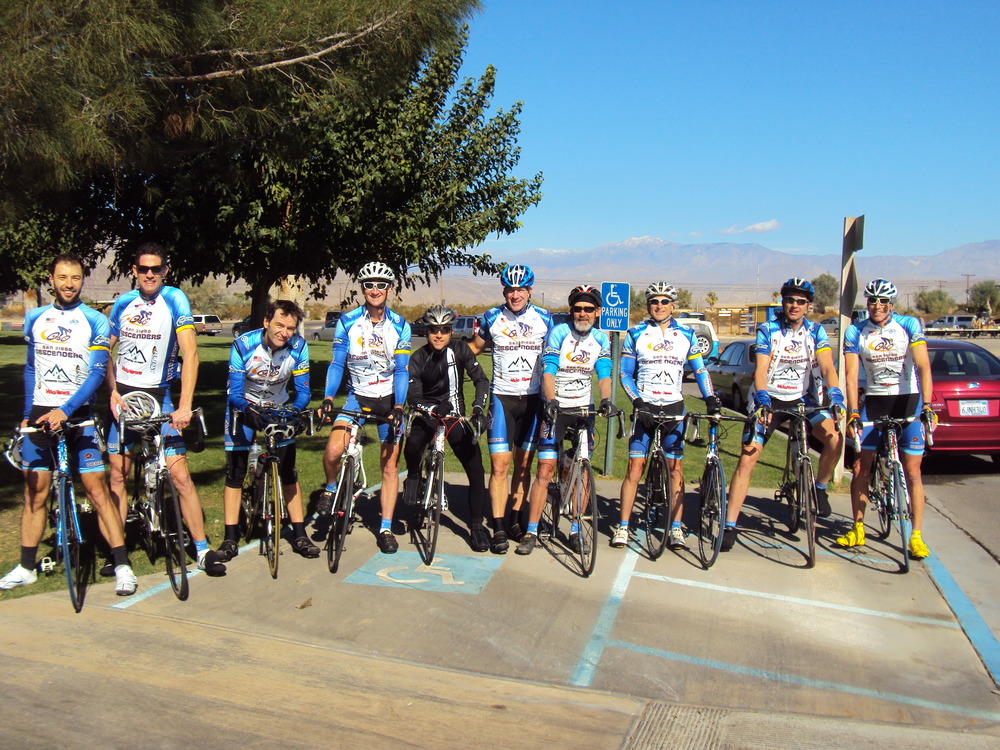
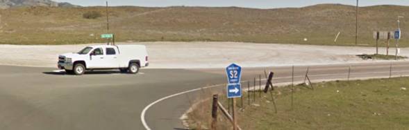
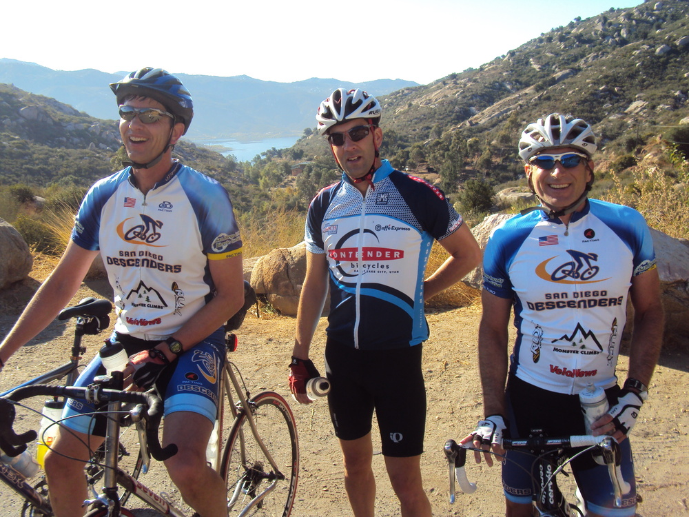
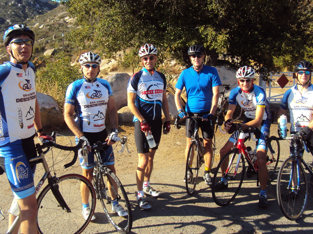
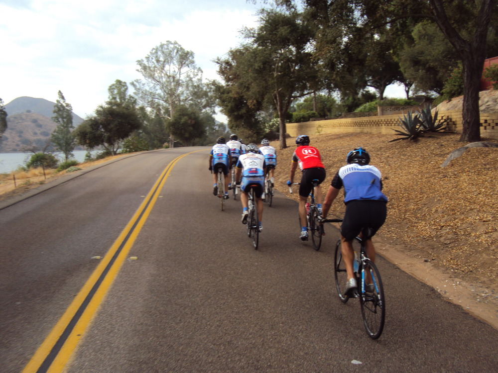
The ride report from Oleg covered the general details of the ride and the pictures he sent were awesome as usual.Oleg rode up in Guido’s car with Hodges and me. He must have taken over a 100 pictures out the window of the car driving up as we viewed the cloud layers and fog levels with the sun shining through. Oleg captured the scenes wonderfully. It was quite brisk when we arrived to find Farkas there attending to one of the Borrego Springs Double Century riders who was hypothermic and not feeling well. He tended to her while we put on all the layers we could find to begin the climb up S2. It was a gradual 6 mile climb before we had the long descent down San Felipe Road to Route 78. This intersection was just east of Scissors Crossing where we took the left towards Borrego. At the turn to Yaqui Pass we stopped to take off some layers before the brief climb up Yaqui. The narrow canyons and curvy roads provided a great smooth ride down into Borrego Springs. We stopped at a small park for a bathroom break and some water in the center of town before heading north on Palm Canyon Road. John headed out first to try to get a lead on the guys. I also went out a bit early in a failed attempt to get some distance between me and the much faster riders I knew were coming when we got to Montezuma. The 11 mile climb and almost 6% average grade lay ahead. The first to blow by me was Rick as he motored up the hill at a blistering pace. Rick finished 2nd in the timed climb according to Strava, less than a minute slower than our very own Logan Fielder. This was a great time given the strong headwinds we faced and the cold temperatures we hit as we climbed to the apex of the hill. Logan rode his KOM time on 15 Jan 2011, the same date a number of other guys also had top 20 times. There must have been some type of road race that day or large group event that might have helped Logan a bit with his impressive time. The next to fly by me was Keith who was climbing as strong a ever. I looked behind me and saw a group of 4 riders working well and closing the gap on me with each passing curve on the road. I pushed hard to stay in front but the group of Oleg, Voris, Bernie and Bob R sailed past. The winds picked up and the temperatures dropped. It was still a beautiful climb. Guido was next on my wheel and I held him off for a bit before finally losing steam. I finally crested the last rise and saw the guys up ahead regrouping. We put on all our cold weather gear again and heading back towards the cars.The last 6 or so miles back were nice rollers with a descent back to the end of S2. We were all glad to find the cars and get warm again. It was a beautiful day and a fantastic route. It was just about 60 miles and 5,100 feet of climbing. We will have to do it again soon. I took a couple of photos on the descent showing the snow on the mountains. Here are a few photos-Rob
Hi guys,Looks like it is going to be a great ride this Sat.We had a fun ride this past Sat as well. It was the Dave Voris Birthday celebration ride to Alpine and El Capitan Reservoir. It was Dave’s 49th b-day on Saturday. We had a large group of 15 riders start the ride from the 7-11 meeting spot, including another Rick. He is a SD police officer who was not sure he could hang with us–his comments before the ride; major sandbagger. The new Rick proved to be an excellent rider throughout the ride. We also had the new Matt join us. He first came to the Engineers ride a few weeks ago. The usual suspects were there as well, but no Guido. Rumor has it he was doing some sprints with the Swami’s group on Sat.The group headed up SPP to then descended 67 towards Lakeside. Sheehan had to cut out early so he cut north on 67 to go towards HVR. Dave S is working too hard these days. I waited for Dave S at the top of SPP before descending. Ernst blew around the SPP corner and got in the draft behind a semi heading down 67; he flew well ahead of me. We regrouped at the bottom and headed over to Harbison Canyon. Geoff B had to turn around just after El Capitan HS due to family commitments. The pace was consistent until we hit the descent of Harbison. The group split into two parts as we flew towards the bottom. Rick B pushed his accelerator and we all regrouped right at the turn for Dehesa Road. The first mile or so was fine, and then I quickly fell off the back as I watched the group ride away from me. We regrouped at Alpine Creek Shopping Center before reversing our ride towards home.Just past Lake Jennings and on a steep descent before we turned onto El Monte Road, Ernst again tried to get in the draft of a vehicle. This time it was a large SUV. The driver must not have wanted Dave on his bumper as he hit his brakes. Fortunately Ernst has quicker reflexes than me so he pulled right to avoid an up close encounter with the bumper of the car. Ernst had to get home so he did not make the turn toward El Capitan reservoir, The group did a nice paceline all the way to the reservoir, except me. I hung in the draft at the back as the pace was fast enough for my ability. A quick break at the reservoir and we headed back out El Monte. The climb back up 67 was brutal as usual.I hit the bottom of the climb and realized both water bottles were empty. I forgot to get water at the shopping center or reservoir so I was in trouble. I saw Dan S and Mike H ahead of me and tried to catch them so I could get a drink. Dan pedaled off but I was able to bum some much needed water from Mike. Birthday boy Voris was KOM on the 67 climb. I got to the top just as Bob Proulx was heading back down SPP. He and I pulled along with a couple of guys doing the CF ride. We decided to go all the way along SPP until we hit Springmeadow where we happily descended back to Voris’ house. Legs were tired after 77 miles and about 5,200 fee of climbing. I spun out the tired legs Sunday am with Mike H riding our MTB bikes on the dirt trails on the north side of Lake Hodges. Fun hour or so of riding. Here are a few photos from the Sat ride.See you for our Montezuma ride on Sat.Rob
Subject:
Nov 5th Montezuma
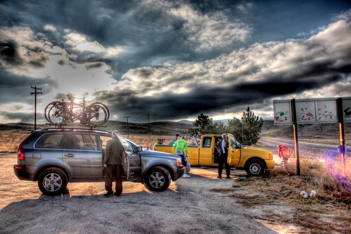
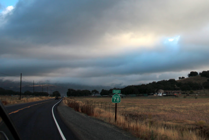
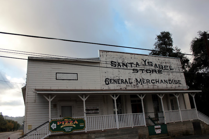
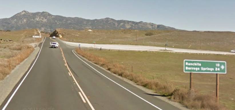
Descenders, Don’t miss the club’s first ride up Montezuma. We will start at the intersection of the 79 and San Felipe Road (also known as S2 – see pictures below of where we park). Lots of parking at this desolate intersection. (We won’t do any riding on the 79 – yikes). The ride starts with a 5 mile mild climb on San Felipe Road east (with a little stinger at mile 5), and then full regroup. We will then have 25-30 miles of mostly downhill where we can display our smooth paceline skills as a club on a pretty desolate road (the phrase “mostly down hill” will be referenced in my defense as crybabies point out that there is a quarter mile climbing section with 15%+ grade prior to the final 5 mile 7% descent down to the desert floor). At mile 30 as we are concluding the descent (5 miles before Borrego) on Yaqui Pass, we will hunt for water on Rams Hill road (golf resort. We will then get back on Yaqui pass, spin through Borrego, then start the Strava-ranked Montezuma Valley Road climb (ranked 60 in California). Strava says 11 miles long 6%. We will then ride back down to our cars. Those who have enough time – pie at Santa Ysabel on the way home. It’s a very cool forecast, with a 20 degree whether drop projected (67 in Borrego Saturday). Hope you can make it. Bring-your-iphone! Dave Here is where we park.
Hi Guys,Looks like we had lots of guys riding all over the place this past weekend. Rick and Mike F were out in Kitchen Creek. Oleg was still riding in Spain according to his Strava posts. Sheehan was returning from Costa Rica for business and got in a Sunday ride. We got cameo appearances from Bob R and Dave Ernst for our Sat group ride.The group met at Voris’ house to start the ride. Bob R swung by on a short solo ride while he is still recovering from his shoulder separation injury. Bob P brought out a new rider, Channing Hamlet. He is a triathlete who is considering joining the Descenders. We rode over to Garden Road and met up with Dan S and Dave Ernst. Ernst showed up with some continuous shifting bike that looked like a MTB bike with no front or rear shock. It looked like a single speed. Ernst tried to explain that his buddy invented the bike and how it worked, it mostly went over my head. We started heading up Sycamore Canyon Road, less than a mile from the start, when the pedal came off of Ernst’s bike. The remaining group consisted of Voris, Guido, Dan , Bob P, John, Channing and me. The pace up SPP and along 67 was reasonable but by the time we got to Mussey only Voris, Guido, Dan and me were left. The four of us were out ahead of the other 3 guys on the descent of Mussey. I stayed in the back of the small group and watched the three of them rotate towards the bottom of Mussey Grade. There was a moments thought to climb Mahogany Ranch but we decided not to do it since Pamo lay ahead. I must have communicated incorrectly to Channing and John because they swung up MR on their climb out of Mussey. We got to the top of Mussey and Voris did not want to stop ride while waiting for Channing and John. He and Guido decided to “go slow” along Dye Road. Bob went back to get the guys while Dan and I caught our breath. We finally regrouped and headed for Dye Road. In a vain effort to catch Voris and Guido, I pulled the length of Dye and through Ramona over the Pamo Road. It was like trying to catch a ghost, they never came into view. I descended down Pamo and before the end of the road, Guido and Voris were returning back up. We all turned back and looped to the top of Pamo, regrouping back at the Chevron. There were numerous flats to fix as we knew there were thorns along the roads. Three bikes needed repairs.We looped back along Dye Road and the group split at Highland Valley Road. Voris, Guido and I went down HVR while the rest of the guys returned behind Mt Woodson. Big mistake on my part. I was already tried from the pulls trying to catch those guys earlier. Voris said he and Guido would keep a “steady pace” while I hung onto their wheel. I suffered but hung on until the steep descent. My rear wheel started to slip on the turns so I had to slow to check my tires. The rear was very low so we gave it some air and we were back on the descent. I suffered until we got to Pomerado and called it quits. According to Strava, I put in a personal best down HVR. No kidding! All you have to do is try to stay on the wheel of Voris and Guido and you will go fast. I decided to pootle home via 4S and behind Black Mountain while Voris and Guido went south on Pomerado.I finished with about 75 miles and 5,000 feet of climbing. Nothing compared to the Kitchen Creek boys, but I was tired. Sunday am I met up with Hodges at XC practice by Kit Carson park. Our kids were running. I went to a run along the north trail of Lake Hodges towards the marina and back. I ran into Matt Davis out for his Sunday am run. Hodges did computer work in his car. I had planned on riding with Sheehan Sunday afternoon but got tied up until late in the afternoon. I did manage to do the Carmel Valley Loop, past the polo fields and back up the 3 witches, getting in just under 24 miles. I thought about looping a bit more to get the 100 mile weekend under my belt but did not want to fall in my driveway. I settled for 99 miles, good weekend.The group ride is Alpine this weekend. Hope to see you then. Here are a few shots from the Sat ride.Rob
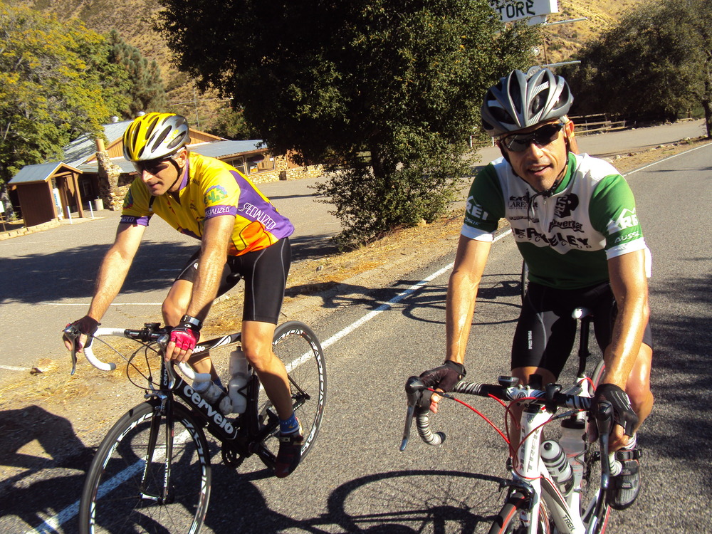
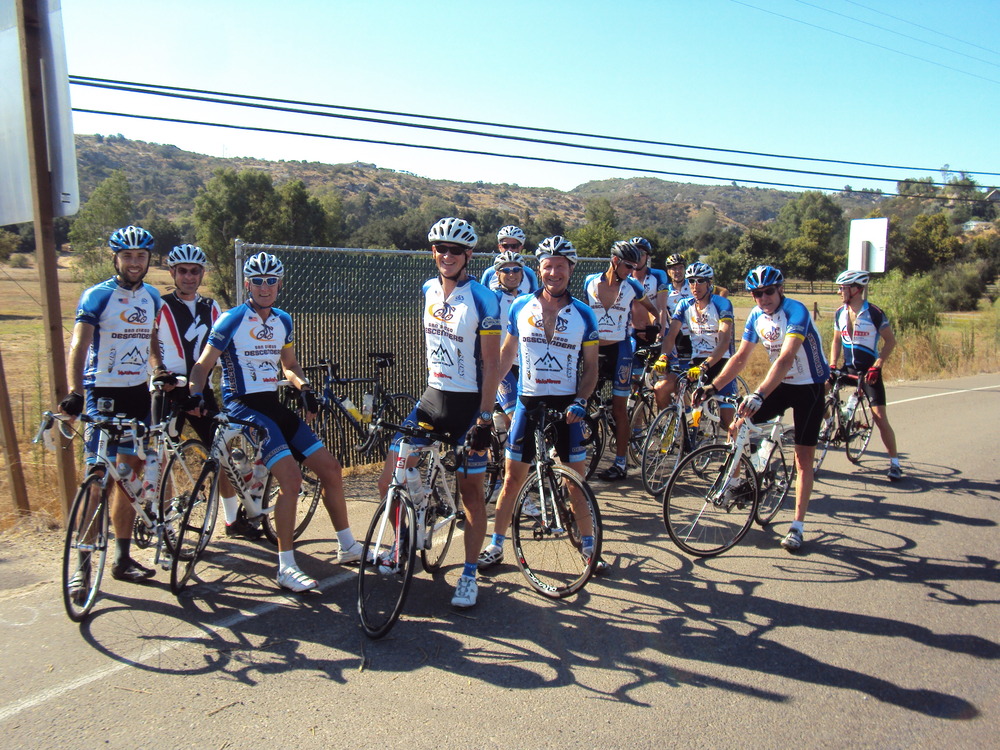
Hi Guys,Great ride in the hills around Julian yesterday. Voris mapped out another awesome route. We all showed up in our retro jerseys, shorts, shoes, and our team Descender socks. Ernst did a solo retro ride and swung by Voris’ house before we drove out to Dudley’s Bakery parking lot. We started off with 12 riders, including two new guys, Matt and Roman. They found us via the Oleg invite on Strava. The group kept a steady pace up toward Julian and turned off onto Wynola Road. The weather was clear, bright and perfect for a ride. We flew along the quiet roads over to Banner Grade and descended towards Scissors Crossing. I turned early at Gorilla Hill to start the climb back up and the group soon followed. All except Hodges who went by me on the descent saying he felt good, so he ended up going all the way to Scissors. The climb was steady and enjoyable with just a slight headwind. The group joined up at Julian Pie shop and headed over towards Engineers Road from town.After a good descent we hit the start of the Strava Climb–Rick, Eric and Farkas hit the gas pedal; others followed quickly up the climb. I was already feeling the effects of the early climbing so I swept up for the group, arriving at the fire station as some were ready to start the return route back. I noted that the day was getting ahead of me and my legs knew what lie ahead. I wanted to return via Wynola but had to get home so I told Voris I would turn west on Highway 79 and head back to the car. The descent back down Engineers was fun but the climb out hurt and sapped me of most of my final energy. I hit 79 and practically coasted back to the car as much as possible. I was a bit surprised to see most of the guys there at the cars already. It looks like I was not the only one that had had enough for the day. Voris took the two new guys back via Wynola to get more mileage for the ride.It was over 56 miles and about 5,500 feet of climbing for me; more for those that went down Banner even farther. Great ride, fun day and I got back home in time.Here are a few photos-Rob
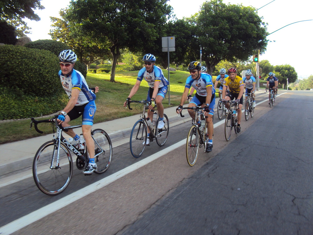
Hi Guys,Lots of rides and runs being posted on Strava. Rick is now training with Strava records in mind and he is KOM all over the place. Rick missed our group ride today as he was smokin’ it up the south grade of Palomar. The group was large, we had 15 riders. It was quite cool when we left PQ to head over the casa Voris. We picked up the early guys and pedaled over to meeting spot at Pomerado and RB. Sheehan pulled in just as the group was about to roll and Cresap was late. back at the light as we went towards Lake Hodges. Jeff knows all the short cuts so he met up with us by the mall. Our pace was spirited and down right fast at times during the ride. We motored in a paceline through Elfin Forest; going 28 mph around those curves is a little tense for me. The gang regrouped before the climb up Double Peak. Views from the top were spectacular; another postcard day in San Diego. The pace did not slow down a bit as we made our way back to Rancho Sante Fe and cruised stud loop; lots of pushes to the finish. We climbed up the 3 witches to Santaluz and guys split everywhere from there to get back home. I pedaled back to the bike path and home with 57 miles of riding and over 4,300 feet of climbing.Good day to be on a bike; see you next Sat for our Retro Ride day.Rob
In addition to Rob’s fantastic photos here is a compilation of video footage from the rear-facing camera collected during yeaterdays rideCheck out this video on YouTube:
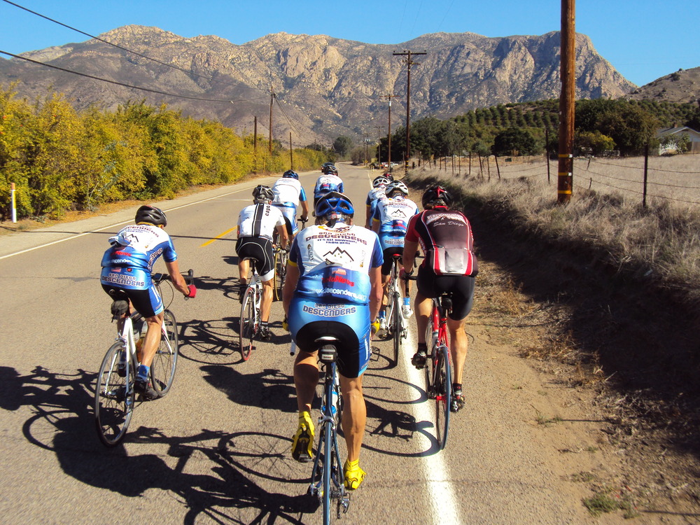
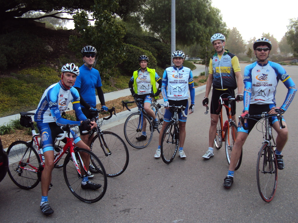
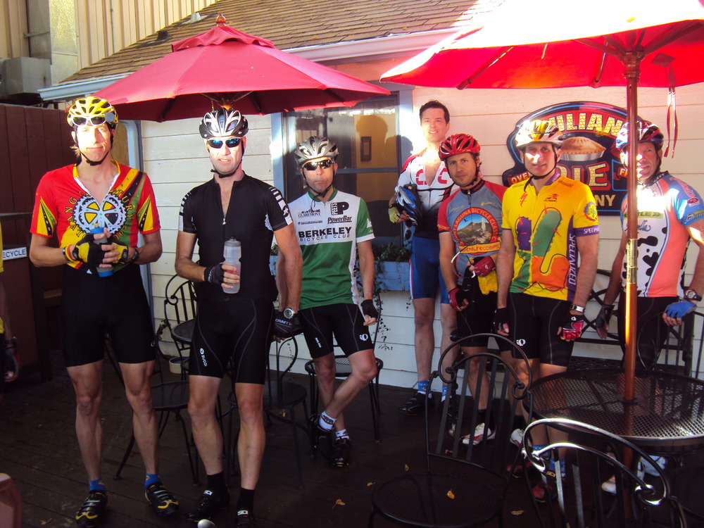
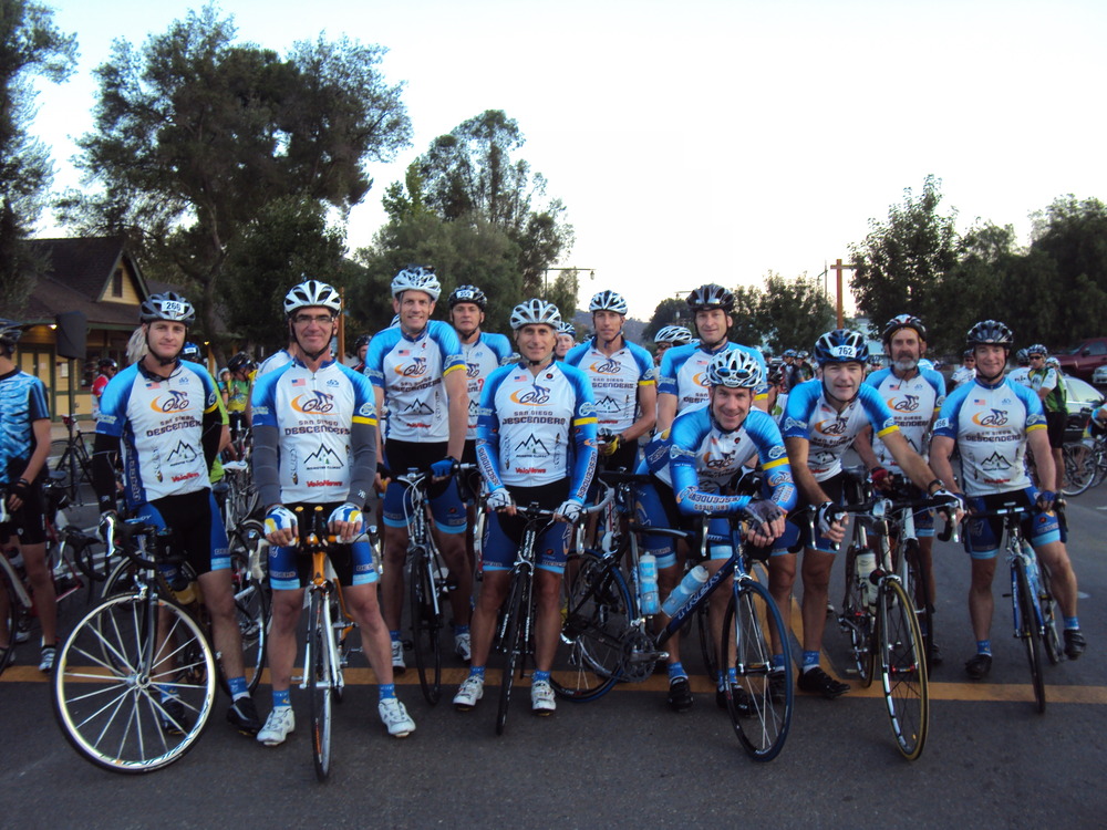
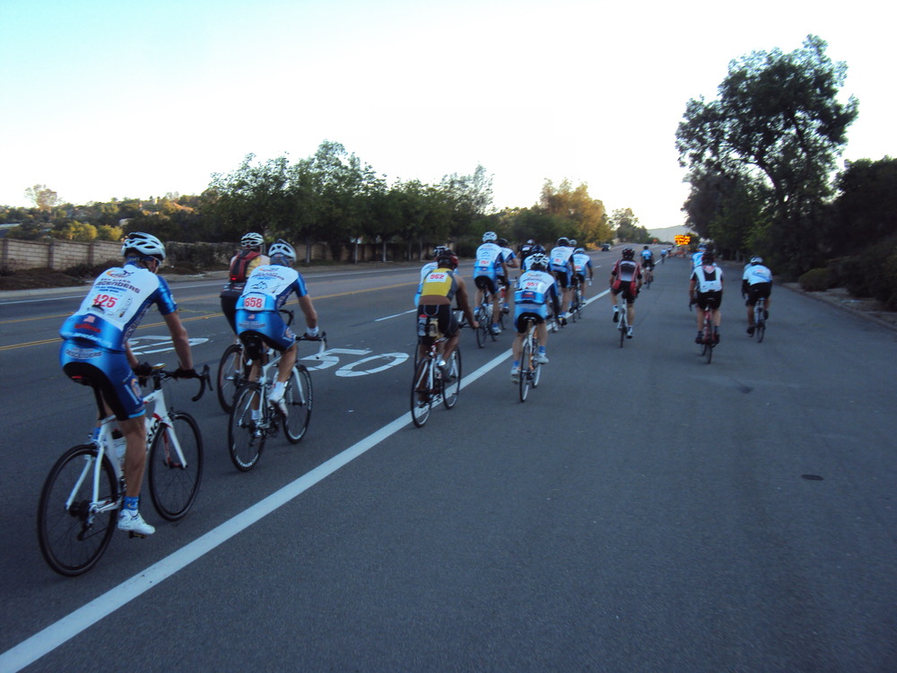
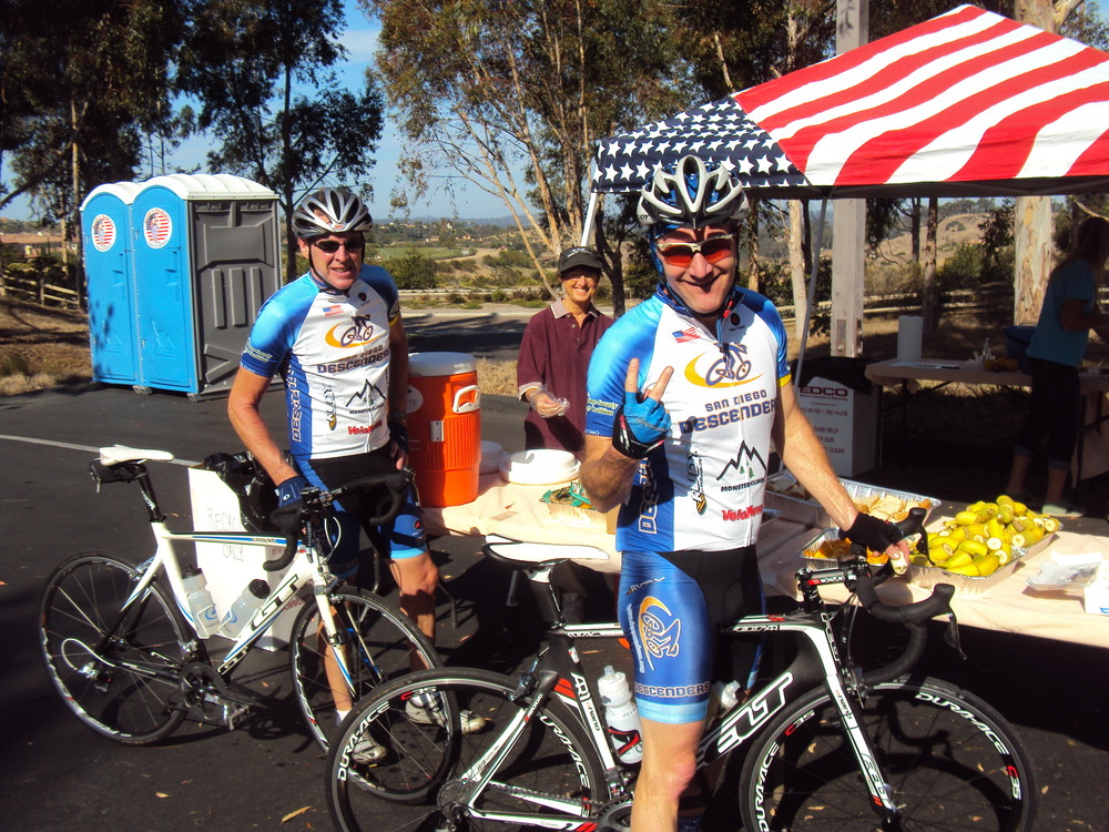
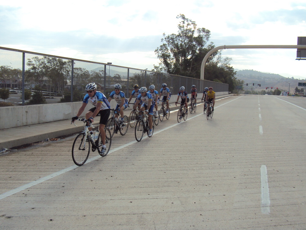
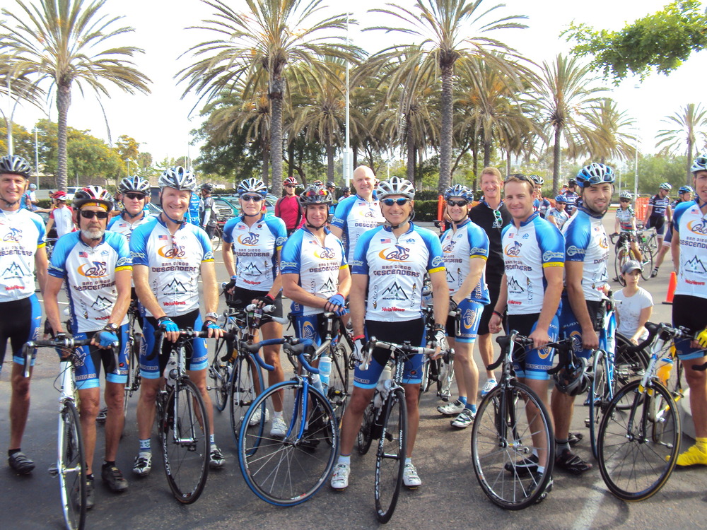
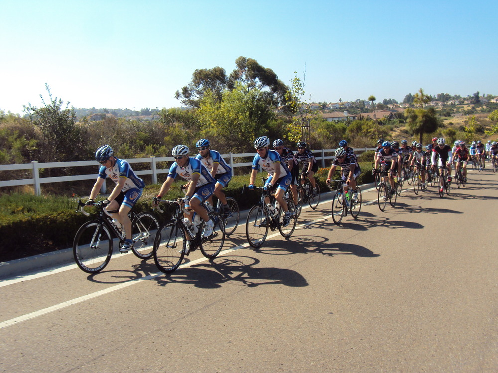
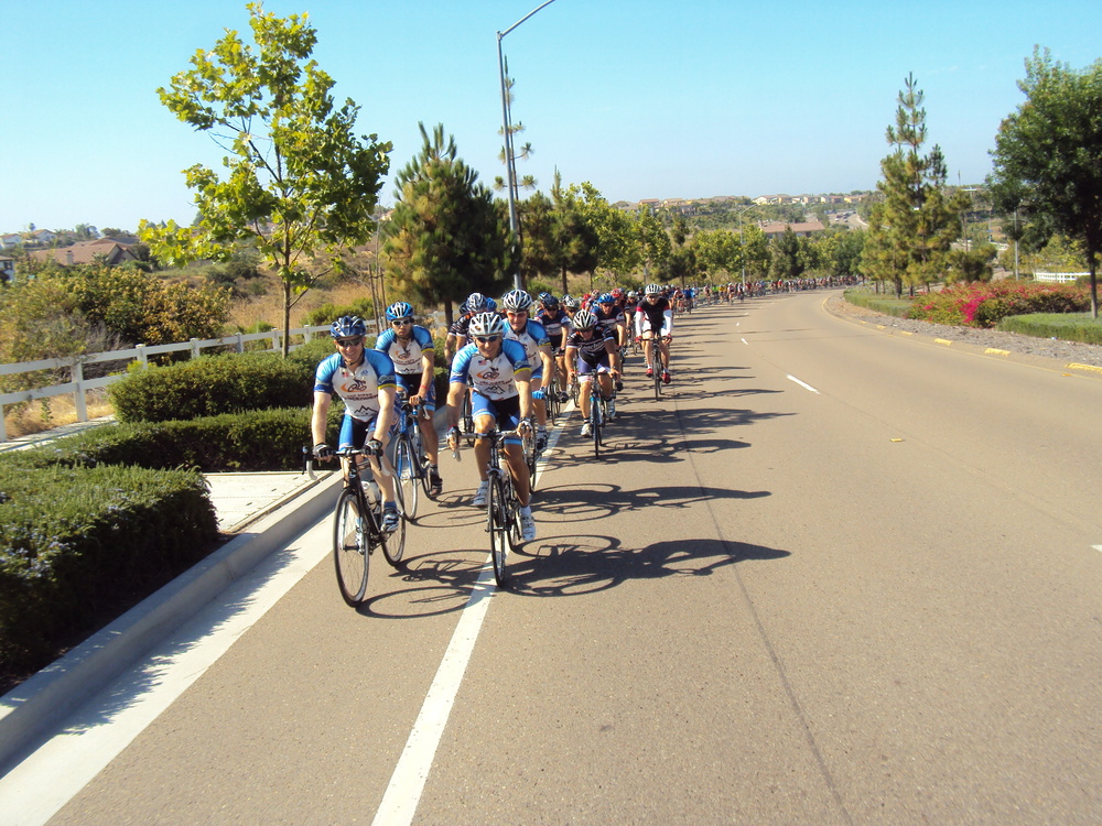
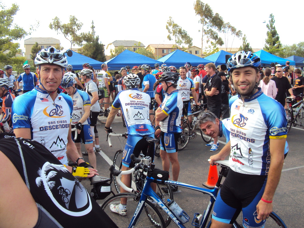
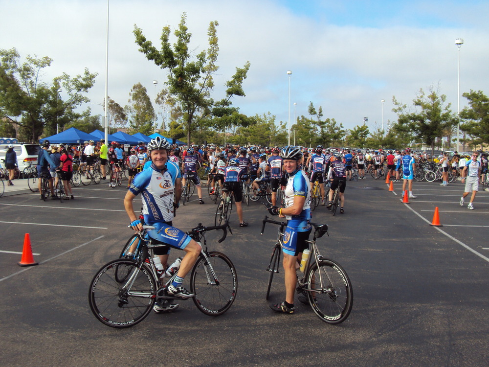
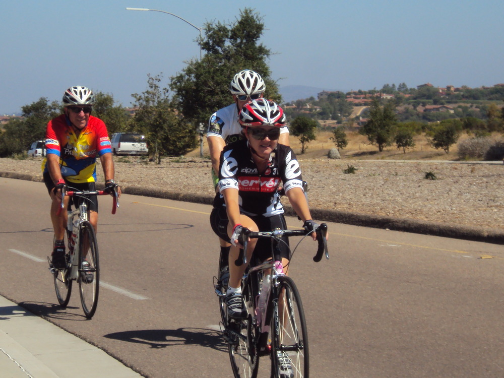
Hi Guys,Congratulations to all the studs who rode the 100+ mile Tour de Poway. We had a great turnout of about 15 or so guys all lined up at the front for the start. Nick Venuto Sr had a few words remembering Nick before he and Deb Venuto led out the group for the ride. The Descenders stormed out to the lead along Poway Road and started to ride faster as we hit the climb of the Poway Grade. Guido shot out to the front and the rest of the peloton was blown to bits. I had the good fortune of being led up the climb by Jeff Cresap. We stayed fairly close to the lead group for much of the way up the climb but when we got to the top of 67, the lead group was gone. Jeff pulled hard on point while I tucked into a safe place behind his wheel. We pulled along a few other guys and eventually caught Geoff Barrall before we got to the top of the Mt Woodson area. Jeff took most of the point time until Geoff came forward to give him a break. I went to the front for a short time along 67 and more guys took turns at the front. I pulled again to the light at Dye Road and one more time along Dye but mostly tried to hang onto the pace. Len the elder now joined our ever growing group. We motored through Ramona and then hit the descent of 78. Geoff and Jeff again on point. The group split apart halfway down the descent but we regrouped heading towards the Wild Animal Park. We spotted Len and Chad changing a tire as we flew past. After the climb up 78 I was on point heading towards Citrus. I saw Sheehan at the turn and motioned him to join me heading south toward Bear Valley while the rest of the 100 mile guys went north on Citrus.Sheehan , Cresap and I went south, along with a good rider, named George, who was riding a Pinarello. Sheehan explained that he was late to the start and joined you guys heading up the grade ahead of everyone else. He said that Rick was pulling the lead group down Dye Road at 28 mph. We were only a few minutes behind you leaders at the Citrus turn. Dave, Jeff and I skipped the pedestrian bridge and rode over Lake Hodges on the freeway. We climbed to 4S and then did the loop behind the back of Black Mountain, to Santaluz and up to Del Sur before returning to Pomerado and the finish. We stopped for water at the last stop by Santaluz. I headed out first thinking Jeff and Dave would catch me. Cresap was helping with cone markers and Sheehan was pooped. I went out fast and they never showed up behind me. I had to get to my flight so I just kept going. I caught up with George along Pomerado and we both hammered the last few miles to the end. Cresap did much of the hard work for me in the ride. He rode back home to Scripps Ranch. I quickly changed and then drove back towards Community Road where I saw Sheehan just before he finished. He had to ride home as well.I am sure the stories from the lead riders will be exciting. I hope the team BBQ at the Venuto’s was enjoyable. Here are a few photos from the ride.See you Sat,Rob
Softened us up with a nice registration dinner Friday night attended by 500 people with tremendous volunteer support by the groups who are supported by the proceeds and were wonderful for the whole weekend. People were talking about Drew already in the registration line, “guy in Cat 5, wins every year by an hour each day, beats half the pros,” got to sit with Drew and his friends, he’s very respected there. Saturday dawned…well dark, cool but basically perfect weather as it was through the weekend, a little breezy at times up in the hills. I imagine the “Monster Climbers” are familiar with all these rides, We warmed up with a 20 mile ride up to South Lake from Milpond, found my place fairly quickly as the lead group (Masters 55+), dropped me 15 minutes into the ride when I was at threshold heart rate and it dawned on me that “this dog wasn’t going to hunt” at this pace for 7 hours. fell in with other droppees and able to find reasonable pace, beautiful scenery would have been more appreciated if suffering weren’t involved. Woohoo, fast descent back to Sawmill road to reach and climb Pine Creek (never passed on a descent through the weekend to live up to the Descenders jersey, wish I could say that for the climbs…passed by pros, amateurs, old, young, males, females, etc…). Back down Pine Creek to the valley, up Lower Rock Creek road, up 395 a bit to Tom’s Place then up, up, up to Mosquito Flat, 22 mile climb to summit and end of timed portion for day (7’32” for me, haven’t seen Drew’s time yet, but I saw him fly by me on the last climb offering kind words, wearing his backpack in contrast to all the riders with support cars he was beating). BTW it’s amazing to see how little effort he appears to expend and minimal leg movement involved with his use of the Power Cranks. Delicious food and drink at the top hit the spot, Challenging first part of descent from Mosquito Flat with cars, bikes on a 3/4 lane road at the top but untimed at least so safer for everyone. LONG ride back down 395 while crying “mama” to get back to the car at Milpond. Lots more food back in Bishop, pastries at Schat’s, fish and chips at Whiskey Creek and then wonderful sleep. Day 2 starts out of Big Pine, 15 miles south of Bishop, at 395 and 168. Started west of 395 after neutral start with a 10 mile climb up to Glacier Lodge, had a nice group to ride with, pace dropped from Saturday, heart rate was very reluctant to push past endurance level, another wonderful descent, DON’T fall off the ride side of the road, there’s no coming back. Back across 395, up Waucoba Canyon for 9 or 10 miles, the only one of 6 climbs that wasn’t an HC, it was a mere Categoy 1… ah a break, this isn’t so bad, kind of like Palomar East Grade, a fun descent at the tail end of pros group, 1 climb left, how bad could this be…..BAD!!! 20 mile climb up 168 to the Ancient Bristlecone Pine forest, started rough, taunted with a couple spots of flat/descent then a friggin beast the last 3 or 4 miles, first thoughts all weekend of whether I’ll make it. A volunteer was kind enough to point out me as I eyed the switchbacks above me that there were only 3 miles and 1200 ft of climbing left, just kept going on and on and on… then 1000 meters left, 200 meters left, done and 4 cokes, quesadillas, bagel and cream cheese, pb and j, pretzels, snickers, well you get the idea. Congratulated Drew who set a personal best, he’s a very nice and humble champion. A wonderful no work thrilling descent down 168 to the car, feast at In and Out Burger on the way home, back to work and looking forward to Tour de Poway.
Bernie
On Thu, Sep 22, 2011 at 8:21 AM, Rick Bienias <rbienias@att.net> wrote:
Good luck to Bernie and Drew at the Everest challenge this weekend.
2 days, 206 Miles, 29000 ft of climbing !!!!!!!!!!!!!!!!! Ouch
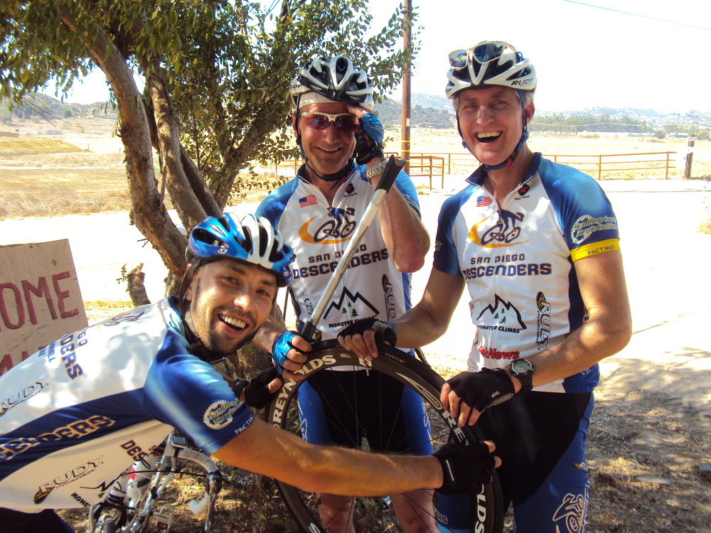
We had a small group meet up for a ride this morning. Fresh legs from Guido and Bob P added to the pace for the day. Joining us were John and Cresap. The five of us cruised toward the coast and added a nice hill loop up Carmel Country Road. We hit PCH and sped along to Swami’s where Jeff decided to return home. The four remaining guys went north to La Costa Road and sped fast, aided by a tailwind, back toward El Camino Real. Guido was on point at 34 mph while Bob and I hung on for dear life. The ride up toward RSF was at a brisk pace as the sun shined brightly. We enjoyed the climb up three witches and cruised back toward the 56 bike path. I had another 46 mile day, so two good rides over the weekend. We head to Oceanside next Saturday, see you there. Here are a few photos from our ride today.Ride on-RobHere’s some photos from our Saturday ride through Highland Valley and Old Julian:
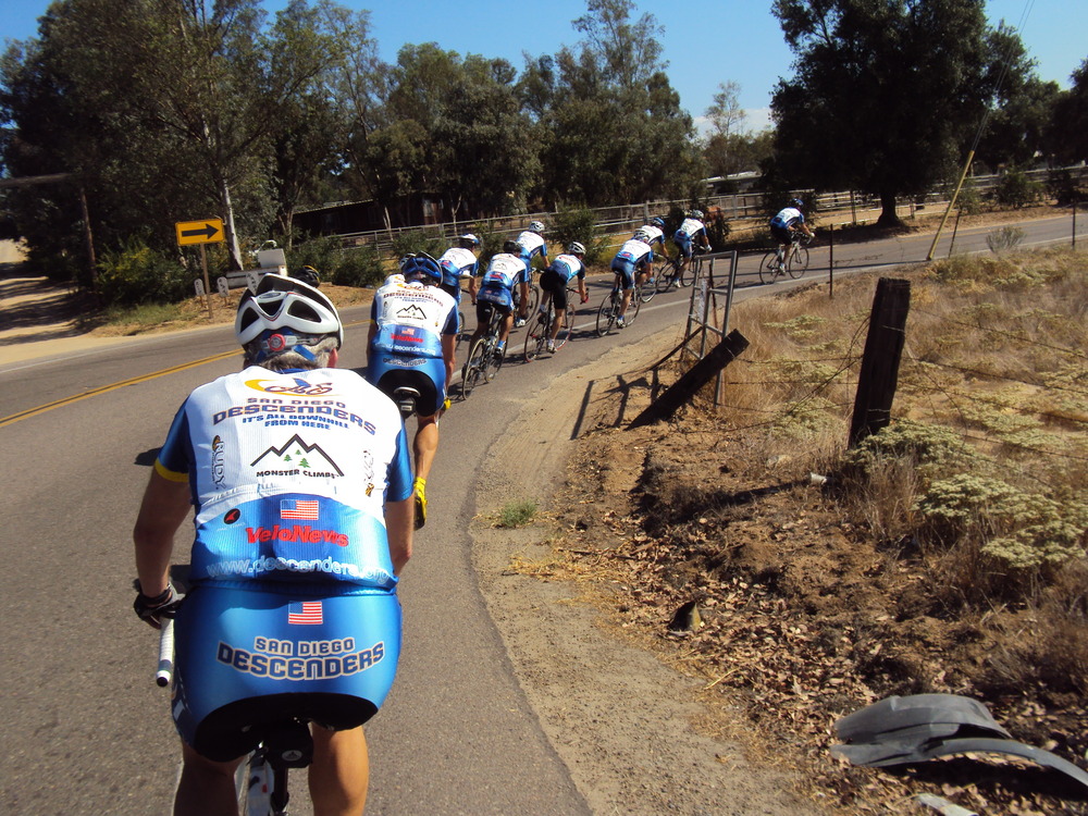
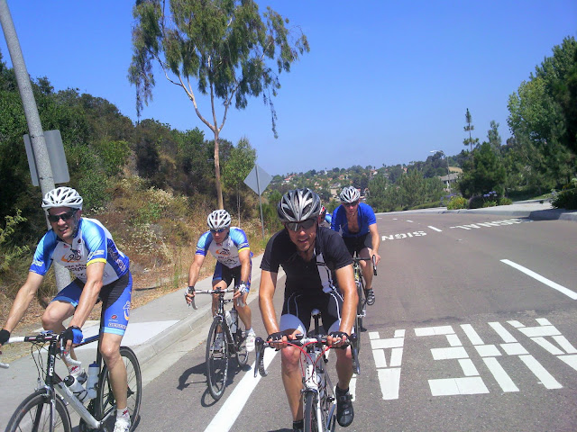
Hi Guys,We had a large group out on the road today. A total of 14 guys met at Pomerado and RB for the climb up Highland Valley Road. Bryan, Keith and I started in PQ and met up with a bunch of guys at Voris’ house. We cruised over to meet up with the rest of the guys, picking up Bob R along the way. It was a civilized pace until we got to the start of the climb. Many tested their legs and were competing against others for future Strava postings. I mostly swept up near the rear but made it to the top. The group cruised back towards 67 where Bryan and I had to split off for home due to soccer games. The rest of the guys climbed up Old Julian.A number of guys were not able to ride today so some are riding tomorrow. We are meeting at 8 am at the corner of the 56 bike path and Black Mountain Road. We will ride to the coast. I also know Bernie is heading up to Dudley’s to climb up Palomar. Reach out to Bernie if you want to climb hard tomorrow.Here are a few photos from the early portion of the ride.See some of you in the morning,RobHere’s some photos from our Saturday ride through Highland Valley and Old Julian:
A few months ago I went to Los Angeles on business and on the way back decided to stop by the Fargo Street in Echo park – which at 33% gradient is the 2nd steepest paved road in the United States (* at least according to our bible – The Complete Guide to Climbing – By Bike). THE steepest road is Canton Ave. in Pittsburgh which is billed at 35% to 37%, depending on who you ask, and features a lot of cobblestone. Fargo Street is just concrete (in places badly cracked up and crumbling, as you can see below), no cobbles, therefore making the steepest US road paved with asphalt or concrete.
A lot of people, even Californians, think that San Francisco is where all the steep roads are, while LA is pretty flat. This is only because the touristy parts of LA are in flatter region, but in fact the steepest 5 or 6 California roads are all in LA, and about half of top 20 steepest US roads are in California – primarily in LA, San Francisco and San Diego.
Here’s some highly unofficial, partial list of steepest climbs in US:
37% Canton Avenue, Pittsburgh (+video) 33% Fargo Street, Los Angeles 33% Eldred Street, Los Angeles 33% 28th Street, Los Angeles 32% Ewing Street, Los Angeles 32% Duane Street, Los Angeles 32% Baxter Street, Los Angeles 31.98% Dornbush Street, Pittsburgh, PA 31.5% Filbert Street between Leavenworth and Hyde, San Francisco 31.5% 22nd Street between Church and Vicksburg, San Francisco 29% Jones between Union and Filbert, San Francisco 29% Boustead Street, Pittsburgh 28.6% Poe Street at Evergreen, San Diego 28.3% Ramona Avenue, San Diego 28% Flowers Street, Pittsburgh 27.9% Duboce between Buena Vista and Alpine, San Francisco 27% East Woodford Avenue, Pittsburgh 26.6% Oliphant Street, San Diego 26% Jones between Green and Union, San Francisco 26% Webster between Vallejo and Broadway, San Francisco 26% Torrance Street, San Diego 25% Logan Street, Pittsburgh 25% Rialto Street, Pittsburgh 25% Duboce between Alpine and Divisadero, San Francisco 24.9% Bandini between San Diego and California, San Diego 24.8% Jones between Pine and California, San Francisco 24% Fillmore between Vallejo and Broadway, San Francisco 24% Tesla Street, Pittsburgh
These roads are all relatively short, as short as 0.1 miles, but it doesn’t help all that much – as you can see from videos below, it takes a full 100% effort to climb those streets, even using compact 34 tooth small ring at the front and 28 cogset in the back, while zigzagging from one side of the street to the next. My hat is off to whoever can ride straight up those hills with standard gearing.
In fact, Fargo Street area shown on the map below, contains several twin streets that go up parallel to Fargo Street, featuring very similar 32-33% gradients according to Garmin – these are Duane, Baxter and Ewing Streets. All of them start at Alessandro St. and all, except Baxter, dead-end at North Alvarado St., while Baxter keep going for steep downhill and another similarly steep uphill, so if you want to experience roller-coaster ride, go ride Baxter St!
Riding up Fargo and its sister streets is a bit tricky at first. One has to balance the weight carefully between the two wheels – forget about sitting on your saddle, don’t even try it as you will pop a wheelie and fall backwards. Instead you have to be standing on your pedals, while leaning forward to provide enough weight for your front wheel to maintain contact with the road. Meanwhile, back wheel has to have enough traction – mine was slipping from under me a few times, especially during “switchbacks” on the side of the road where there were a few leaves and other debris. Any momentum you can hope to gain before climbing will be lost in the first few meters, that’s how steep the road is – and even if you are trying to ride straight up (which is what I tried at first), be prepared to start zig-zagging as you are running out of power to keep the pedals turning over. Be prepared to unclip too, these roads are very steep and get slippery especially wearing cleats!
If you are zig-zagging, make sure you accelerate a little to gain momentum as you reach the turning point – you don’t want to get “stuck” while your bike is pointing upward, the idea is to go through the turn as quickly as possible.
Here’s my ride up famous Fargo Street:
As well as my rides up Ewing and Baxter Street nearby:
Finally, here’s some video from 2011 installment of the annual Fargo Street Climb that gives you an idea of how difficult the climb is, even with mountain bike gearing:
Posted inRoad Trip Ride Report|Comments Off on Ride Report: Los Angeles, Fargo Street, 33% (by Oleg Shpyrko)
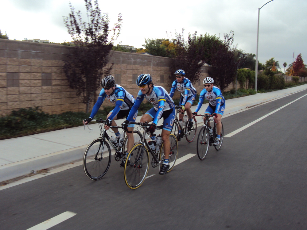
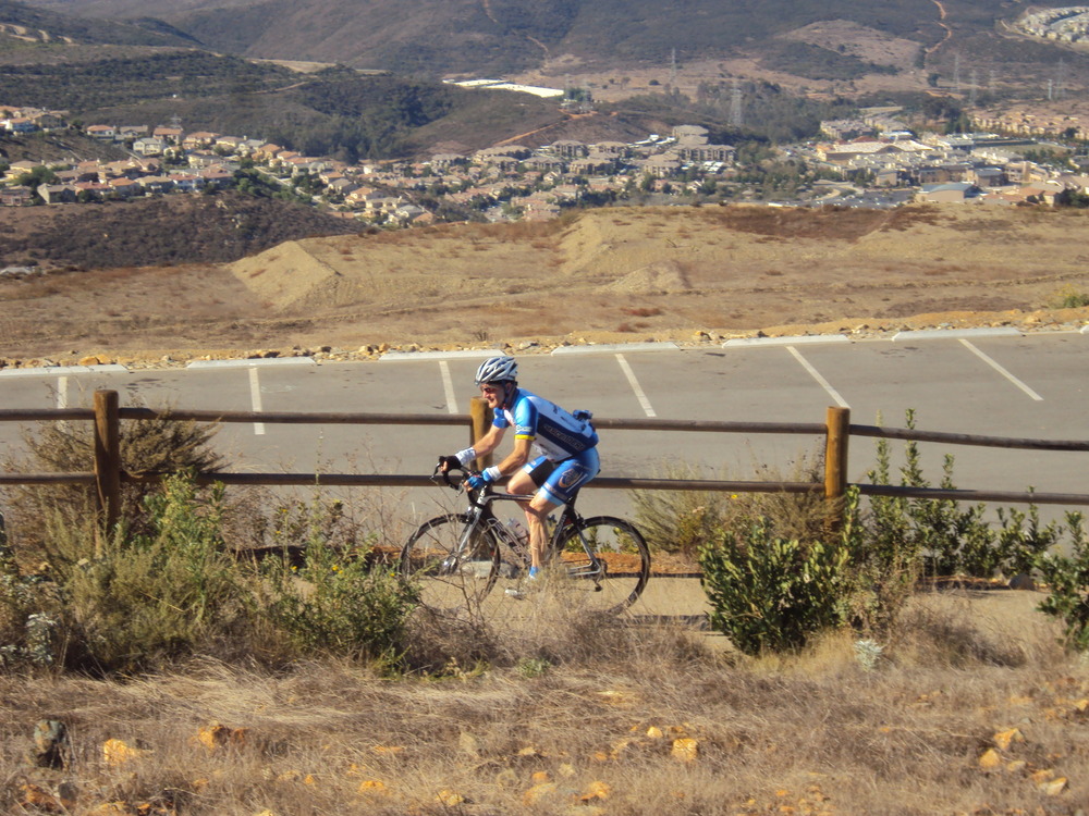
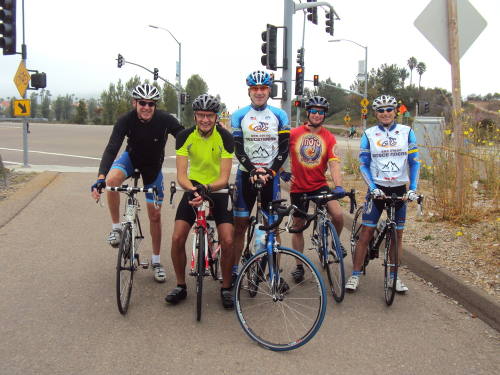
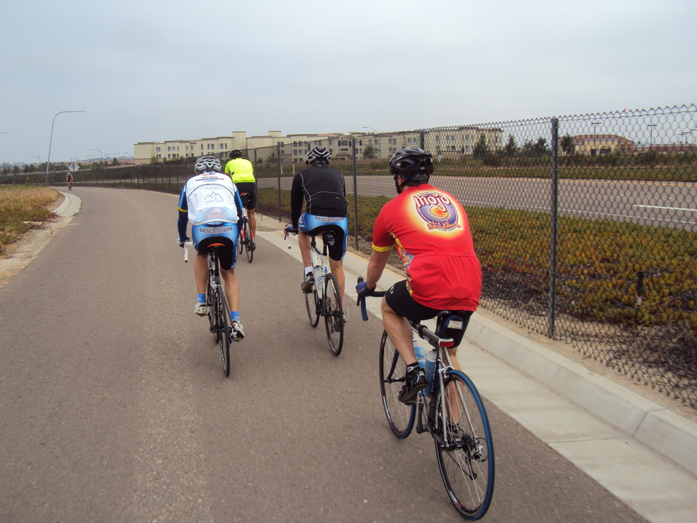
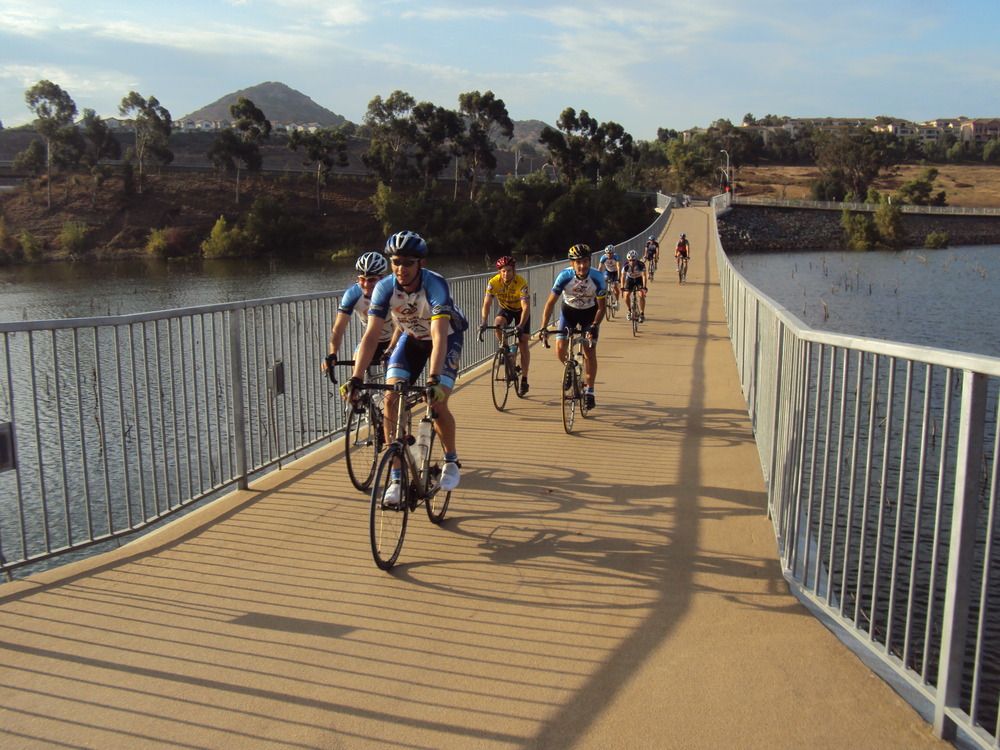
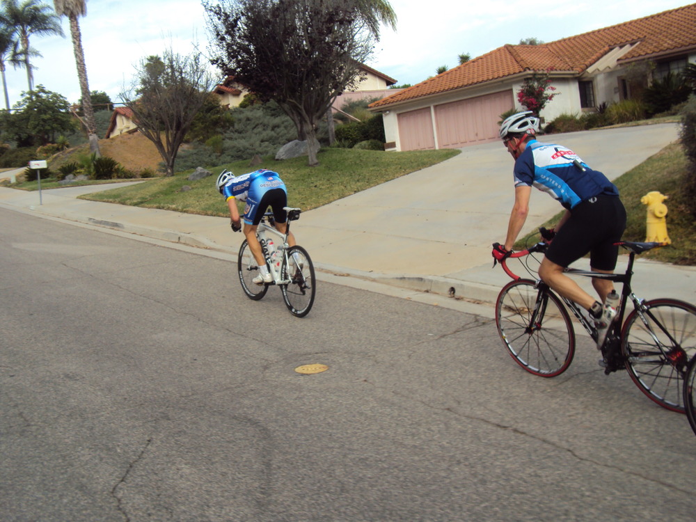
Hi Guys,We had another large group ride this morning. Guido and I cruised over to meet Voris and Hodges before heading to the corner of Pomerado and RB. We had about a dozen guys in total. We met up with Ernst, Sheehan, Cresap, Dan, Bob R and his two buddies. The group headed along Pomerado and over I-15 to the pedestrian bridge and back toward Via Rancho Parkway, then headed west. We looped around Felicita Park until we got back to Lake Dr. The descent down along Lake Hodges was stunning with the lake filled to the top. We climbed back to Del Dios Highway and cruised at a good pace towards Rancho Sante Fe. Regrouping before heading toward San Dieguito Road, we passed a burning car on El Apajo, and then climbed up to Santaluz. The hill climb around Santaluz was fast as was the descent back to the south gate. The group split at Carmel Valley Road with some guys continuing onto the 56 bike path while others headed back towards RB. I peeled off the bike path with a total of 41 miles and got to my house before the rain started to fall. It was a spirited ride and lots of fun, good way to end the long weekend. Here are a few photos.Rob
Hi Guys,Great to get back out for a group ride again. Thanks for letting me get out ahead for the climbs and for cutting the descents short as I struggled to find my legs again. I only made it through the Mussey Grade descent and the cruise over to Ramona. Ernst had a mechanical problem back on Dye Road so I quickly volunteered to head back to help Ernst and cut the ride short; my legs were already shot. Sheehan, Oleg and I went back to help Ernst with the flat. We struggled to fix it but were finally on our way home. The group split at 67 with Oleg and Ernst heading back around Mt Woodson while Sheehan and I headed down HVR. Sheehan did all the hard work out front with the wind in our faces. We descended quickly down HVR to Pomerado. My plan to cruise home via 4S changed when Dave offered a ride home. We got to Sheehan’s house after a fun ride, looking forward to a dip in the pool. It will take me a few weeks to be ready to hang for an entire Descenders ride.Here are a few photos. I will get the rest posted to the Shutterfly album. See you riding soon-Rob
We had at least 13 (?) riders come out today – August is behind us and a lot of Descenders are getting back in cycling mode. Many descenders, myself included, missed many weeks of rides, it was nice to be back in the “peloton”! We were slowed by a few flats, as well as the heat (I saw 92F in Ramona), but otherwise it was a very enjoyable, fast ride, as always. Here’s the photos (the proof that this ride DID happen!):https://picasaweb.google.com/109410926478548321411/20110903You should have come, Oleg
The ride started with taking a BART from Oakland towards San Francisco:
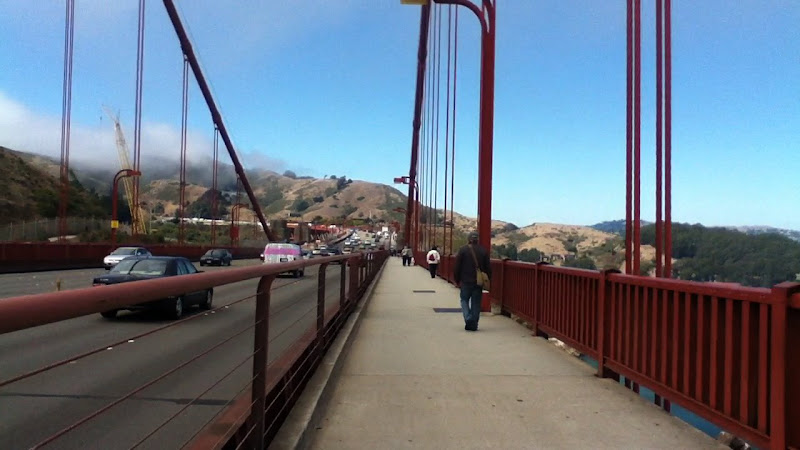
Then I was off to ride across San Francisco downtown and across Golden Gate Bridge:
The bike path across Golden Gate was closed so we were forced into sharing the pedestrian path with hundreds of tourists.
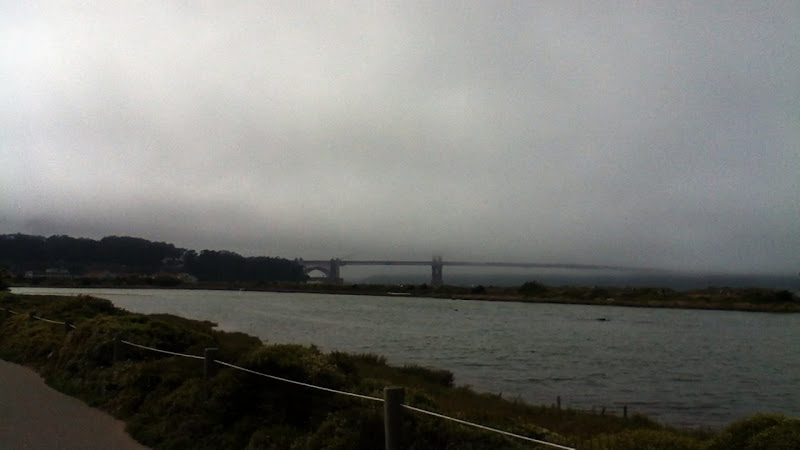
The bridge was covered in fog, so it wasn’t the best day for photos.
Then I was off riding towards Mill City, and made it to the road in Muir Woods park (with gorgeous redwoods, as seen below) that would be taking me all the way up to Mt. Tam, but had to turn back as to not miss my flight. Mt. Tam, we shall meet again some other day!
Here’s my Ritchey after climbing Lombard Street, one of the really steep and famous streets in San Francisco:
and another photo of Ritchey by Embarcardero in downtown San Francisco:
My first trip I brought my new Ritchey Breakaway was the trip to San Francisco. I landed in Oakland Airport at 8:30, got my bag at 8:50, got into rental car and drove towards Mt. Diablo, arriving at 10:00AM, got the bike out of the bag and assembled in just under 20 minutes, and rolled off at 10:20AM.
After about 20 min warmup, I started climbing. The fog has cleared
The climb was beautiful and brutal at times. It took me about 1:20 (including a few short stops to take photos) to get to the top from the beginning of the climb.
Finally, at the top, after a short but painful 22% grade, I got to the summit, culminating more than 3,500 ft of climbing over 10 miles, plus warmup. The descent was quick, the bike climbed like a mountain goat and then bombed the descents by smoothly carving out curves at full speed.
Great day overall, in one of the most beautiful, scenic views that Bay Area can provide.
Views from Mt. Diablo Climb:
Posted inNorCal Ride Reports|Comments Off on Bay Area Rides: Day 1, Mt. Diablo
Hi guys,We had a large group meet at the North County Mall for the ride on Saturday. There were 11 Descenders in total, including Denise. Ready for a good ride were: Oleg, Rick, Denise, John M, Len (TE), Guido, Geoff, Chad, Mike, Bernie and Rob. A number of the Ranchos rode by us while we prepared to depart. They gathered in a nearby parking lot. Guido led us out onto Bear Parkway and through some fun climbing and turns on Mary Lane and Summit Dr before connecting back onto Route 78. We turned on Citrus when we saw all the Ranchos waiting for some maintenance on one of their bikes. The group rode together until we hit the Lake Wohlford climb. We regrouped at the top and cruised over to Woods Valley Road for some fast paced 36 mph pace lines into Valley Center. The group then headed along Lilac towards West Lilac where again the pace quickened. Guido, Bernie, Chad, Geoff and Rob hit high gear just when Farkas declared a nature stop. Oleg was in hot pursuit as we hammered over the bridge to Old 395 where we waited for the rest of the group. After a fast descent down West Lilac, where we saw the Ranchos heading up the hill, we regrouped along Camino Del Ray. The group again split with the fast guys motored to the camp ground rest stop while the rest of us mere mortals pedaled along with what was let if our tank. The climb along Old 395 was painful as usual for me. The Rancho riders that passed me seemed to enjoy it too much. I was the last Descender to finish the climb. We regrouped on one side of the intersection, the Ranchos the other side. Weird? Home was in sight so the headed for Jesmond Dene Road, the Ash and back down Citrus towards Bear Valley. I caught a few lights near the end just right and tried to make a quick escape to the Mall. Unfortunately Farkas timed by surges well and was on my wheel in no time. He finished first with the rest of the group right behind. The weather was perfect all day, we covered 58 miles with about 4,000 of climbing. Good day in the saddle.Here are a few photos from the ride. I will upload a number of weeks or photos into our Shutterfly account soon. The next few rides are now posted on the web site. I head to Vail on Friday so I will miss the next two weeks of rides but will get in a little high altitude training in Colorado.Ride on-Rob
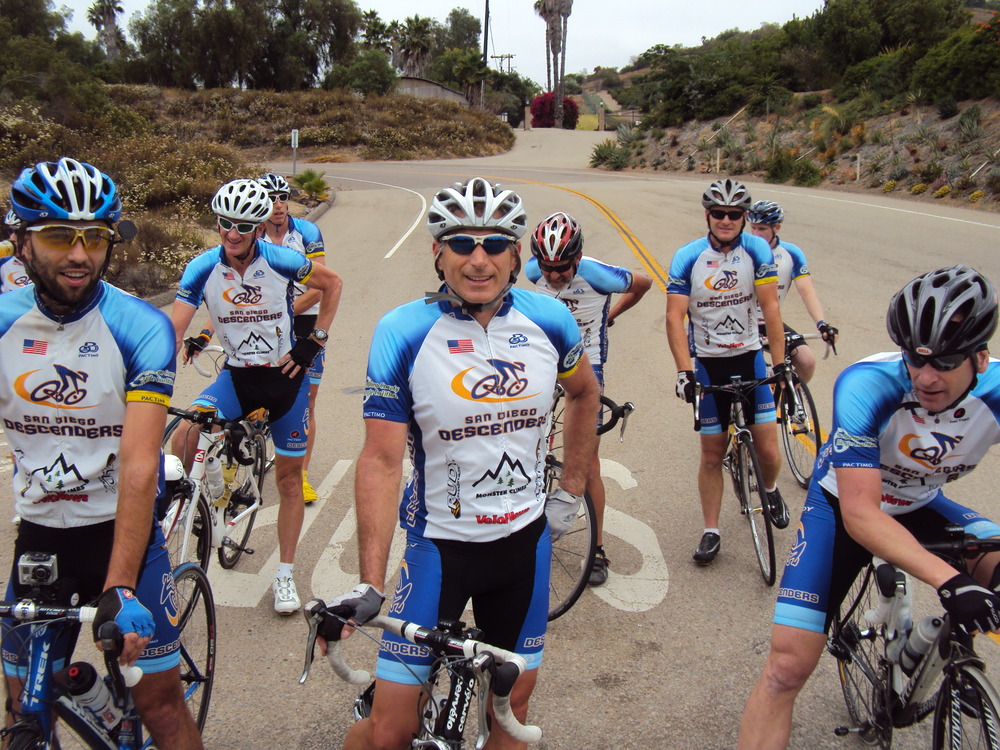
Hi Guys,Thanks to all who came out to support the Venuto family yesterday. We had the opportunity to celebrate the cycling that Nick loved. It was a huge turnout and many of the Descenders played important roles in its success. Pat Johnson and his team did a great job setting up all the logistics. Voris and Rick helped a ton with set-up and tear down on the course. Guido brought a table, cooler and his pop-up cover to help with the ride. Bernie was on security detail and passing out post ride snacks. Eric was at the turn down in Fairbanks Ranch to make sure everyone had a safe ride. We had guys on point leading out the ride, guys along the route and a large Descenders presence throughout the event. There must have been 500+ riders from many clubs in the county. We saw Art riding with his Mira Mesa crew. The Ranchos were there, acting like the Ranchos. Guys from SDBC rode and many with Ride Across California jerseys too. Nick, Sr gave a moving speech before the ride about Nick’s bike riding history. Nick’s widow, Deb, and the 2 kids were there. I was able to take a couple of photos of them on their ride. It was an emotional time, remembering Nick, and celebrating his love of riding.After all the tear down and clean-up, a few of us went out for more miles. Ernst, Guido, John Moran and I rode back towards Rancho Sante Fe. We added about 35 miles before getting back to Westview High School. Guido and Ernst whipped John and I along the route. We did climb the 3 witches again to finish another great day on the bike. Here are a few photos from the Nick ride.Dave Voris and I are planning the next few weeks of group rides. They will be posted soon on the web site. Ride safe-Rob


 Then I was off riding towards Mill City, and made it to the road in Muir Woods park (with gorgeous redwoods, as seen below) that would be taking me all the way up to Mt. Tam, but had to turn back as to not miss my flight. Mt. Tam, we shall meet again some other day!


You must be logged in to post a comment.